Hindu Temple nearby Kaliyappa Vairavar Kovil
Sri Lanka
Hindu Temple nearby Kaliyappa Vairavar Kovil
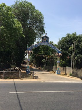
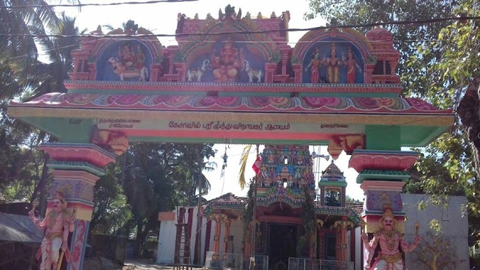
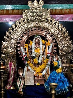
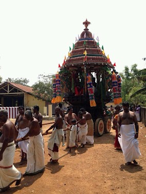
Kaliyappa Vairavar Kovil
Kokuvil East, Sri Lanka
contacts phone
:
+94
website:
kaliyappabairavarkovil.weebly.com
Latitude:
9.6927524
, Longitude:
80.0142726
larger map & directions
read more
nearest Hindu Temple
327 m
Kirupakara Sivasubramaniya Kovil
AB16, Kokuvil East
Hindu Temple
read more
375 m
Thalayali Vairavavar Kovil
Sri Lanka
Hindu Temple
read more
384 m
thalayali vairavavar kovil
Kokuvil East
Hindu Temple
read more
470 m
Manchavanapathy Murugan Temple
Hindu Temple
read more
476 m
Sorna Siththi Vinajakar
Sorna Vadali Lane, Jaffna
Hindu Temple
read more
485 m
Kesavil Pillaiyar Temple
Jaffna
Hindu Temple
read more
573 m
வைரவர் _நாச்சிமார் கோவில்
Jaffna-Kankesanturai Road
Hindu Temple
read more
604 m
Maniyarpathi Murukan Temple
Maniyarpathi Road
Hindu Temple
read more
607 m
Nachchimar Kovil
Dżafna
Hindu Temple
read more
607 m
Nachchimar Kovil
Jaffna
Hindu Temple
read more
625 m
Amman Temple Compex
Jaffna
Hindu Temple
read more
710 m
Sri Sabapathy Vinayagar Temple
Jaffna
Hindu Temple
read more
710 m
Sri Sabapathy Vinayagar Temple
Dżafna
Hindu Temple
read more
739 m
Murukamoorthy Pillayar Kovil
Sivaprahasam Road, Jaffna
Hindu Temple
read more
777 m
mthanai kanatha suwamy Kovileast
Kokuvil East
Hindu Temple
read more
807 m
Koddaiyammpathi murugan temple
Lotus road vannarponnai, Jaffna
Hindu Temple
read more
808 m
Muthaly Kovil
Jaffna
Hindu Temple
read more
839 m
Kaladdy Pillayar Kovil
Jaffna
Hindu Temple
read more
942 m
Kaladdy Amman Kovil
Kaladdi Amman Kovil Road, Jaffna
Hindu Temple
read more
952 m
Naavalady Gnanavairavar Temple
Jaffna
Hindu Temple
read more
974 m
Ayyanar Kovil
Jaffna
Hindu Temple
read more
1.055 km
Murugan Temple
Jaffna
Hindu Temple
read more
1.311 km
Parameswaran Kovil
Kokuvil East
Hindu Temple
read more
1.384 km
Nandhavil Amman
Sri Lanka
Hindu Temple
read more
2.556 km
Nallur Pillayar Kovil
383 Kovil Road, Jaffna
Hindu Temple
read more
📑
all categories
Accounting
Administrative area level 1
Administrative area level 2
Airport
Amusement park
Aquarium
Art gallery
Atm
Bakery
Bank
Bar
Beauty salon
Bicycle store
Book store
Bowling alley
Bus station
Cafe
Campground
Car dealer
Car rental
Car repair
Car wash
Casino
Cemetery
Church
City hall
Clothing store
Colloquial area
Convenience store
Country
Courthouse
Dentist
Department store
Doctor
Electrician
Electronics store
Embassy
Finance
Fire station
Florist
Food
Funeral home
Furniture store
Gas station
General contractor
Grocery or supermarket
Gym
Hair care
Hardware store
Health
Hindu Temple
Home goods store
Hospital
Insurance agency
Intersection
Jewelry store
Laundry
Lawyer
Library
Light rail station
Liquor store
Local government office
Locality
Locksmith
Lodging
Meal delivery
Meal takeaway
Mosque
Movie rental
Movie theater
Moving company
Museum
Natural feature
Neighborhood
Night club
Painter
Park
Parking
Pet store
Pharmacy
Physiotherapist
Place of worship
Plumber
Point of interest
Police
Political
Post office
Premise
Real estate agency
Restaurant
Roofing contractor
Route
Rv park, camping
School
Shoe store
Shopping mall
Spa
Stadium
Storage
Store
Subpremise
Supermarket
Synagogue
Taxi stand
Train station
Transit station
Travel agency
University
Veterinary care
Zoo
administrative area level 3
sublocality level 1
sublocality level 2
↑