Hindu Temple nearby Malikaithidal Amman Kovil
Sri Lanka
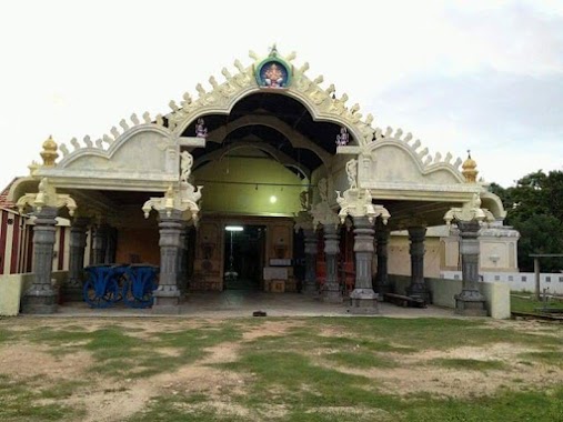
Hindu Temple nearby Malikaithidal Amman Kovil
Malikaithidal Amman Kovil
kudathanai malikaithidal kudathanai, pointpedro Sri Lanka
contacts phone
:
+94
Latitude:
9.7430644
, Longitude:
80.2649217
read more
nearest Hindu Temple
435 m
Murugan Temple
Sri Lanka
Hindu Temple
read more
849 m
Sri Murugan Temple to kutattanaivat
Jaffna
Hindu Temple
read more
853 m
Kudathanai northern Sri Murugan Temple
Hindu Temple
read more
880 m
Vairavar Koyil, Kudathanai
Hindu Temple
read more
1.304 km
Pillaiyar Temple
Ampan
Hindu Temple
read more
3.944 km
varany sri savilippiddy kantha suvamy temple
Varany - Navatkadu Road / வரணி - நாவற்காடு வீதி
Hindu Temple
read more
3.945 km
savalapiddi kandasamy temple
Jaffna
Hindu Temple
read more
4.018 km
Varany Periyathampiran Temple
Jaffna
Hindu Temple
read more
4.018 km
Varany Periyathampiran Temple
Dżafna
Hindu Temple
read more
4.198 km
Annamar Kovil
Natkadu Road,Navakadu, Varany
Hindu Temple
read more
4.313 km
Ganesha Temple komputatti
Jaffna
Hindu Temple
read more
4.396 km
Moonrampallam Kovil
Unnamed Road
Hindu Temple
read more
4.409 km
Varany Kumpudan Pillayar Kovil
Dżafna
Hindu Temple
read more
4.409 km
Varany Kumpudan Pillayar Kovil
Jaffna
Hindu Temple
read more
4.595 km
Koddodai Pillayar
Jaffna
Hindu Temple
read more
5.46 km
Suddipuram Temple
Sri Lanka
Hindu Temple
read more
5.893 km
Koddaimoorthy Kalithevi
Jaffna
Hindu Temple
read more
5.893 km
Koddaimoorthy Kalithevi
Dżafna
Hindu Temple
read more
6.019 km
Innavollai Murugan kovil
AB31, Point Pedro
Hindu Temple
read more
6.019 km
Puttu Temple
Jaffna
Hindu Temple
read more
6.019 km
Puttu Temple
Dżafna
Hindu Temple
read more
6.449 km
Thunnalai Velikamthota Pillaiar Kovil
Point Pedro
Hindu Temple
read more
6.697 km
Thillaiyampala Pillaiyaar Temple
Sri Lanka
Hindu Temple
read more
9.718 km
Theivakovil
thetuvotamveethi, Jaffna
Hindu Temple
read more
13.458 km
Koviyampathy Pillaiyar Temple
Valvettithurai
Hindu Temple
read more
📑
all categories
Accounting
Administrative area level 1
Administrative area level 2
Airport
Amusement park
Aquarium
Art gallery
Atm
Bakery
Bank
Bar
Beauty salon
Bicycle store
Book store
Bowling alley
Bus station
Cafe
Campground
Car dealer
Car rental
Car repair
Car wash
Casino
Cemetery
Church
City hall
Clothing store
Colloquial area
Convenience store
Country
Courthouse
Dentist
Department store
Doctor
Electrician
Electronics store
Embassy
Finance
Fire station
Florist
Food
Funeral home
Furniture store
Gas station
General contractor
Grocery or supermarket
Gym
Hair care
Hardware store
Health
Hindu Temple
Home goods store
Hospital
Insurance agency
Intersection
Jewelry store
Laundry
Lawyer
Library
Light rail station
Liquor store
Local government office
Locality
Locksmith
Lodging
Meal delivery
Meal takeaway
Mosque
Movie rental
Movie theater
Moving company
Museum
Natural feature
Neighborhood
Night club
Painter
Park
Parking
Pet store
Pharmacy
Physiotherapist
Place of worship
Plumber
Point of interest
Police
Political
Post office
Premise
Real estate agency
Restaurant
Roofing contractor
Route
Rv park, camping
School
Shoe store
Shopping mall
Spa
Stadium
Storage
Store
Subpremise
Supermarket
Synagogue
Taxi stand
Train station
Transit station
Travel agency
University
Veterinary care
Zoo
administrative area level 3
sublocality level 1
sublocality level 2
↑