Hospital nearby central government dispensary muddaragama
Sri Lanka
Hospital nearby central government dispensary muddaragama
central government dispensary muddaragama
Muddaragama, Sri Lanka
contacts phone
:
+94
Latitude:
7.2118325
, Longitude:
80.059092
larger map & directions
read more
nearest Hospital
1.937 km
Dr E.M.D.U De Saram
Gampaha
Hospital
read more
3.425 km
Pallewala Aurveda Medical Centre (PVT)
Kaleliya - Medagampitiya Road, Veyangoda
Hospital
read more
3.513 km
Niwahana Medical center
Pallewela
Hospital
read more
4.196 km
Goverment Dispensary
Kaleliya - Medagampitiya Road, Pallewela
Hospital
read more
4.292 km
Dispensury & Surgery
Divulapitiya
Hospital
read more
4.518 km
Medical Centre
Divulapitiya
Hospital
read more
4.527 km
Suwasawiya Medical Center
Divulapitiya
Hospital
read more
4.528 km
Medical Center - Dr Nishadhi
Kottala Road, Veyangoda
Hospital
read more
4.549 km
Suwasaviya Medical Center
Divulapitiya
Hospital
read more
4.571 km
Clinic Centre Moh
Veyangoda
Hospital
read more
5.295 km
Dellegoda Ayurweda Weda Madura
Veyangoda
Hospital
read more
6.455 km
Ayuruwedic Hospital
B445, Veyangoda
Hospital
read more
6.721 km
Halpe Government Dispensary
Halpe, Thalakolayaya Halpe Road, Gurullagama
Hospital
read more
6.729 km
Government Central Dispensary Halpe Mirigama.
Thalakolayaya Halpe Road, Mirigama
Hospital
read more
9.397 km
Ayurvedic Medical Center
Pasyala - Giriulla Road, Mirigama
Hospital
read more
9.833 km
Hospital Nambulwa
Nabuluwa
Hospital
read more
11.164 km
Theath Health Care Center
Aluthgama-Bogamuwa, Kalagedihena
Hospital
read more
11.357 km
Seth Meditech & Diagnostic
Nittambuwa - Ruwanwella Road, Wathupitiwala
Hospital
read more
12.35 km
Gampaha Hart/ගම්පහ හෘද
Gampaha
Hospital
read more
13.752 km
Fit Life Animal Clinic
Minuwangoda
Hospital
read more
14.228 km
Suwa Sewana
Yakkala
Hospital
read more
14.455 km
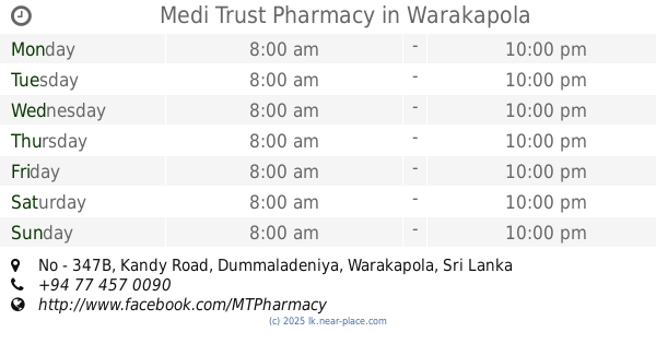
Medi Trust Pharmacy
No - 347B, Kandy Road, Dummaladeniya, Warakapola
Hospital
read more
14.691 km
Tusitha Hewamanna Medical Center
Ananda Mawatha, Gampaha
Hospital
read more
14.744 km
mahajana dispancery
Negombo-Kurunegala Road, Giriulla
Hospital
read more
18.016 km
Matrnal and Child Health Clinic - Makewita
80 A33
Hospital
read more
📑
all categories
Accounting
Administrative area level 1
Administrative area level 2
Airport
Amusement park
Aquarium
Art gallery
Atm
Bakery
Bank
Bar
Beauty salon
Bicycle store
Book store
Bowling alley
Bus station
Cafe
Campground
Car dealer
Car rental
Car repair
Car wash
Casino
Cemetery
Church
City hall
Clothing store
Colloquial area
Convenience store
Country
Courthouse
Dentist
Department store
Doctor
Electrician
Electronics store
Embassy
Finance
Fire station
Florist
Food
Funeral home
Furniture store
Gas station
General contractor
Grocery or supermarket
Gym
Hair care
Hardware store
Health
Hindu Temple
Home goods store
Hospital
Insurance agency
Intersection
Jewelry store
Laundry
Lawyer
Library
Light rail station
Liquor store
Local government office
Locality
Locksmith
Lodging
Meal delivery
Meal takeaway
Mosque
Movie rental
Movie theater
Moving company
Museum
Natural feature
Neighborhood
Night club
Painter
Park
Parking
Pet store
Pharmacy
Physiotherapist
Place of worship
Plumber
Point of interest
Police
Political
Post office
Premise
Real estate agency
Restaurant
Roofing contractor
Route
Rv park, camping
School
Shoe store
Shopping mall
Spa
Stadium
Storage
Store
Subpremise
Supermarket
Synagogue
Taxi stand
Train station
Transit station
Travel agency
University
Veterinary care
Zoo
administrative area level 3
sublocality level 1
sublocality level 2
↑