Hospital nearby Dundeniya Medical Center
Sri Lanka
Hospital nearby Dundeniya Medical Center
Dundeniya Medical Center
no 19,Giliulla road, Indiparape, Sri Lanka
contacts phone
:
+94
Latitude:
7.2120826
, Longitude:
80.1109932
larger map & directions
read more
nearest Hospital
466 m
Ayurwedic Hospital
Kaleliya
Hospital
read more
1.966 km
Medicare Clinic
Kaleliya
Hospital
read more
2.461 km
Goverment Dispensary
Kaleliya - Medagampitiya Road, Pallewela
Hospital
read more
2.702 km
Nahalle Medical Center
Bolana - Mallehewa Road, Kaleliya
Hospital
read more
3.013 km
Niwahana Medical center
Pallewela
Hospital
read more
3.079 km
Theja Hasthi Isuri Medical Center
Veyangoda
Hospital
read more
3.126 km
Pallewala Aurveda Medical Centre (PVT)
Kaleliya - Medagampitiya Road, Veyangoda
Hospital
read more
3.534 km
Path Lab & Channeling Center
Mirigama
Hospital
read more
3.544 km
Sahanya Private Hospital
Mirigama
Hospital
read more
3.645 km
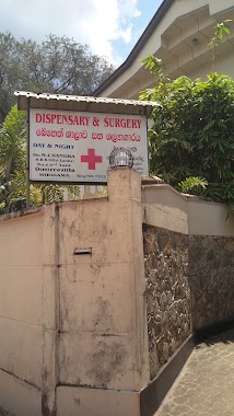
Dispensary And Surgery
Mirigama
Hospital
read more
3.756 km
Madical Center
Mirigama
Hospital
read more
4.063 km
Dr. Gunasekara Medical Centre
Mirigama
Hospital
read more
4.553 km
Medical Center
Hakurukumbura
Hospital
read more
4.602 km
Government Central Dispensary Halpe Mirigama.
Thalakolayaya Halpe Road, Mirigama
Hospital
read more
4.614 km
Halpe Government Dispensary
Halpe, Thalakolayaya Halpe Road, Gurullagama
Hospital
read more
4.824 km
Medical Center
Kotadeniyawa - Mirigama Road, Mirigama
Hospital
read more
5.123 km
Dellegoda Ayurweda Weda Madura
Veyangoda
Hospital
read more
5.15 km
Hamangalle Medical center
Pasyala
Hospital
read more
5.251 km
Ayurvedic Medical Center
Pasyala - Giriulla Road, Mirigama
Hospital
read more
5.404 km
Hospital Nambulwa
Nabuluwa
Hospital
read more
5.407 km
Kamalpitiya Hospital
Nabuluwa
Hospital
read more
6.016 km
Medical Center - Dr Nishadhi
Kottala Road, Veyangoda
Hospital
read more
6.033 km
Clinic Centre Moh
Veyangoda
Hospital
read more
9.747 km
Seth Meditech & Diagnostic
Nittambuwa - Ruwanwella Road, Wathupitiwala
Hospital
read more
17.82 km
Tusitha Hewamanna Medical Center
Ananda Mawatha, Gampaha
Hospital
read more
📑
all categories
Accounting
Administrative area level 1
Administrative area level 2
Airport
Amusement park
Aquarium
Art gallery
Atm
Bakery
Bank
Bar
Beauty salon
Bicycle store
Book store
Bowling alley
Bus station
Cafe
Campground
Car dealer
Car rental
Car repair
Car wash
Casino
Cemetery
Church
City hall
Clothing store
Colloquial area
Convenience store
Country
Courthouse
Dentist
Department store
Doctor
Electrician
Electronics store
Embassy
Finance
Fire station
Florist
Food
Funeral home
Furniture store
Gas station
General contractor
Grocery or supermarket
Gym
Hair care
Hardware store
Health
Hindu Temple
Home goods store
Hospital
Insurance agency
Intersection
Jewelry store
Laundry
Lawyer
Library
Light rail station
Liquor store
Local government office
Locality
Locksmith
Lodging
Meal delivery
Meal takeaway
Mosque
Movie rental
Movie theater
Moving company
Museum
Natural feature
Neighborhood
Night club
Painter
Park
Parking
Pet store
Pharmacy
Physiotherapist
Place of worship
Plumber
Point of interest
Police
Political
Post office
Premise
Real estate agency
Restaurant
Roofing contractor
Route
Rv park, camping
School
Shoe store
Shopping mall
Spa
Stadium
Storage
Store
Subpremise
Supermarket
Synagogue
Taxi stand
Train station
Transit station
Travel agency
University
Veterinary care
Zoo
administrative area level 3
sublocality level 1
sublocality level 2
↑