Hospital nearby Galaha Hospital
Sri Lanka
Hospital nearby Galaha Hospital
Galaha Hospital
Peradeniya-Deltota-Rikiligaskada Road, 20420, Galaha, Kandy, LK Sri Lanka
contacts phone
:
+94
Latitude:
7.1944355
, Longitude:
80.6758654
larger map & directions
read more
nearest Hospital
881 m
Govt. Veterinary Medical Office
Peradeniya-Deltota-Rikiligaskada Road, Galaha
Hospital
read more
1.722 km
M O H Office
Galaha
Hospital
read more
3.75 km
District Hospital Deltota
Deltota
Hospital
read more
3.874 km
Morahena Hospital
morahena hospital, mulgama, gampola
Hospital
read more
4.908 km
Wanahapuwa dispensary
Wanahapuwa
Hospital
read more
5.438 km
Sisila Rehabilitation center, Naranhinna, Deltota.
Deltota
Hospital
read more
6.651 km
Hospital panwila Thanna
Hospital
read more
9.554 km
Binara Medical Centre
82 Kandy-Mahiyangane-Padiyatalawa Highway, Kundasale
Hospital
read more
9.775 km
Bodhawatthe Traditional Medicine House
Swarna Hansa Mawatha, Nattarampota
Hospital
read more
9.841 km
Seth Medical Centre
A26, Pallekele
Hospital
read more
10.688 km
Siddhayurveda Panchakarma Treatment Centre
Gampola
Hospital
read more
11.348 km
Fertaid Baby Hospital
619 Peradeniya Road, Kandy
Hospital
read more
11.384 km
Asiri Hospital
Kandy
Hospital
read more
11.43 km
Suwasewana Hospital
627 Peradeniya Road, Kandy
Hospital
read more
11.445 km
Cardiothoracic Unit
Kandy
Hospital
read more
11.457 km
ETU
Kandy
Hospital
read more
11.526 km
New Medi Clinic
Kandy
Hospital
read more
11.922 km
MOH Office Udunuwara
Kovilakanda
Hospital
read more
12.364 km
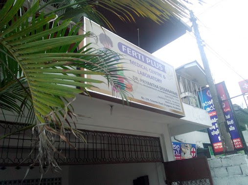
Ferti Plus | Fertility Clinic
Peradeniya
Hospital
read more
13.544 km
Pamunuwa Public Hospital
Udunuwara
Hospital
read more
14.803 km
Western Medical Center
29 Sirimalwatte Road Madawala Bazaar Sirimalwatta - Amunugama - Madawala Road Kandy Central Province20000, 29 Sirimalwatta - Amunugama - Madawala Road, Madawala
Hospital
read more
15.52 km
Safe Medicare
226, Madawela road, Katugastota, Kandy
Hospital
read more
15.619 km
Seetha Holdings Car Park
163 Colombo - Kandy Road, Pilimathalawa
Hospital
read more
16.099 km
Arogya Medical Centre
Karalliyadda
Hospital
read more
17.683 km
Barigama Hospital
Katugastota-Kurunegala-Puttalam Highway, Nugawela
Hospital
read more
📑
all categories
Accounting
Administrative area level 1
Administrative area level 2
Airport
Amusement park
Aquarium
Art gallery
Atm
Bakery
Bank
Bar
Beauty salon
Bicycle store
Book store
Bowling alley
Bus station
Cafe
Campground
Car dealer
Car rental
Car repair
Car wash
Casino
Cemetery
Church
City hall
Clothing store
Colloquial area
Convenience store
Country
Courthouse
Dentist
Department store
Doctor
Electrician
Electronics store
Embassy
Finance
Fire station
Florist
Food
Funeral home
Furniture store
Gas station
General contractor
Grocery or supermarket
Gym
Hair care
Hardware store
Health
Hindu Temple
Home goods store
Hospital
Insurance agency
Intersection
Jewelry store
Laundry
Lawyer
Library
Light rail station
Liquor store
Local government office
Locality
Locksmith
Lodging
Meal delivery
Meal takeaway
Mosque
Movie rental
Movie theater
Moving company
Museum
Natural feature
Neighborhood
Night club
Painter
Park
Parking
Pet store
Pharmacy
Physiotherapist
Place of worship
Plumber
Point of interest
Police
Political
Post office
Premise
Real estate agency
Restaurant
Roofing contractor
Route
Rv park, camping
School
Shoe store
Shopping mall
Spa
Stadium
Storage
Store
Subpremise
Supermarket
Synagogue
Taxi stand
Train station
Transit station
Travel agency
University
Veterinary care
Zoo
administrative area level 3
sublocality level 1
sublocality level 2
↑