Hospital nearby Health Care
Sri Lanka
Hospital nearby Health Care
Health Care
Colombo - Galle Main Road, Wadduwa Sri Lanka
contacts phone
:
+94
Latitude:
6.6073211
, Longitude:
79.9530298
read more
nearest Hospital
463 m
Dr.L.K Kalubowila Medical Centre
Vilegoda North, Wadduwa
Hospital
read more
722 m
Dr. Senani Medical Center
Colombo - Galle Main Road, Wadduwa
Hospital
read more
828 m
Dr.Hiran De Soyza Medical Centre
Dediyawala Road, Wadduwa
Hospital
read more
1.009 km
Family Doctor
Colombo - Galle Main Road, Wadduwa
Hospital
read more
1.174 km
Kalutara Ayurvedik Center
Abesekara Road, Wadduwa
Hospital
read more
1.325 km
Family Medical Center
Colombo - Galle Main Road, Wadduwa
Hospital
read more
2.636 km
Nirogya Medical Centre
62 Waskaduwa - Bandaragama Road, Wadduwa
Hospital
read more
2.709 km
Munirathne Ayurveda Osusala
39 Station Road, Kalutara
Hospital
read more
2.975 km
Filaria Unit
Kalutara South, Kalutara
Hospital
read more
3.285 km
Suwa Medicals
Kaluthara Horana Road, Wadduwa
Hospital
read more
3.296 km
New Philip Hospitals
No: 225, Galle Road, Kalutara
Hospital
read more
3.725 km
Dr.Arunlal Silva Medical Centre
Panapitiya North, Wadduwa
Hospital
read more
4.181 km
Dental surgery
Kalutara South, A
Hospital
read more
5.622 km
Green House Medical Center
Katukurunda, Kalutara
Hospital
read more
5.914 km
Family Care Hospital
Kalutara
Hospital
read more
5.919 km
Durdans Laboratory Nagoda
Nagoda Hospital Junction, B304
Hospital
read more
5.952 km
Nagoda Hospital Junction
B304
Hospital
read more
6.058 km
General Hospital Nagoda - Kalutara
Kalutara-Matugama Road
Hospital
read more
6.193 km
Blood Bank
Nagoda West, Katukurunda
Hospital
read more
7.128 km
Athula Medical Center
Kalutara
Hospital
read more
9.677 km
Aurveda Millaniya
Delkada Road
Hospital
read more
11.847 km
Medi City Hospital
Galle Road, Panadura
Hospital
read more
12.553 km
Sithnivana Rehabilitation Centre
260 Uyanwattha Rd, Bandaragama
Hospital
read more
13.878 km
Rural Hospital Neboda
wellatha Neboda ., Neboda - Wellatha Road
Hospital
read more
17.984 km
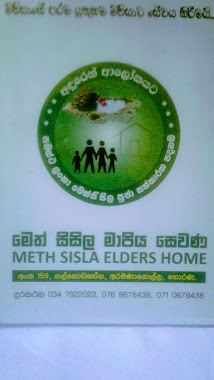
Meth Sisila Elders Home
Horana
Hospital
read more
📑
all categories
Accounting
Administrative area level 1
Administrative area level 2
Airport
Amusement park
Aquarium
Art gallery
Atm
Bakery
Bank
Bar
Beauty salon
Bicycle store
Book store
Bowling alley
Bus station
Cafe
Campground
Car dealer
Car rental
Car repair
Car wash
Casino
Cemetery
Church
City hall
Clothing store
Colloquial area
Convenience store
Country
Courthouse
Dentist
Department store
Doctor
Electrician
Electronics store
Embassy
Finance
Fire station
Florist
Food
Funeral home
Furniture store
Gas station
General contractor
Grocery or supermarket
Gym
Hair care
Hardware store
Health
Hindu Temple
Home goods store
Hospital
Insurance agency
Intersection
Jewelry store
Laundry
Lawyer
Library
Light rail station
Liquor store
Local government office
Locality
Locksmith
Lodging
Meal delivery
Meal takeaway
Mosque
Movie rental
Movie theater
Moving company
Museum
Natural feature
Neighborhood
Night club
Painter
Park
Parking
Pet store
Pharmacy
Physiotherapist
Place of worship
Plumber
Point of interest
Police
Political
Post office
Premise
Real estate agency
Restaurant
Roofing contractor
Route
Rv park, camping
School
Shoe store
Shopping mall
Spa
Stadium
Storage
Store
Subpremise
Supermarket
Synagogue
Taxi stand
Train station
Transit station
Travel agency
University
Veterinary care
Zoo
administrative area level 3
sublocality level 1
sublocality level 2
↑