Hospital nearby State Dispensary - Thummodara
Sri Lanka
Hospital nearby State Dispensary - Thummodara
State Dispensary - Thummodara
B188, Labugama, Colombo, LK Sri Lanka
contacts phone
:
+94
Latitude:
6.862579
, Longitude:
80.1692075
larger map & directions
read more
nearest Hospital
114 m
Thummodara Central Dispensary
Thummodara, Labugama
Hospital
read more
4.864 km
Dunkola Weda Mahaththaya.
Arangala Weda Medura, Negombo-Colombo Main Road, Wattala
Hospital
read more
6.403 km
Medical Center
Kahahena
Hospital
read more
8.403 km
Kiriporuwa Weda Gedara
Mitipola Road
Hospital
read more
8.743 km
Medical office of Health
Galagedera - Horana Rd, Padukka
Hospital
read more
9.133 km
Kiriporuwa Rural Hospital
Mitipola Road
Hospital
read more
9.702 km
Salawa Medical Centre
Avissawella Road, Kosgama
Hospital
read more
9.805 km
Ranasinghe Medical Center
Colombo - Batticaloa Highway
Hospital
read more
10.541 km
Ayurveda Medical Center
142, Nedurana Road, Eheliyagoda
Hospital
read more
10.679 km
Suwahasa Ayurwadic Medical Centre
Hanwella Junction Road, Hanwella
Hospital
read more
10.893 km
Government Ayurvedic Medical Centre
Colombo-Hanwella Road, Hanwella
Hospital
read more
11.046 km
Asiri Laborotary
Kudagama Road, Avissawella
Hospital
read more
11.089 km
Venus Hospital
Avissawella
Hospital
read more
11.13 km
Suwaya Medical Centre
Hanwella
Hospital
read more
13.143 km
Siri Weda Madura
No 216C, Giridara, Kapugoda.
Hospital
read more
13.989 km
Siri Weda Madura
Ingiriya Road, Ingiriya
Hospital
read more
14.074 km
Aurweda Hospital
Sri Lanka
Hospital
read more
14.959 km
Madagoda Dispensary
Kegalle
Hospital
read more
15.046 km
කැඩුම් බිදුම් උපෙක්ෂා වෙද මැදුර
Embilladeniya
Hospital
read more
15.089 km
Suwa Arana Medical Center
Welipillewa
Hospital
read more
15.575 km
HINGURALAKANDA - Hospital
Sri Lanka, Hinguralakanda - Batangala Road
Hospital
read more
15.769 km
Nalani Osusala
Delgoda-Pugoda-Giridara Road, Giridara Junction
Hospital
read more
15.893 km
Adhikari Medical Center
Gonapola - Thalagala Road
Hospital
read more
15.953 km
Family care Channeling center
Kegalle
Hospital
read more
19.124 km
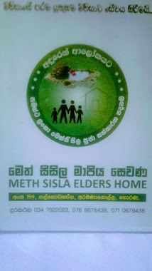
Meth Sisila Elders Home
Horana
Hospital
read more
📑
all categories
Accounting
Administrative area level 1
Administrative area level 2
Airport
Amusement park
Aquarium
Art gallery
Atm
Bakery
Bank
Bar
Beauty salon
Bicycle store
Book store
Bowling alley
Bus station
Cafe
Campground
Car dealer
Car rental
Car repair
Car wash
Casino
Cemetery
Church
City hall
Clothing store
Colloquial area
Convenience store
Country
Courthouse
Dentist
Department store
Doctor
Electrician
Electronics store
Embassy
Finance
Fire station
Florist
Food
Funeral home
Furniture store
Gas station
General contractor
Grocery or supermarket
Gym
Hair care
Hardware store
Health
Hindu Temple
Home goods store
Hospital
Insurance agency
Intersection
Jewelry store
Laundry
Lawyer
Library
Light rail station
Liquor store
Local government office
Locality
Locksmith
Lodging
Meal delivery
Meal takeaway
Mosque
Movie rental
Movie theater
Moving company
Museum
Natural feature
Neighborhood
Night club
Painter
Park
Parking
Pet store
Pharmacy
Physiotherapist
Place of worship
Plumber
Point of interest
Police
Political
Post office
Premise
Real estate agency
Restaurant
Roofing contractor
Route
Rv park, camping
School
Shoe store
Shopping mall
Spa
Stadium
Storage
Store
Subpremise
Supermarket
Synagogue
Taxi stand
Train station
Transit station
Travel agency
University
Veterinary care
Zoo
administrative area level 3
sublocality level 1
sublocality level 2
↑