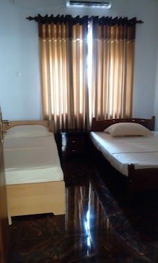
Lodging nearby Fort View
Sri Lanka
Lodging nearby Fort View
Fort View
Galle 80000, Sri Lanka
contacts phone
:
+94 77 207 8238
Latitude:
6.045944
, Longitude:
80.2144536
larger map & directions
read more
nearest Lodging
103 m
Arken Lanka Hotel
No 42 Sangamiththa Ln, Galle
Lodging
read more
134 m
The One Apartment
79 A Woodward Street, Galle
Lodging
read more
177 m
Wakwella Villa
246 Wakwella Road, Galle
Lodging
read more
223 m
Seyansa Guest House
Galle
Lodging
read more
271 m
Dream Guest House & Restuarant
99/10,Hums Rd, Galle
Lodging
read more
343 m
Galle Lakinrose
18/2 A, Mahinda Lane,, Sapugahawatta,, Dangedara, Galle
Lodging
read more
344 m
The Desh House
Galle
Lodging
read more
523 m
Water Villa
4/1, Pokunuwatta Road, Dangedara, Galle
Lodging
read more
603 m
Nsj Rooms
Galle
Lodging
read more
626 m
Somnasa
No 43, Steel Road, Galle
Lodging
read more
634 m
Villa Udumbara
No.1A1 2nd Lane, Galle
Lodging
read more
643 m
Janaka Beach
Galle
Lodging
read more
695 m
Peace Garden Holiday Villa
63 E.A. Wijesooriya Mawatha, Galle
Lodging
read more
713 m
Mick Villa
No.26, Crips Road, Galle
Lodging
read more
718 m
Tea Zone Villa
75/2, Jiffriya Street, Dangedara, Galle
Lodging
read more
737 m
Omaclan villa
No: 19/2, Kandewatta 1st lane, Galle
Lodging
read more
797 m
Prasad Guest
Galle
Lodging
read more
866 m
Happy Homestay
Galle - Baddegama Road, Galle
Lodging
read more
928 m
Vista BnB Lower Dickson Road
Lower Dickson Road, Galle
Lodging
read more
958 m
Lady Hill
29 Upper Dickson Road, Galle
Lodging
read more
993 m
Villa 26
26, Sri Hemanandha mawatha, Bataganvila, Galle, ගාල්ල
Lodging
read more
995 m
skyline
455 Galle Road, Wakwella
Lodging
read more
1.001 km
Ministry Of Home Affairs Circuit Bungalow
Donald Janz Road, Galle
Lodging
read more
1.003 km
Villa 88 Street
88 Havelock Road 88, Havelock Road, Galle 1st floor, Galle
Lodging
read more
1.085 km
Galle city villa
22/1 Kandewatte 1st Lane, Galle
Lodging
read more
📑
all categories
Accounting
Administrative area level 1
Administrative area level 2
Airport
Amusement park
Aquarium
Art gallery
Atm
Bakery
Bank
Bar
Beauty salon
Bicycle store
Book store
Bowling alley
Bus station
Cafe
Campground
Car dealer
Car rental
Car repair
Car wash
Casino
Cemetery
Church
City hall
Clothing store
Colloquial area
Convenience store
Country
Courthouse
Dentist
Department store
Doctor
Electrician
Electronics store
Embassy
Finance
Fire station
Florist
Food
Funeral home
Furniture store
Gas station
General contractor
Grocery or supermarket
Gym
Hair care
Hardware store
Health
Hindu Temple
Home goods store
Hospital
Insurance agency
Intersection
Jewelry store
Laundry
Lawyer
Library
Light rail station
Liquor store
Local government office
Locality
Locksmith
Lodging
Meal delivery
Meal takeaway
Mosque
Movie rental
Movie theater
Moving company
Museum
Natural feature
Neighborhood
Night club
Painter
Park
Parking
Pet store
Pharmacy
Physiotherapist
Place of worship
Plumber
Point of interest
Police
Political
Post office
Premise
Real estate agency
Restaurant
Roofing contractor
Route
Rv park, camping
School
Shoe store
Shopping mall
Spa
Stadium
Storage
Store
Subpremise
Supermarket
Synagogue
Taxi stand
Train station
Transit station
Travel agency
University
Veterinary care
Zoo
administrative area level 3
sublocality level 1
sublocality level 2
↑