Lodging nearby Jaffna University Guest House
Sri Lanka
Lodging nearby Jaffna University Guest House
Jaffna University Guest House
Kokuvil East, Sri Lanka
contacts phone
:
+94
Latitude:
9.6866399
, Longitude:
80.0203572
larger map & directions
read more
nearest Lodging
38 m
Balasingam Boys Hostel
Brown Road, Kokuvil East
Lodging
read more
91 m
Ananda Coomaraswamy Girls Hostel
Ramanathan Road, Kokuvil East
Lodging
read more
91 m
Balasingam Girls Hostel
Ramanathan Road, Kokuvil East
Lodging
read more
91 m
Balasingam Boys Hostel
Ramanathan Road, Kokuvil East
Lodging
read more
192 m
Oâsis Guest House
Kokuvil East
Lodging
read more
197 m
New Girls Hostel, University Of Jaffna
Kokuvil East
Lodging
read more
203 m
Anandha Kumaraswamy Girl's Hostel
Ramanathan Road, Kokuvil East
Lodging
read more
271 m
UOJ Science Demonstrator's
Jaffna
Lodging
read more
430 m
Millon Inn
Jaffna
Lodging
read more
516 m
New Abiraamy Hotel
Jaffna
Lodging
read more
547 m
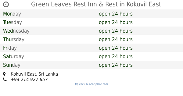
Green Leaves Rest Inn & Rest
Kokuvil East
Lodging
read more
638 m
The Thinnai
86, Palaly Road Thirunelveli, Jaffna
Lodging
read more
638 m
The Thinnai
No. 86, Palaly Road, Thirunelnveli, யாழ்ப்பாணம்
Lodging
read more
642 m
University Students Hostel
Kokuvil East
Lodging
read more
667 m
Kaladdi Hostel
Jaffna
Lodging
read more
684 m
Harmony Center - Jaffna
Sabapathy Lane, Jaffna
Lodging
read more
753 m
Anna Bavan
958, Jaffna-Kankesanturai Road, Jaffna
Lodging
read more
791 m
Yarl Hotel
Jaffna
Lodging
read more
858 m
Girls Hostel
Kokuvil East
Lodging
read more
889 m
Suja's hostel
Jaffna
Lodging
read more
906 m
Senthil Complex Banquet Hall & Rooms
88, Sivapragasam Road (Near Thaddatheru Junction), Jaffna
Lodging
read more
988 m
Palm House
Jaffna
Lodging
read more
1.054 km
Uthayan Guest House
Jaffna
Lodging
read more
1.072 km
11 to Eleven HomeStay
99/7, Brown Road, Jaffna
Lodging
read more
1.216 km
Jaffna Hindu College Hostel
College Lane, Jaffna
Lodging
read more
📑
all categories
Accounting
Administrative area level 1
Administrative area level 2
Airport
Amusement park
Aquarium
Art gallery
Atm
Bakery
Bank
Bar
Beauty salon
Bicycle store
Book store
Bowling alley
Bus station
Cafe
Campground
Car dealer
Car rental
Car repair
Car wash
Casino
Cemetery
Church
City hall
Clothing store
Colloquial area
Convenience store
Country
Courthouse
Dentist
Department store
Doctor
Electrician
Electronics store
Embassy
Finance
Fire station
Florist
Food
Funeral home
Furniture store
Gas station
General contractor
Grocery or supermarket
Gym
Hair care
Hardware store
Health
Hindu Temple
Home goods store
Hospital
Insurance agency
Intersection
Jewelry store
Laundry
Lawyer
Library
Light rail station
Liquor store
Local government office
Locality
Locksmith
Lodging
Meal delivery
Meal takeaway
Mosque
Movie rental
Movie theater
Moving company
Museum
Natural feature
Neighborhood
Night club
Painter
Park
Parking
Pet store
Pharmacy
Physiotherapist
Place of worship
Plumber
Point of interest
Police
Political
Post office
Premise
Real estate agency
Restaurant
Roofing contractor
Route
Rv park, camping
School
Shoe store
Shopping mall
Spa
Stadium
Storage
Store
Subpremise
Supermarket
Synagogue
Taxi stand
Train station
Transit station
Travel agency
University
Veterinary care
Zoo
administrative area level 3
sublocality level 1
sublocality level 2
↑