Lodging nearby Lady hill peradeniya
Sri Lanka
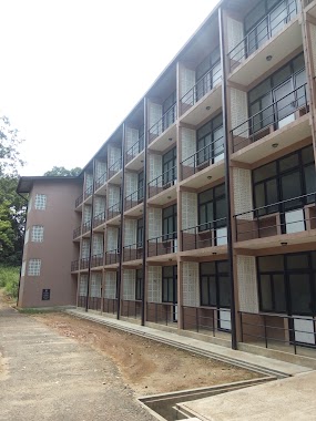
Lodging nearby Lady hill peradeniya
Lady hill peradeniya
Peradeniya, Sri Lanka
contacts phone
:
+94
Latitude:
7.2711823
, Longitude:
80.6010481
larger map & directions
read more
nearest Lodging
413 m
Keshan Food Cabin
Peradeniya Road
Lodging
read more
487 m
Senaka Bibile Hall
Kandy
Lodging
read more
721 m
Jay's Inn
No 22, Prospect Hill, Udaperadeniya, Peradeniya, Kandy
Lodging
read more
746 m
Mountbatten Bungalow - Kandy
No 04, Spring Hill Estate, Bowalawatte
Lodging
read more
763 m
Gangaaddara Hotel
Deveni Rajasinghe Mawatha, Kandy
Lodging
read more
801 m
Oak Ray Regency Hotel
Deveni Rajasinghe Mawatha, Kandy
Lodging
read more
830 m
Pearl Residence
Udaperadeniya Road
Lodging
read more
850 m
Misty Hills
37, Uda Peradeniya, Peradeniya
Lodging
read more
858 m
Paradise Inn Kandy
Dangolla Road, Kandy
Lodging
read more
912 m
Cave Cottage
752 Peradeniya Road, Kandy
Lodging
read more
927 m
Dangolla BOC Rest
Wimaladharma Road, Kandy
Lodging
read more
968 m
Clarion Inn
18/13, Wimaladharma Mw,, Dangolla Road, Gatambe., Kandy
Lodging
read more
1.004 km
Honeypot Restaurant & Guest House
33Deveni Rajasinghe Mawatha, මහනුවර
Lodging
read more
1.021 km
Lady Hill Guest House
Park Avenue, Kandy
Lodging
read more
1.035 km
Royal Garden View
1, 10, Gannoruwa Road
Lodging
read more
1.035 km
Royal Garden View
1, 10, B365
Lodging
read more
1.043 km
kandy maima
Dangolla, Kandy
Lodging
read more
1.059 km
Royal Silk Villa
No.No.678/12 sirimavo bandaranayaka mawatha, Kandy
Lodging
read more
1.071 km
Baramba HOUSE
22, Upul Mawatha, මහනුවර
Lodging
read more
1.123 km
Thajmahal Hotel
Lodging
read more
1.127 km
New Buhary Hotel
Sri Lanka
Lodging
read more
1.136 km
Ever Green Chilli Hotel
Peradeniya Road
Lodging
read more
1.204 km
SLT circuit banglow Kandy
Primrose Road, Kandy
Lodging
read more
1.229 km
BENSON Hotel
Gampola Road
Lodging
read more
1.287 km
Araliya Home Stay
No.6, Lane 4, Araliya Mawatha, Primrose Garden, Kandy, මහනුවර
Lodging
read more
📑
all categories
Accounting
Administrative area level 1
Administrative area level 2
Airport
Amusement park
Aquarium
Art gallery
Atm
Bakery
Bank
Bar
Beauty salon
Bicycle store
Book store
Bowling alley
Bus station
Cafe
Campground
Car dealer
Car rental
Car repair
Car wash
Casino
Cemetery
Church
City hall
Clothing store
Colloquial area
Convenience store
Country
Courthouse
Dentist
Department store
Doctor
Electrician
Electronics store
Embassy
Finance
Fire station
Florist
Food
Funeral home
Furniture store
Gas station
General contractor
Grocery or supermarket
Gym
Hair care
Hardware store
Health
Hindu Temple
Home goods store
Hospital
Insurance agency
Intersection
Jewelry store
Laundry
Lawyer
Library
Light rail station
Liquor store
Local government office
Locality
Locksmith
Lodging
Meal delivery
Meal takeaway
Mosque
Movie rental
Movie theater
Moving company
Museum
Natural feature
Neighborhood
Night club
Painter
Park
Parking
Pet store
Pharmacy
Physiotherapist
Place of worship
Plumber
Point of interest
Police
Political
Post office
Premise
Real estate agency
Restaurant
Roofing contractor
Route
Rv park, camping
School
Shoe store
Shopping mall
Spa
Stadium
Storage
Store
Subpremise
Supermarket
Synagogue
Taxi stand
Train station
Transit station
Travel agency
University
Veterinary care
Zoo
administrative area level 3
sublocality level 1
sublocality level 2
↑