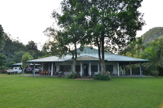
Lodging nearby Liyangama Touchwood
Sri Lanka
Lodging nearby Liyangama Touchwood
Liyangama Touchwood
Ratnapura, Sri Lanka
contacts phone
:
+94
Latitude:
6.8255922
, Longitude:
80.2198891
larger map & directions
read more
nearest Lodging
1.7 km
Wavila Ruber Land RESORT
Ratnapura
Lodging
read more
3.8 km
SK HOTEL
B222, Eheliyagoda
Lodging
read more
4.207 km
Anton Kasturirathne
Karandana Road
Lodging
read more
4.527 km
Serenity Village
Wewila Rd, Wewila
Lodging
read more
5.014 km
sandaken plant's Nursery.
21/1, B222, Eheliyagoda
Lodging
read more
5.113 km
Hotel Jilani
Eheliyagoda
Lodging
read more
5.495 km
Suwinra Hotel and Restaurant - Eheliyagoda
Colombo - Batticaloa Highway, Eheliyagoda
Lodging
read more
5.652 km
Jana Hitha Hotel
Eheliyagoda
Lodging
read more
5.681 km
Jayasiri Hotel
Eheliyagoda
Lodging
read more
5.847 km
Famous Hotel
Eheliyagoda
Lodging
read more
7.155 km
Banana Leaf Hotel
Sri Lanka
Lodging
read more
7.305 km
Jilani Hotel
Mennanna
Lodging
read more
9.375 km
Ranmin Bellair Banglow
Gatamawara Mawatha
Lodging
read more
9.387 km
Boiled Manioc Hotel
Ratnapura
Lodging
read more
10.538 km
Hotel Silent River
Kalutara
Lodging
read more
10.681 km
Volanro Resort
Welikanna, No133, Waga
Lodging
read more
12.497 km
Graten Tea Gardens Bungalow
Panadura Road, Ratnapura
Lodging
read more
13.751 km
Hotel Rays Lanka
2/5 Avissawella Road, Avissawella
Lodging
read more
13.991 km
Kithulkanda Mountain Hotel
No. 07,, Meepe - Ingiriya Road, Padukka
Lodging
read more
14.457 km
Sandasiri Hotel
Padukka
Lodging
read more
15.152 km
Ukwattage hotel And Grocery
Kuruwita
Lodging
read more
15.973 km
Sureshi Holiday Home
Unnamed Road, Ratnapura
Lodging
read more
16.199 km
Lake Serenity Resort
Gonapitiya Road, Ratnapura
Lodging
read more
16.922 km
Sandamira Guest
218//2 Highlevel Road, Hanwella
Lodging
read more
17.552 km
ක්ක්
Deraniyagala
Lodging
read more
📑
all categories
Accounting
Administrative area level 1
Administrative area level 2
Airport
Amusement park
Aquarium
Art gallery
Atm
Bakery
Bank
Bar
Beauty salon
Bicycle store
Book store
Bowling alley
Bus station
Cafe
Campground
Car dealer
Car rental
Car repair
Car wash
Casino
Cemetery
Church
City hall
Clothing store
Colloquial area
Convenience store
Country
Courthouse
Dentist
Department store
Doctor
Electrician
Electronics store
Embassy
Finance
Fire station
Florist
Food
Funeral home
Furniture store
Gas station
General contractor
Grocery or supermarket
Gym
Hair care
Hardware store
Health
Hindu Temple
Home goods store
Hospital
Insurance agency
Intersection
Jewelry store
Laundry
Lawyer
Library
Light rail station
Liquor store
Local government office
Locality
Locksmith
Lodging
Meal delivery
Meal takeaway
Mosque
Movie rental
Movie theater
Moving company
Museum
Natural feature
Neighborhood
Night club
Painter
Park
Parking
Pet store
Pharmacy
Physiotherapist
Place of worship
Plumber
Point of interest
Police
Political
Post office
Premise
Real estate agency
Restaurant
Roofing contractor
Route
Rv park, camping
School
Shoe store
Shopping mall
Spa
Stadium
Storage
Store
Subpremise
Supermarket
Synagogue
Taxi stand
Train station
Transit station
Travel agency
University
Veterinary care
Zoo
administrative area level 3
sublocality level 1
sublocality level 2
↑