Lodging nearby Pigera Stores & Hotel
Sri Lanka
Lodging nearby Pigera Stores & Hotel
Pigera Stores & Hotel
Welivita, Sri Lanka
contacts phone
:
+94 112 414 138
Latitude:
6.938349
, Longitude:
79.9522214
larger map & directions
read more
nearest Lodging
111 m
Grand Arena
80,, Avissawella Rd, Welivita
Lodging
read more
218 m
Mitchell Grand Hotel
No: 107/E2, Arangapolawatta,, Weliwita, Kaduwela
Lodging
read more
355 m
Flower Garden Hotel
Welivita
Lodging
read more
609 m
Woodland Cottage
170, Welivita , Kaduwela, Weliwita
Lodging
read more
800 m
Renuka Tourist Hotel
Biyagama Road, Peliyagoda
Lodging
read more
830 m
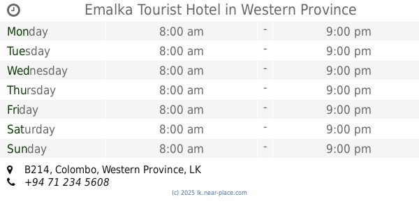
Emalka Tourist Hotel
B214
Lodging
read more
1.023 km
Hotel New Flower Garden
112/E1, Weliwita, කඩුවෙල
Lodging
read more
1.222 km
Janahitha Bakers
Bollegala
Lodging
read more
1.279 km
Nilnadee Inn
Sri Lanka
Lodging
read more
1.467 km
Himbutu Uyana Housing Scheme
Himbutana Road
Lodging
read more
1.617 km
The Shady Family Hotel
Raggahawatta
Lodging
read more
1.701 km
King Villa
No. 51, Orchid Nivasie Housing Project, No. 51, මාලබේ
Lodging
read more
1.729 km
Wijitha Hotel
Raggahawatta
Lodging
read more
1.729 km
Hotel River Park
Mabima West
Lodging
read more
1.743 km
Proposed Boys Hostel for Horizon Campus
Sri Lanka
Lodging
read more
1.755 km
Pigera Stores
Welivita Road, Welivita
Lodging
read more
1.862 km
Chathum River Side
Biyagama Road
Lodging
read more
1.927 km
Samarathunga Stores
Biyagama Road, Peliyagoda
Lodging
read more
1.947 km
White Palace Boys Hostel
No. 394, Walivita,, Kaduwela,
Lodging
read more
1.997 km
Coca Cola Hostel
Bandaranayaka Mawatha, Malabe
Lodging
read more
2.064 km
Horizon Hostel
Welivita Road, Welivita
Lodging
read more
2.07 km
MiPlace
405 / B, Welivita Rd, Malabe
Lodging
read more
2.197 km
Grand Anupama Hotel
Welivita
Lodging
read more
2.286 km
Senura Hotel
Sri Lanka
Lodging
read more
3.575 km
JSS Hostels
161/6/8, Malabe
Lodging
read more
📑
all categories
Accounting
Administrative area level 1
Administrative area level 2
Airport
Amusement park
Aquarium
Art gallery
Atm
Bakery
Bank
Bar
Beauty salon
Bicycle store
Book store
Bowling alley
Bus station
Cafe
Campground
Car dealer
Car rental
Car repair
Car wash
Casino
Cemetery
Church
City hall
Clothing store
Colloquial area
Convenience store
Country
Courthouse
Dentist
Department store
Doctor
Electrician
Electronics store
Embassy
Finance
Fire station
Florist
Food
Funeral home
Furniture store
Gas station
General contractor
Grocery or supermarket
Gym
Hair care
Hardware store
Health
Hindu Temple
Home goods store
Hospital
Insurance agency
Intersection
Jewelry store
Laundry
Lawyer
Library
Light rail station
Liquor store
Local government office
Locality
Locksmith
Lodging
Meal delivery
Meal takeaway
Mosque
Movie rental
Movie theater
Moving company
Museum
Natural feature
Neighborhood
Night club
Painter
Park
Parking
Pet store
Pharmacy
Physiotherapist
Place of worship
Plumber
Point of interest
Police
Political
Post office
Premise
Real estate agency
Restaurant
Roofing contractor
Route
Rv park, camping
School
Shoe store
Shopping mall
Spa
Stadium
Storage
Store
Subpremise
Supermarket
Synagogue
Taxi stand
Train station
Transit station
Travel agency
University
Veterinary care
Zoo
administrative area level 3
sublocality level 1
sublocality level 2
↑