Lodging nearby Sirisara Uyana Appartments
Sri Lanka
Lodging nearby Sirisara Uyana Appartments
Sirisara Uyana Appartments
Colombo, Sri Lanka
contacts phone
:
+94
Latitude:
6.9610631
, Longitude:
79.8917205
larger map & directions
read more
nearest Lodging
243 m
Hotel RUHUNU
410 Colombo - Kandy Road, Kelaniya.
Lodging
read more
389 m
Tina's Cosy Room 2
Old Kandy Road, Peliyagoda
Lodging
read more
762 m
Boys Hostel, University Of Kelaniya
Peliyagoda Pattiya East, Peliyagoda
Lodging
read more
765 m
Villa3000
9/2 Nuge Road, Wattala
Lodging
read more
821 m
Kelani Hotel
K J Peiris Road, Peliyagoda
Lodging
read more
988 m
Markzio Apartments
21/6 Walawwatta Wanawasala Road, Thorana Junction, Kelaniya
Lodging
read more
1.003 km
Memories Rooms
135 Waragoda Road, Kelaniya
Lodging
read more
1.053 km
Kaushalya Hotel
Sri Lanka
Lodging
read more
1.151 km
Hotel...Madusanka
Sri Lanka
Lodging
read more
1.151 km
Hotel...Madusanka
170 Sedawatta - Ambatale Road, Peliyagoda
Lodging
read more
1.156 km
Nawaloka Hotel
350 Negombo-Colombo Main Road, Peliyagoda
Lodging
read more
1.193 km
uga escapes
Colombo
Lodging
read more
1.297 km
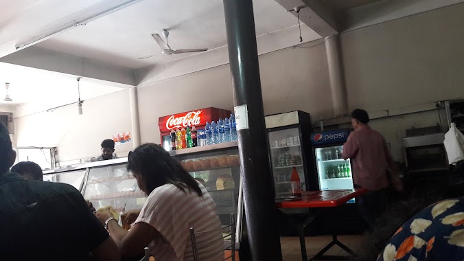
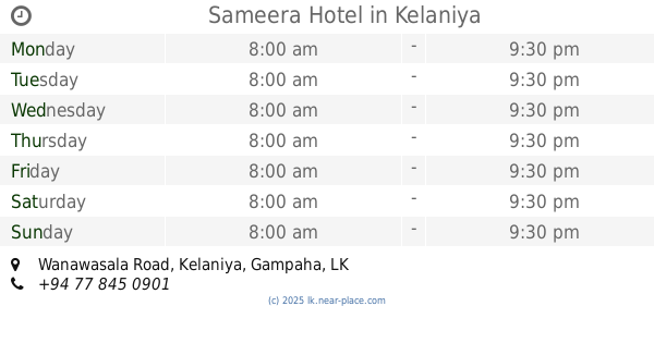
Sameera Hotel
no 88/2, Wanawasala Road, Kelaniya
Lodging
read more
1.382 km
Jayabima Hotel
Biyagama Road
Lodging
read more
1.489 km
Mattakkuliya Temple
10/52-1 sri kelanigaga mill, road, Colombo
Lodging
read more
1.633 km
Airport Homestay
626, 32 කොළඹ - පුත්තලම පාර, நீர்கொழும்பு
Lodging
read more
1.643 km
Sarasa Hotel
Dalugama
Lodging
read more
1.644 km
Kajen Accommodation
451/7 Ferguson Road, Colombo
Lodging
read more
1.974 km
Rismiya Fruit Shop
Mattakkuliya, Colombo
Lodging
read more
2.177 km
Indika Hotel
633 Sirimavo Bandaranaike Mawatha, Colombo
Lodging
read more
2.177 km
Indika Hotel
Sri Lanka
Lodging
read more
2.233 km
Riverside Hotel
80/4, Sedawatta - Ambatale Road, Kolonnawa
Lodging
read more
2.324 km
Majestic HOTEL
Grandpass North, Colombo
Lodging
read more
2.33 km
Laksiri Hotel
Colombo
Lodging
read more
2.337 km
Angoda
195/D, Samagi Mawatha, Angoda
Lodging
read more
📑
all categories
Accounting
Administrative area level 1
Administrative area level 2
Airport
Amusement park
Aquarium
Art gallery
Atm
Bakery
Bank
Bar
Beauty salon
Bicycle store
Book store
Bowling alley
Bus station
Cafe
Campground
Car dealer
Car rental
Car repair
Car wash
Casino
Cemetery
Church
City hall
Clothing store
Colloquial area
Convenience store
Country
Courthouse
Dentist
Department store
Doctor
Electrician
Electronics store
Embassy
Finance
Fire station
Florist
Food
Funeral home
Furniture store
Gas station
General contractor
Grocery or supermarket
Gym
Hair care
Hardware store
Health
Hindu Temple
Home goods store
Hospital
Insurance agency
Intersection
Jewelry store
Laundry
Lawyer
Library
Light rail station
Liquor store
Local government office
Locality
Locksmith
Lodging
Meal delivery
Meal takeaway
Mosque
Movie rental
Movie theater
Moving company
Museum
Natural feature
Neighborhood
Night club
Painter
Park
Parking
Pet store
Pharmacy
Physiotherapist
Place of worship
Plumber
Point of interest
Police
Political
Post office
Premise
Real estate agency
Restaurant
Roofing contractor
Route
Rv park, camping
School
Shoe store
Shopping mall
Spa
Stadium
Storage
Store
Subpremise
Supermarket
Synagogue
Taxi stand
Train station
Transit station
Travel agency
University
Veterinary care
Zoo
administrative area level 3
sublocality level 1
sublocality level 2
↑