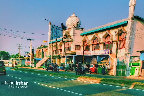
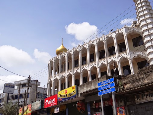
Mosque nearby Ibnu Umar Jumma Mosque
Sri Lanka
Mosque nearby Ibnu Umar Jumma Mosque
Ibnu Umar Jumma Mosque
Percy Dias Mawatha, Kandana, Gampaha, LK Sri Lanka
contacts phone
:
+94
Latitude:
7.0074312
, Longitude:
79.895174
larger map & directions
read more
nearest Mosque
305 m
Mabola Jummah Masjid
Negombo-Colombo Main Road, Wattala
Mosque
read more
414 m
Masjidul Saliheem
Naiduwa, වත්තල
Mosque
read more
666 m
Duwa Jumma Mosque
Duwa Road, Wattala
Mosque
read more
1.93 km
Muslim Mosque
Paranakanda Road, Wattala
Mosque
read more
1.948 km
Welegoda Jumma Masjid
Wattala-Mabola
Mosque
read more
2.427 km
AKBARTOWN JUMMAH MOSQUE
Hunupitiya
Mosque
read more
2.501 km
Jumma Masjid Wattala
Samagi Mawatha, Wattala
Mosque
read more
2.514 km
Adiwissa Jummah Masjid
Ragama
Mosque
read more
2.624 km
Masjidul Firdous
Rosevilla Garden Road, Wattala
Mosque
read more
2.876 km
Noorul Islam Madrasa, Bangalawatta
Bangalawatta Road
Mosque
read more
3.218 km
Dippitigoda Mosque Mohiyyaddinethakkiya
Dippitigoda Road
Mosque
read more
3.248 km
Masjidul Ayesha Jummah Masjid
Wattala
Mosque
read more
4.108 km
Al Masjidhul Ilahiya Mosqe
Colombo
Mosque
read more
4.278 km
Al Masjidhul Dheeniya
Kelani Ganga Mill Road, Colombo
Mosque
read more
4.347 km
Zaviyathul Khairiya Jumma Masjid
Colombo
Mosque
read more
4.39 km
Zavia Mosque
St. Mary's Road, Colombo
Mosque
read more
4.569 km
Peliyagoda Jumma Mosque
A3, Wattala
Mosque
read more
4.576 km
Noor Mosque
7th Lane, Colombo
Mosque
read more
4.829 km
Thakkiya Mosque
170 Vystwyke Road, Colombo
Mosque
read more
4.829 km
Thakkiya Mosque
Vystwyke Road, Colombo
Mosque
read more
5.042 km
Jabal Masjid
289 Ferguson's Road, Colombo
Mosque
read more
5.125 km
Modera jumma mosque
Modera Street, Colombo
Mosque
read more
7.275 km
Masjidun Noor Jummah Mosque
Welewatta
Mosque
read more
9.889 km
Fort Jumma Mosque مسجد
Chatham Street, Colombo
Mosque
read more
15.407 km
Al-Masjidul Musthafaviyyah Thakkiya
Sri Lanka
Mosque
read more
📑
all categories
Accounting
Administrative area level 1
Administrative area level 2
Airport
Amusement park
Aquarium
Art gallery
Atm
Bakery
Bank
Bar
Beauty salon
Bicycle store
Book store
Bowling alley
Bus station
Cafe
Campground
Car dealer
Car rental
Car repair
Car wash
Casino
Cemetery
Church
City hall
Clothing store
Colloquial area
Convenience store
Country
Courthouse
Dentist
Department store
Doctor
Electrician
Electronics store
Embassy
Finance
Fire station
Florist
Food
Funeral home
Furniture store
Gas station
General contractor
Grocery or supermarket
Gym
Hair care
Hardware store
Health
Hindu Temple
Home goods store
Hospital
Insurance agency
Intersection
Jewelry store
Laundry
Lawyer
Library
Light rail station
Liquor store
Local government office
Locality
Locksmith
Lodging
Meal delivery
Meal takeaway
Mosque
Movie rental
Movie theater
Moving company
Museum
Natural feature
Neighborhood
Night club
Painter
Park
Parking
Pet store
Pharmacy
Physiotherapist
Place of worship
Plumber
Point of interest
Police
Political
Post office
Premise
Real estate agency
Restaurant
Roofing contractor
Route
Rv park, camping
School
Shoe store
Shopping mall
Spa
Stadium
Storage
Store
Subpremise
Supermarket
Synagogue
Taxi stand
Train station
Transit station
Travel agency
University
Veterinary care
Zoo
administrative area level 3
sublocality level 1
sublocality level 2
↑