Mosque nearby Masjithul Hitha
Sri Lanka
Mosque nearby Masjithul Hitha
Masjithul Hitha
30300,, Eravur 30300, Sri Lanka
contacts phone
:
+94
Latitude:
7.7835074
, Longitude:
81.6108297
larger map & directions
read more
nearest Mosque
289 m
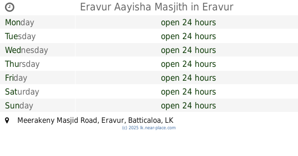
Eravur Aayisha Masjith
Meerakeny Masjid Road, Eravur
Mosque
read more
300 m
Akbar Jummah Masjth
Eravur
Mosque
read more
307 m
Akber Jummah Mosque
30300,, Eravur
Mosque
read more
331 m
Zuhatha Mosque Eravur
Eravur
Mosque
read more
562 m
Masjithul Hairath
Eravur
Mosque
read more
710 m
Merakerny Jumma Masjid
Meerakeny Masjid Road, Eravur
Mosque
read more
759 m
Kattuppalli Masjith
Town,, Eravur
Mosque
read more
795 m
Masjithul Afrar
Thaikkah cross Road, Eravur
Mosque
read more
796 m
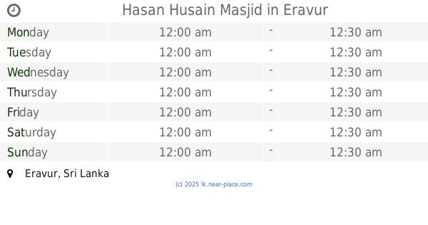
Hasan Husain Masjid
Eravur
Mosque
read more
824 m
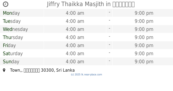
Jiffry Thaikka Masjith
Town,, ஏறாவூர்
Mosque
read more
835 m
Shaafi Mosque
Ghanthiyar Cross Road, Eravur-03
Mosque
read more
882 m
Abusalih Thikah Mosque
Eravur
Mosque
read more
950 m
Masjid Hamza
Eravur
Mosque
read more
950 m
Al Markazul Islami Jum'a Masjid
Jiffry Thikah Lane, Eravur
Mosque
read more
1.019 km
Masjidul Thakwa
Unnamed Road, Eravur
Mosque
read more
1.083 km
Vaaliyappa Thaikka Mosque
Eravur
Mosque
read more
1.172 km
Satham Husain Mosque
Eravur
Mosque
read more
1.181 km
Eravur Mohideen Jumma Masjid
Town,, Eravur
Mosque
read more
1.182 km
Zaviya Mosque
Eravur
Mosque
read more
1.261 km
Misbah Masjith
Munaiyavalavu Road, Eravur
Mosque
read more
1.262 km
SLTJ Eravur Branch
Town,, ஏறாவூர்
Mosque
read more
1.324 km
Meera Grand Jumma Mosque
Oothupalli Road
Mosque
read more
1.485 km
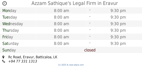
Azzam Sathique's Legal Firm
Rc Road, Eravur
Mosque
read more
3.666 km
University Mosque
Eastern University
Mosque
read more
17.07 km
Meththai Grand Jummah Masjidh
Kattankudi
Mosque
read more
📑
all categories
Accounting
Administrative area level 1
Administrative area level 2
Airport
Amusement park
Aquarium
Art gallery
Atm
Bakery
Bank
Bar
Beauty salon
Bicycle store
Book store
Bowling alley
Bus station
Cafe
Campground
Car dealer
Car rental
Car repair
Car wash
Casino
Cemetery
Church
City hall
Clothing store
Colloquial area
Convenience store
Country
Courthouse
Dentist
Department store
Doctor
Electrician
Electronics store
Embassy
Finance
Fire station
Florist
Food
Funeral home
Furniture store
Gas station
General contractor
Grocery or supermarket
Gym
Hair care
Hardware store
Health
Hindu Temple
Home goods store
Hospital
Insurance agency
Intersection
Jewelry store
Laundry
Lawyer
Library
Light rail station
Liquor store
Local government office
Locality
Locksmith
Lodging
Meal delivery
Meal takeaway
Mosque
Movie rental
Movie theater
Moving company
Museum
Natural feature
Neighborhood
Night club
Painter
Park
Parking
Pet store
Pharmacy
Physiotherapist
Place of worship
Plumber
Point of interest
Police
Political
Post office
Premise
Real estate agency
Restaurant
Roofing contractor
Route
Rv park, camping
School
Shoe store
Shopping mall
Spa
Stadium
Storage
Store
Subpremise
Supermarket
Synagogue
Taxi stand
Train station
Transit station
Travel agency
University
Veterinary care
Zoo
administrative area level 3
sublocality level 1
sublocality level 2
↑