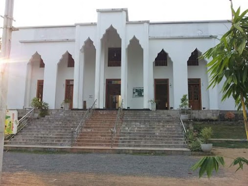
Mosque nearby Nambuluwa Grand Mosque
Sri Lanka
Mosque nearby Nambuluwa Grand Mosque
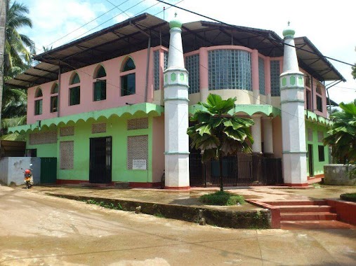
Nambuluwa Grand Mosque
Weerasurikanda Road, Nabuluwa, Gampaha, LK Sri Lanka
contacts phone
:
+94 332 285 436
Latitude:
7.1720522
, Longitude:
80.1350953
larger map & directions
read more
nearest Mosque
169 m
Nambuluwa Thuheed mosque
Nabuluwa
Mosque
read more
222 m
Islamic Studies Centre
Nabuluwa
Mosque
read more
409 m
Polgahathenna Mosque
Gampaha
Mosque
read more
411 m
Polgahthenna Mosqe
Gampaha
Mosque
read more
423 m
Masjid Tahir
Nabuluwa
Mosque
read more
512 m
Kammalpitya Mosque
Nabuluwa
Mosque
read more
1.088 km
Pasyala Jumma Mosque
A1, Pasyala
Mosque
read more
1.215 km
Darul Amaan
no 70 kandy road, pasyala
Mosque
read more
1.36 km
Masjid Thaqwa - Ellalamulla Pasyala.
B361, Pasyala
Mosque
read more
1.594 km
Radawadunna Masjid
Colombo - Kandy Road, Radawadunna
Mosque
read more
2.066 km
Jamiuth Thaqwa Jumma Masjidh
Allalamulla
Mosque
read more
2.189 km
Allalamulla Mosque
Ellamulla Pasyala, Pasyala - Attanagalla Road
Mosque
read more
3.108 km
Algama Jumma Masjid
Algama Haggalla Road -, Bogahamula
Mosque
read more
3.308 km
Masjidh Masra'uddeen
Veyangoda
Mosque
read more
3.652 km
Masjid
Kaleliya
Mosque
read more
3.7 km
Jamiul Huda Masjidh
198/H/1, Kaleel Place Abdul Cader Mawatha, Kaleliya
Mosque
read more
3.921 km
Al-Masjidul Subhani Grand Mosque
Abdul Carder Mawatha
Mosque
read more
4.07 km
Weweldeniya Jummah Masjid
Weweldeniya
Mosque
read more
4.463 km
Godawala Mosque
Godawela
Mosque
read more
4.49 km
Dampillawa Masjid
Abdul Carder Mawatha, Kaleliya
Mosque
read more
4.721 km
Hansagiriya Masjidh
Pallewela
Mosque
read more
5.112 km
Ranpokunagama Jumma Mosque
Nittambuwa
Mosque
read more
6.575 km
SLTG Horagala Branch
Gampaha
Mosque
read more
6.575 km
SLTJ Horagolla Branch
Gampaha
Mosque
read more
6.575 km
Sltj horagola branch
Gampaha
Mosque
read more
📑
all categories
Accounting
Administrative area level 1
Administrative area level 2
Airport
Amusement park
Aquarium
Art gallery
Atm
Bakery
Bank
Bar
Beauty salon
Bicycle store
Book store
Bowling alley
Bus station
Cafe
Campground
Car dealer
Car rental
Car repair
Car wash
Casino
Cemetery
Church
City hall
Clothing store
Colloquial area
Convenience store
Country
Courthouse
Dentist
Department store
Doctor
Electrician
Electronics store
Embassy
Finance
Fire station
Florist
Food
Funeral home
Furniture store
Gas station
General contractor
Grocery or supermarket
Gym
Hair care
Hardware store
Health
Hindu Temple
Home goods store
Hospital
Insurance agency
Intersection
Jewelry store
Laundry
Lawyer
Library
Light rail station
Liquor store
Local government office
Locality
Locksmith
Lodging
Meal delivery
Meal takeaway
Mosque
Movie rental
Movie theater
Moving company
Museum
Natural feature
Neighborhood
Night club
Painter
Park
Parking
Pet store
Pharmacy
Physiotherapist
Place of worship
Plumber
Point of interest
Police
Political
Post office
Premise
Real estate agency
Restaurant
Roofing contractor
Route
Rv park, camping
School
Shoe store
Shopping mall
Spa
Stadium
Storage
Store
Subpremise
Supermarket
Synagogue
Taxi stand
Train station
Transit station
Travel agency
University
Veterinary care
Zoo
administrative area level 3
sublocality level 1
sublocality level 2
↑