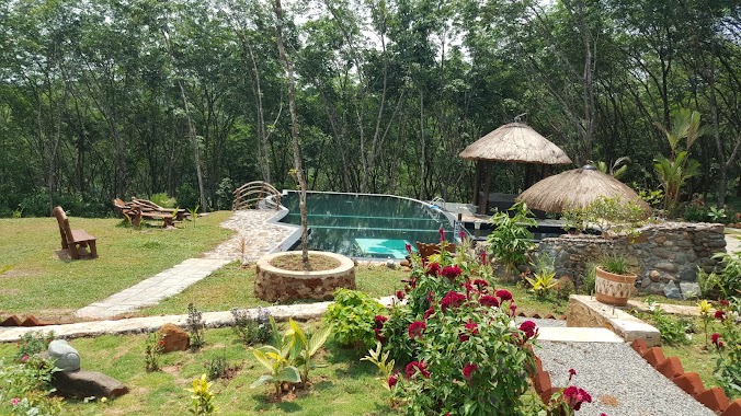
Park nearby Community Hall, Horagala West
Sri Lanka
Park nearby Community Hall, Horagala West
Community Hall, Horagala West
Horagala West, Sri Lanka
contacts phone
:
+94
Latitude:
6.8057379
, Longitude:
80.050642
larger map & directions
read more
nearest Park
3.864 km
Munagama Estate
Munagama Estate, Oaboduwa,Gonapola
Park
read more
3.9 km
Poragedara Ground
Poregedara
Park
read more
5.378 km
Kanrich Green City
Gonapola
Park
read more
5.64 km
SK lands
Homagama
Park
read more
5.712 km
Pitipana Sri Bhodhirajarama Vihara Park
Homagama
Park
read more
7.954 km
Mattegoda Cemetery
41, Sandunpura, පොල්ගස්ඕවිට
Park
read more
8.111 km
Kanrich Sunshine Garden
Horana
Park
read more
8.871 km
Children's Playground
Polgasowita
Park
read more
9.999 km
Lassana Nwasa
Kalutara
Park
read more
12.015 km
Kids Park
Sri Lanka
Park
read more
12.95 km
Udagama Waterfall
Udagama
Park
read more
13.204 km
Children's Park
Ballapitiya
Park
read more
13.234 km
Sathsara Uyana Ballapitiya
Ballapitiya
Park
read more
14.221 km
陶瓷村
Kahapola Road
Park
read more
14.286 km
Bodinagala Forest Reserve (Dobagaskanda)
Bodhinagala Road
Park
read more
14.964 km
Children's Park
Sri Jayawardenepura Kotte
Park
read more
15.702 km
Track 2 Walkway Parking & Rest
Sri Jayawardenapura Kotte
Park
read more
16.156 km
Owinka Lake Resort
Kawatayagoda Road
Park
read more
17.006 km
Statue of War Indian War Heros
Statue of War Indian War Heros, Parliament Road, Sri Jayawardenepura Kotte
Park
read more
17.208 km
Herbal Garden
Battaramulla
Park
read more
17.272 km
Subhodha Enterprices
No 1127/2 Mihindupura,, Battaramulla
Park
read more
17.499 km
Parliament Grounds
Parliament Drive, Sri Jayawardenepura Kotte
Park
read more
17.708 km
Seethawaka Miracle
No:200/4B Dunkolahena Road Hewainna Avissawella
Park
read more
17.913 km
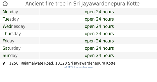
Ancient fire tree
1250 Rajamalwate Road, Sri Jayawardenepura Kotte
Park
read more
18.602 km
Raaja Pohottu Garden
Sri Lanka
Park
read more
📑
all categories
Accounting
Administrative area level 1
Administrative area level 2
Airport
Amusement park
Aquarium
Art gallery
Atm
Bakery
Bank
Bar
Beauty salon
Bicycle store
Book store
Bowling alley
Bus station
Cafe
Campground
Car dealer
Car rental
Car repair
Car wash
Casino
Cemetery
Church
City hall
Clothing store
Colloquial area
Convenience store
Country
Courthouse
Dentist
Department store
Doctor
Electrician
Electronics store
Embassy
Finance
Fire station
Florist
Food
Funeral home
Furniture store
Gas station
General contractor
Grocery or supermarket
Gym
Hair care
Hardware store
Health
Hindu Temple
Home goods store
Hospital
Insurance agency
Intersection
Jewelry store
Laundry
Lawyer
Library
Light rail station
Liquor store
Local government office
Locality
Locksmith
Lodging
Meal delivery
Meal takeaway
Mosque
Movie rental
Movie theater
Moving company
Museum
Natural feature
Neighborhood
Night club
Painter
Park
Parking
Pet store
Pharmacy
Physiotherapist
Place of worship
Plumber
Point of interest
Police
Political
Post office
Premise
Real estate agency
Restaurant
Roofing contractor
Route
Rv park, camping
School
Shoe store
Shopping mall
Spa
Stadium
Storage
Store
Subpremise
Supermarket
Synagogue
Taxi stand
Train station
Transit station
Travel agency
University
Veterinary care
Zoo
administrative area level 3
sublocality level 1
sublocality level 2
↑