Pharmacy nearby Lanka Ayurveda Osusala
Sri Lanka
Pharmacy nearby Lanka Ayurveda Osusala
Lanka Ayurveda Osusala
B84, Piliyandala, Colombo, LK Sri Lanka
contacts phone
:
+94 112 702 006
Latitude:
6.7949251
, Longitude:
79.9413434
larger map & directions
read more
nearest Pharmacy
110 m
Indipa Pharmacy
Kesbewa-Kindelpitiya-Bandaragama Road, Piliyandala
Pharmacy
read more
110 m
Indipa Pharmacy
Bandaragama Road, Piliyandala
Pharmacy
read more
306 m
Bimka Pharmacy
B84, Piliyandala
Pharmacy
read more
826 m
Remedy Pharmacy
Colombo - Horana Road, Piliyandala
Pharmacy
read more
1.919 km
Osoga Pharmacy
Piliyandala
Pharmacy
read more
2.023 km
Royal Pharmacy
50 B84, Piliyandala
Pharmacy
read more
2.083 km
Southern Pharmacy
Piliyandala
Pharmacy
read more
2.151 km
Sinhala & English Medicine
B 5, Piliyandala
Pharmacy
read more
2.167 km
Osusala (Piliyandala Phamacy)
Piliyandala
Pharmacy
read more
2.178 km
Ranmed Pharmacy
Piliyandala
Pharmacy
read more
2.286 km
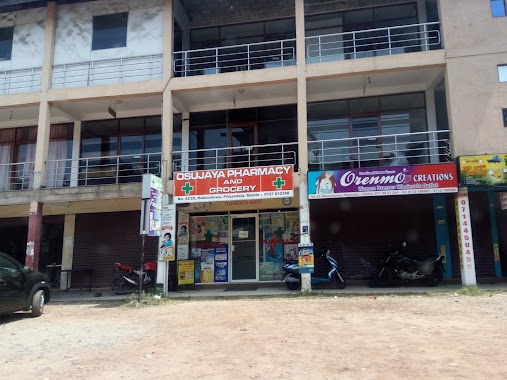
Osujaya Pharmacy and Grocery
42 20th Lane, Piliyandala
Pharmacy
read more
2.29 km
Oselka Phamacy
Piliyandala
Pharmacy
read more
2.514 km
Ruchika Pharmacy
136/4 Madapatha Road, Piliyandala
Pharmacy
read more
2.707 km
New Pharmacy
Kota Gedara Road, Piliyandala
Pharmacy
read more
2.721 km
P & J Pharmacy
Polgasowita Road, Polgasowita
Pharmacy
read more
2.76 km
SKS Pharmacy
B84, Polgasowita
Pharmacy
read more
2.839 km
Polgasowita Pharmacy
B84, Polgasowita
Pharmacy
read more
2.925 km
Sha Pharmacy & Grocery
Madapatha Road, Piliyandala
Pharmacy
read more
3.668 km
Pharmacy
Bokundara, Piliyandala
Pharmacy
read more
3.775 km
Bokundara Pharmacy
B84, Piliyandala
Pharmacy
read more
3.892 km
Sajeevi Pharmacy
Wethara, Polgasowita
Pharmacy
read more
4.053 km
Thimalya Pharmacy
Pannipitiya Road, Pannipitiya
Pharmacy
read more
5.178 km
Peoples Medical
St.Anthony's Road, Moratuwa
Pharmacy
read more
5.495 km
Healthguard Pharmacy
Keells Super, 114 Kottawa - Talagala Road, Pannipitiya
Pharmacy
read more
5.944 km
Keystone Pharmacy & Grocery
Sri Lanka
Pharmacy
read more
📑
all categories
Accounting
Administrative area level 1
Administrative area level 2
Airport
Amusement park
Aquarium
Art gallery
Atm
Bakery
Bank
Bar
Beauty salon
Bicycle store
Book store
Bowling alley
Bus station
Cafe
Campground
Car dealer
Car rental
Car repair
Car wash
Casino
Cemetery
Church
City hall
Clothing store
Colloquial area
Convenience store
Country
Courthouse
Dentist
Department store
Doctor
Electrician
Electronics store
Embassy
Finance
Fire station
Florist
Food
Funeral home
Furniture store
Gas station
General contractor
Grocery or supermarket
Gym
Hair care
Hardware store
Health
Hindu Temple
Home goods store
Hospital
Insurance agency
Intersection
Jewelry store
Laundry
Lawyer
Library
Light rail station
Liquor store
Local government office
Locality
Locksmith
Lodging
Meal delivery
Meal takeaway
Mosque
Movie rental
Movie theater
Moving company
Museum
Natural feature
Neighborhood
Night club
Painter
Park
Parking
Pet store
Pharmacy
Physiotherapist
Place of worship
Plumber
Point of interest
Police
Political
Post office
Premise
Real estate agency
Restaurant
Roofing contractor
Route
Rv park, camping
School
Shoe store
Shopping mall
Spa
Stadium
Storage
Store
Subpremise
Supermarket
Synagogue
Taxi stand
Train station
Transit station
Travel agency
University
Veterinary care
Zoo
administrative area level 3
sublocality level 1
sublocality level 2
↑