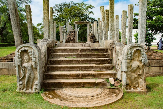
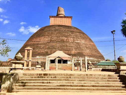
Place of worship nearby Buddhist Temple
Sri Lanka
Place of worship nearby Buddhist Temple
Buddhist Temple
Anuradhapura, Sri Lanka
contacts phone
:
+94
Latitude:
8.3580658
, Longitude:
80.3995227
larger map & directions
read more
nearest Place of worship
272 m
Dalada Maligawa
Anuradhapura
Place of worship
read more
374 m
Sangamiththa Stupa
Anuradhapura
Place of worship
read more
398 m
Padalanchana Chethiya
Thuparama Mawatha, Anuradhapura
Place of worship
read more
401 m
Padalanchana Stupa (පාදලාංඡන චේතිය)
Anuradhapura
Place of worship
read more
402 m
Thuparamya Temple
Anuradhapura
Place of worship
read more
452 m
Thuparamaya Dagaba
Anuradhapura
Place of worship
read more
463 m
Thuparamaya
Thuparama Mawatha, Anuradhapura
Place of worship
read more
596 m
Sangamittaramaya Temple
Thuparama Mawatha, Anuradhapura
Place of worship
read more
604 m
Sri Sudarshana Sangharamaya
Anuradhapura
Place of worship
read more
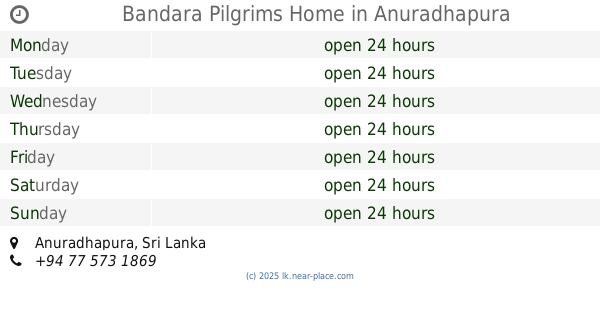
637 m
Bandara Pilgrims Home
Anuradhapura
Place of worship
read more
651 m
Sri Vishuddharamaya
Anuradhapura
Place of worship
read more
715 m
Jethawanarama Pilima Geya
Anuradhapura
Place of worship
read more
741 m
Silachetiya (Kujjatissa) Stupa
Anuradhapura
Place of worship
read more
743 m
Purvarama temple
Anuradhapura
Place of worship
read more
822 m
Ruwanwalisaya (Entrance For Disabled)
Abhayawewa Road, Anuradhapura
Place of worship
read more
858 m
Jethawanaramaya Dagaba
B341 Watawandana Road, Anuradhapura
Place of worship
read more
886 m
Nakha Vihara - නඛා වෙහෙර
Anuradhapura
Place of worship
read more
887 m
Siri Rahal Senasuna
Baswakkulama Road, Anuradhapura
Place of worship
read more
957 m
Ruwanwelisaya Dagaba
Abhayawewa Road, Anuradhapura
Place of worship
read more
962 m
Anuradhapura Ruwanmeliseya
Anuradhapura
Place of worship
read more
966 m
Kuttampokuna Raja Maha Viharaya
Watawandana Road, Anuradhapura
Place of worship
read more
1.171 km
Sri Maha Mahinda Piriwena
Anuradhapura
Place of worship
read more
1.202 km
Lankarama Dagaba
Lankarama Road, Anuradhapura
Place of worship
read more
1.203 km
Lankaramaya
Lankarama Road, Anuradhapura
Place of worship
read more
1.206 km
Lankaramaya Dagoba
Anuradhapura
Place of worship
read more
📑
all categories
Accounting
Administrative area level 1
Administrative area level 2
Airport
Amusement park
Aquarium
Art gallery
Atm
Bakery
Bank
Bar
Beauty salon
Bicycle store
Book store
Bowling alley
Bus station
Cafe
Campground
Car dealer
Car rental
Car repair
Car wash
Casino
Cemetery
Church
City hall
Clothing store
Colloquial area
Convenience store
Country
Courthouse
Dentist
Department store
Doctor
Electrician
Electronics store
Embassy
Finance
Fire station
Florist
Food
Funeral home
Furniture store
Gas station
General contractor
Grocery or supermarket
Gym
Hair care
Hardware store
Health
Hindu Temple
Home goods store
Hospital
Insurance agency
Intersection
Jewelry store
Laundry
Lawyer
Library
Light rail station
Liquor store
Local government office
Locality
Locksmith
Lodging
Meal delivery
Meal takeaway
Mosque
Movie rental
Movie theater
Moving company
Museum
Natural feature
Neighborhood
Night club
Painter
Park
Parking
Pet store
Pharmacy
Physiotherapist
Place of worship
Plumber
Point of interest
Police
Political
Post office
Premise
Real estate agency
Restaurant
Roofing contractor
Route
Rv park, camping
School
Shoe store
Shopping mall
Spa
Stadium
Storage
Store
Subpremise
Supermarket
Synagogue
Taxi stand
Train station
Transit station
Travel agency
University
Veterinary care
Zoo
administrative area level 3
sublocality level 1
sublocality level 2
↑