Place of worship nearby Pillayar Kovil
Sri Lanka
Place of worship nearby Pillayar Kovil
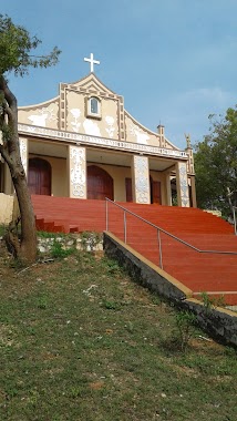
Pillayar Kovil
Samanthar Road, Trincomalee, Trincomalee, LK Sri Lanka
contacts phone
:
+94
Latitude:
8.5765576
, Longitude:
81.2284329
larger map & directions
read more
nearest Place of worship
711 m
Sri Jayasumanaramaya Vihara ශ්රී ජයසුමනාරාම විහාරය
Main Street, Trincomalee
Place of worship
read more
713 m
St.Anthonys Church
Trincomalee
Place of worship
read more
949 m
Infant Jesus Church
80/1 Orr's Hill Centre Road, Trincomalee
Place of worship
read more
1.064 km
St Josep's Convent
Trincomalee
Place of worship
read more
1.087 km
Budu Madura
Inner Harbour Road, Trincomalee
Place of worship
read more
1.123 km
CPM Trincomalee
Snake Lane, Trincomalee
Place of worship
read more
1.223 km
Buddhist Temple
Fort Fredrick Road, Trincomalee
Place of worship
read more
1.248 km
Sangamiththa Viharaya
Konesar Road, Trincomalee
Place of worship
read more
1.394 km
Gokanna Rajamaha Viharaya
Fort Frederick, Trincomalee
Place of worship
read more
1.644 km
Sri Anandaramaya
North Coast Road, Trincomalee
Place of worship
read more
1.829 km
Madcove Temple
Trincomalee
Place of worship
read more
2.152 km
Abhayarama Temple
Trincomalee
Place of worship
read more
2.502 km
Sri Gnanavairavar Kovil
Trincomalee
Place of worship
read more
3.252 km
Abhinawaramaya
Abhinawaramaya,, திருகோணமலை
Place of worship
read more
3.26 km
St.Anthony The Hermit Church
Trincomalee
Place of worship
read more
3.372 km
Holy Cross Convent
Trincomalee
Place of worship
read more
3.691 km
Sangama
Trincomalee
Place of worship
read more
4.409 km
Siri Vajiraramaya
A6, Trincomalee
Place of worship
read more
4.737 km
Sri Thissa Raja Maha Viharaya
Trincomalee
Place of worship
read more
4.743 km
Chinabay Temple
Trincomalee Highway
Place of worship
read more
5.973 km
Sri Bodhipadaparamaya
Sri Bodhipadaparamaya,5th Mile Post,, A6, Sardhapura
Place of worship
read more
8.333 km
Dimuthugama
Sri Lanka
Place of worship
read more
13.056 km
Palampattaru Kovil
Palampoddaru
Place of worship
read more
13.918 km
Sri Uthurugiri Viharaya
Mutur
Place of worship
read more
14.993 km
aayiram arivom - Technology Institute
Old Batticaloa Road, Mutur
Place of worship
read more
📑
all categories
Accounting
Administrative area level 1
Administrative area level 2
Airport
Amusement park
Aquarium
Art gallery
Atm
Bakery
Bank
Bar
Beauty salon
Bicycle store
Book store
Bowling alley
Bus station
Cafe
Campground
Car dealer
Car rental
Car repair
Car wash
Casino
Cemetery
Church
City hall
Clothing store
Colloquial area
Convenience store
Country
Courthouse
Dentist
Department store
Doctor
Electrician
Electronics store
Embassy
Finance
Fire station
Florist
Food
Funeral home
Furniture store
Gas station
General contractor
Grocery or supermarket
Gym
Hair care
Hardware store
Health
Hindu Temple
Home goods store
Hospital
Insurance agency
Intersection
Jewelry store
Laundry
Lawyer
Library
Light rail station
Liquor store
Local government office
Locality
Locksmith
Lodging
Meal delivery
Meal takeaway
Mosque
Movie rental
Movie theater
Moving company
Museum
Natural feature
Neighborhood
Night club
Painter
Park
Parking
Pet store
Pharmacy
Physiotherapist
Place of worship
Plumber
Point of interest
Police
Political
Post office
Premise
Real estate agency
Restaurant
Roofing contractor
Route
Rv park, camping
School
Shoe store
Shopping mall
Spa
Stadium
Storage
Store
Subpremise
Supermarket
Synagogue
Taxi stand
Train station
Transit station
Travel agency
University
Veterinary care
Zoo
administrative area level 3
sublocality level 1
sublocality level 2
↑