Premise nearby Indusrial Area
Sri Lanka
Premise nearby Indusrial Area
Indusrial Area
Indusrial Area, Sri Lanka
contacts phone
:
+94
Latitude:
7.1519284
, Longitude:
79.9475999
larger map & directions
read more
nearest Premise
579 m
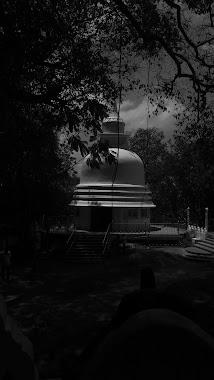
Sri Wivekaramaya Temple
Sri Lanka
Premise
read more
823 m
Principal's Office
Ellangala
Premise
read more
908 m
Paththanduwana Aththam Niwasa Play Ground
Paththanduwana
Premise
read more
1.054 km
Paththanduwana Temple
Paththanduwana
Premise
read more
1.612 km
Cargills Building
Minuwangoda
Premise
read more
1.668 km
Sri Kalyanamithra Sil Aramaya
Mathammana
Premise
read more
1.782 km
Super Market
Minuwangoda
Premise
read more
1.883 km
Lumbini Viharaya
Sri Lanka
Premise
read more
1.905 km
Minuwangoda Roundabout
Minuwangoda
Premise
read more
1.936 km
Vihara Mandhiraya
Sri Lanka
Premise
read more
1.951 km
Sri Susiladhararama Viharaya
Sri Lanka
Premise
read more
1.966 km
Divisional Secretariat
Minuwangoda
Premise
read more
2.057 km
Agrarian Services Office
Minuwangoda
Premise
read more
2.059 km
Minuwangoda Fair
Minuwangoda
Premise
read more
2.069 km
Education Office
Minuwangoda
Premise
read more
2.375 km
Aswana Pirivena
Sri Lanka
Premise
read more
2.422 km
Sri Sugatharamaya
Minuwangoda
Premise
read more
2.522 km
Uggalboda Temple
Sri Lanka
Premise
read more
2.561 km
Bandara Ilanganthilka Mansion
Sri Lanka
Premise
read more
2.734 km
Mahen Gunasekara Playgound
Sri Lanka
Premise
read more
2.783 km
St. Anthony's Church
Sri Lanka
Premise
read more
2.86 km
Ranmuthu Elders Home
Sri Lanka
Premise
read more
2.978 km
Yatiyana Wijayamangala Piriwana
Sri Lanka
Premise
read more
3.208 km
Kotugoda Grid Substation
Sri Lanka
Premise
read more
3.654 km
Camso Loadstar Central Mixing Plant
Opatha, Kotugoda
Premise
read more
📑
all categories
Accounting
Administrative area level 1
Administrative area level 2
Airport
Amusement park
Aquarium
Art gallery
Atm
Bakery
Bank
Bar
Beauty salon
Bicycle store
Book store
Bowling alley
Bus station
Cafe
Campground
Car dealer
Car rental
Car repair
Car wash
Casino
Cemetery
Church
City hall
Clothing store
Colloquial area
Convenience store
Country
Courthouse
Dentist
Department store
Doctor
Electrician
Electronics store
Embassy
Finance
Fire station
Florist
Food
Funeral home
Furniture store
Gas station
General contractor
Grocery or supermarket
Gym
Hair care
Hardware store
Health
Hindu Temple
Home goods store
Hospital
Insurance agency
Intersection
Jewelry store
Laundry
Lawyer
Library
Light rail station
Liquor store
Local government office
Locality
Locksmith
Lodging
Meal delivery
Meal takeaway
Mosque
Movie rental
Movie theater
Moving company
Museum
Natural feature
Neighborhood
Night club
Painter
Park
Parking
Pet store
Pharmacy
Physiotherapist
Place of worship
Plumber
Point of interest
Police
Political
Post office
Premise
Real estate agency
Restaurant
Roofing contractor
Route
Rv park, camping
School
Shoe store
Shopping mall
Spa
Stadium
Storage
Store
Subpremise
Supermarket
Synagogue
Taxi stand
Train station
Transit station
Travel agency
University
Veterinary care
Zoo
administrative area level 3
sublocality level 1
sublocality level 2
↑