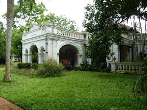
Premise nearby Wawala Viharaya
Sri Lanka
Premise nearby Wawala Viharaya
Wawala Viharaya
Mirigama Alawwa Road, Kurunegala, North Western Province, LK Sri Lanka
contacts phone
:
+94
Latitude:
7.2841085
, Longitude:
80.1867219
larger map & directions
read more
nearest Premise
1.092 km
Polkatu Reservation
Sri Lanka
Premise
read more
1.604 km
Yaththalgoda Sri Devagiri Temple
Sri Lanka
Premise
read more
1.96 km
Udakakulawala Temple
Siyambalapitiya
Premise
read more
2.055 km
Sri Wijaya Sundararamaya
Sri Lanka
Premise
read more
2.123 km
Marathunga's Cottage
Sri Lanka
Premise
read more
2.444 km
Military Area
Sri Lanka
Premise
read more
2.482 km
Agrabodhi Viharaya
Sri Lanka
Premise
read more
2.524 km
Sri Bodimalau Viharaya
Sri Lanka
Premise
read more
3.295 km
Koskale Forest Reserve
Sri Lanka
Premise
read more
3.346 km
Kiruwampola Purana Viharaya
Sri Lanka
Premise
read more
3.359 km
Alawwa West Dialog
Sri Lanka
Premise
read more
3.706 km
Bo Maluwa Viharaya
Sri Lanka
Premise
read more
3.861 km
Madurupitiya School Playground
Sri Lanka
Premise
read more
3.929 km
Parama Nibbana Dharmayathanaya
Sri Lanka
Premise
read more
4.173 km
Galdeniya Raja Maha Viharaya
Sri Lanka
Premise
read more
4.491 km
Makura Temple
Sri Lanka
Premise
read more
4.62 km
Sri Sumanaramaya
Thulhiriya
Premise
read more
4.683 km
Bothale Walawwa
Bothale
Premise
read more
4.711 km
Handloom Training School
Thulhiriya
Premise
read more
4.748 km
Keppitiwalana Purana Viharaya
Sri Lanka
Premise
read more
4.89 km
Alawwa Divisional Secretariat Office
Sri Lanka
Premise
read more
5.054 km
Alawwa Water Treatment Center
Alawwa
Premise
read more
5.161 km
Alawwa Public Ground
Alawwa
Premise
read more
5.308 km
Abepussa Maha Vidyalaya Ground
Ambepussa
Premise
read more
5.474 km
Ambepussa Junction Clock Tower
Ambepussa
Premise
read more
📑
all categories
Accounting
Administrative area level 1
Administrative area level 2
Airport
Amusement park
Aquarium
Art gallery
Atm
Bakery
Bank
Bar
Beauty salon
Bicycle store
Book store
Bowling alley
Bus station
Cafe
Campground
Car dealer
Car rental
Car repair
Car wash
Casino
Cemetery
Church
City hall
Clothing store
Colloquial area
Convenience store
Country
Courthouse
Dentist
Department store
Doctor
Electrician
Electronics store
Embassy
Finance
Fire station
Florist
Food
Funeral home
Furniture store
Gas station
General contractor
Grocery or supermarket
Gym
Hair care
Hardware store
Health
Hindu Temple
Home goods store
Hospital
Insurance agency
Intersection
Jewelry store
Laundry
Lawyer
Library
Light rail station
Liquor store
Local government office
Locality
Locksmith
Lodging
Meal delivery
Meal takeaway
Mosque
Movie rental
Movie theater
Moving company
Museum
Natural feature
Neighborhood
Night club
Painter
Park
Parking
Pet store
Pharmacy
Physiotherapist
Place of worship
Plumber
Point of interest
Police
Political
Post office
Premise
Real estate agency
Restaurant
Roofing contractor
Route
Rv park, camping
School
Shoe store
Shopping mall
Spa
Stadium
Storage
Store
Subpremise
Supermarket
Synagogue
Taxi stand
Train station
Transit station
Travel agency
University
Veterinary care
Zoo
administrative area level 3
sublocality level 1
sublocality level 2
↑