Restaurant nearby Blue Sky
Sri Lanka
Restaurant nearby Blue Sky
Blue Sky
Rajasinghe Mawatha, Kaduwela, Colombo, LK Sri Lanka
contacts phone
:
+94
Latitude:
6.9250935
, Longitude:
79.9785053
larger map & directions
read more
nearest Restaurant
358 m
That Cafe In Colombo
119/1 New Kandy Road, Kaduwela
Restaurant
read more
467 m
Certis Lanka
111/A B263, Kaduwela
Restaurant
read more
489 m
Lassana
Kaduwela
Restaurant
read more
499 m
Manik Tea Enterprises (Pvt) Ltd
62/C/15 Kaduwela Road, Welivita
Restaurant
read more
520 m
Burger Mart
No. 110/3, New Kandy Road Kekirideniya Road, Kaduwela
Restaurant
read more
563 m
Chilly
B263
Restaurant
read more
563 m
Chilly
New Kandy Road
Restaurant
read more
719 m
Gedarin
Kaduwela Road, Kaduwela
Restaurant
read more
769 m
Kayvees Restaurant
No 343,, B263, Kaduwela
Restaurant
read more
769 m
Kayvees Restaurant
No 343,, New Kandy Rd, Kaduwela
Restaurant
read more
788 m
Ampal cafe
Kaduwela Road, Kaduwela
Restaurant
read more
869 m
New Apple Green
No: 359, New Kandy Road, ., Kaduwela
Restaurant
read more
870 m
Y Junction Restaurant
Kothalawala, Malabe
Restaurant
read more
897 m
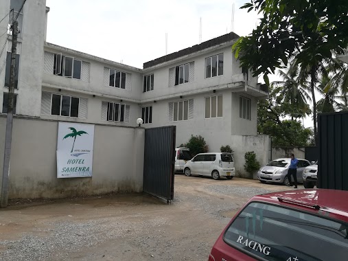
Hotel Samenra
Kaduwela
Restaurant
read more
946 m
The Kaduwela Hotel
Kaduwela Road, Malabe
Restaurant
read more
1.099 km
Gayan hotel
Malabe
Restaurant
read more
1.179 km
The Burger Bro
Malabe North, Malabe
Restaurant
read more
1.185 km
Jolly Bees
Malabe
Restaurant
read more
1.187 km
Sun Rich
New Kandy Road, Malabe
Restaurant
read more
1.381 km
Wije Aiya's Restaurant
Malabe
Restaurant
read more
1.424 km
Lobster Seafood Restaurant
Welivita, Malabe
Restaurant
read more
1.466 km
Ceylon Hotel Corporation
Wijayaba Place, Malabe
Restaurant
read more
1.482 km
River Pot
Raggahawatta, Kaduwela
Restaurant
read more
1.501 km
Sansa Food
Raggahawatta
Restaurant
read more
1.913 km
Rukshan Tasty Food
181/A Welivita Road, Kaduwela
Restaurant
read more
📑
all categories
Accounting
Administrative area level 1
Administrative area level 2
Airport
Amusement park
Aquarium
Art gallery
Atm
Bakery
Bank
Bar
Beauty salon
Bicycle store
Book store
Bowling alley
Bus station
Cafe
Campground
Car dealer
Car rental
Car repair
Car wash
Casino
Cemetery
Church
City hall
Clothing store
Colloquial area
Convenience store
Country
Courthouse
Dentist
Department store
Doctor
Electrician
Electronics store
Embassy
Finance
Fire station
Florist
Food
Funeral home
Furniture store
Gas station
General contractor
Grocery or supermarket
Gym
Hair care
Hardware store
Health
Hindu Temple
Home goods store
Hospital
Insurance agency
Intersection
Jewelry store
Laundry
Lawyer
Library
Light rail station
Liquor store
Local government office
Locality
Locksmith
Lodging
Meal delivery
Meal takeaway
Mosque
Movie rental
Movie theater
Moving company
Museum
Natural feature
Neighborhood
Night club
Painter
Park
Parking
Pet store
Pharmacy
Physiotherapist
Place of worship
Plumber
Point of interest
Police
Political
Post office
Premise
Real estate agency
Restaurant
Roofing contractor
Route
Rv park, camping
School
Shoe store
Shopping mall
Spa
Stadium
Storage
Store
Subpremise
Supermarket
Synagogue
Taxi stand
Train station
Transit station
Travel agency
University
Veterinary care
Zoo
administrative area level 3
sublocality level 1
sublocality level 2
↑