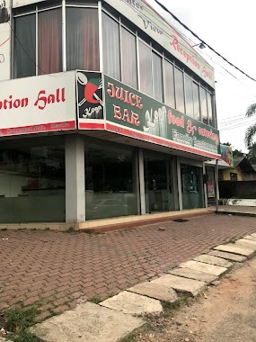
Restaurant nearby Dagi Food Centre
Sri Lanka
Restaurant nearby Dagi Food Centre
Dagi Food Centre
1/1/A, Angoda, Sri Lanka
contacts phone
:
+94
Latitude:
6.9165807
, Longitude:
79.9236421
larger map & directions
read more
nearest Restaurant
342 m
THE WESTERN HORIZON
Aggona
Restaurant
read more
428 m
Koga Food
Kalapaluwawa Road, Battaramulla
Restaurant
read more
592 m
Liyana Hotel
North, Battaramulla, Heenatikubura Road, Thalankama
Restaurant
read more
637 m
Flower Gate
Walpola
Restaurant
read more
640 m
Bake Star
Walpola Road
Restaurant
read more
661 m
Dine Way, Resturant
Walpola Road
Restaurant
read more
694 m
Citrus Restaurent & Takeaway
Thalangama North
Restaurant
read more
753 m
Manju's food Court
Walpola
Restaurant
read more
765 m
Wawalanga Kade
1 B231, Kotikawatta
Restaurant
read more
789 m
Hot Cookies
118/5 Koswatta Road, Sri Jayawardenepura Kotte
Restaurant
read more
789 m
Hot Cookies
118/5 Kalapaluwawa Road, Sri Jayawardenepura Kotte
Restaurant
read more
817 m
Chandrasiri Stores
Sri Lanka
Restaurant
read more
908 m
Siyenra
Kalapaluwawa Road, Sri Jayawardenepura Kotte
Restaurant
read more
1.062 km
Dons Food Cabin
Koswatta Road
Restaurant
read more
1.077 km
Liyenski Palace
Kolombo
Restaurant
read more
1.077 km
Liyenski Palace
Colombo
Restaurant
read more
1.141 km
C.M. Bites
Koswatta, Sri Jayawardenepura Kotte
Restaurant
read more
1.221 km
Samudra Bakers
189/a, Gothatuwa New Town, කොළඹ
Restaurant
read more
1.294 km
The blue cuisine
B240, Sri Jayawardenepura Kotte
Restaurant
read more
1.318 km
Flavors
218/1 Kalapaluwawa Road, Sri Jayawardenepura Kotte
Restaurant
read more
1.449 km
Super Caterers Outlet - Battaramulla
323 B240, Sri Jayawardenepura Kotte
Restaurant
read more
1.454 km
Burger Pavilion
52/15 Buthgamuwa Road
Restaurant
read more
1.557 km
Pussella Meat Shop
B240, Battaramulla
Restaurant
read more
1.579 km
Ambula
B240
Restaurant
read more
1.822 km
Diyatha Station
Sri Jayawardenepura Mawatha, Sri Jayawardenepura Kotte
Restaurant
read more
📑
all categories
Accounting
Administrative area level 1
Administrative area level 2
Airport
Amusement park
Aquarium
Art gallery
Atm
Bakery
Bank
Bar
Beauty salon
Bicycle store
Book store
Bowling alley
Bus station
Cafe
Campground
Car dealer
Car rental
Car repair
Car wash
Casino
Cemetery
Church
City hall
Clothing store
Colloquial area
Convenience store
Country
Courthouse
Dentist
Department store
Doctor
Electrician
Electronics store
Embassy
Finance
Fire station
Florist
Food
Funeral home
Furniture store
Gas station
General contractor
Grocery or supermarket
Gym
Hair care
Hardware store
Health
Hindu Temple
Home goods store
Hospital
Insurance agency
Intersection
Jewelry store
Laundry
Lawyer
Library
Light rail station
Liquor store
Local government office
Locality
Locksmith
Lodging
Meal delivery
Meal takeaway
Mosque
Movie rental
Movie theater
Moving company
Museum
Natural feature
Neighborhood
Night club
Painter
Park
Parking
Pet store
Pharmacy
Physiotherapist
Place of worship
Plumber
Point of interest
Police
Political
Post office
Premise
Real estate agency
Restaurant
Roofing contractor
Route
Rv park, camping
School
Shoe store
Shopping mall
Spa
Stadium
Storage
Store
Subpremise
Supermarket
Synagogue
Taxi stand
Train station
Transit station
Travel agency
University
Veterinary care
Zoo
administrative area level 3
sublocality level 1
sublocality level 2
↑