Restaurant nearby Gopal's Bording House
Sri Lanka
Restaurant nearby Gopal's Bording House
Gopal's Bording House
Jaffna, Sri Lanka
contacts phone
:
+94
Latitude:
9.6727152
, Longitude:
80.0073301
larger map & directions
read more
nearest Restaurant
333 m
Vikey Farm (Chicken and Egg)
Jaffna
Restaurant
read more
405 m
Sri muthu vinayagar cafe
Sivan Kovilady, Jaffna
Restaurant
read more
415 m
The Kottu Lanka (Pvt) Ltd
271 Jaffna-Kankesanturai Road, Jaffna
Restaurant
read more
418 m
Shanmugam Hotel
No. 10 kannathddy road, near at sivan kovil, Jaffna
Restaurant
read more
450 m
Gem Hotel
260, Jaffna-Kankesanturai Road, Jaffna
Restaurant
read more
502 m
Rahman Hotel
308 Jaffna-Kankesanturai Road, Jaffna
Restaurant
read more
522 m
Greedy's Pizza & Restaurant
Kasthuriyar Road, Jaffna
Restaurant
read more
563 m
Sri Palm Beach hotel
Kasthuriyar Road, Jaffna
Restaurant
read more
564 m
Rolexkitchen
212, Kasthuriyar road, Jaffna
Restaurant
read more
610 m
Lingan Ice Cream
213 Stanley road, යාපනය
Restaurant
read more
622 m
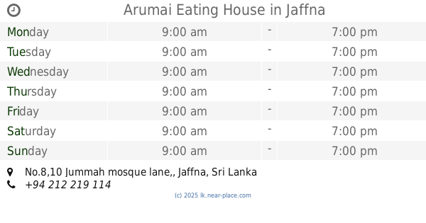
Arumai Eating House
No.8,10 Jummah mosque lane,, Jaffna
Restaurant
read more
737 m
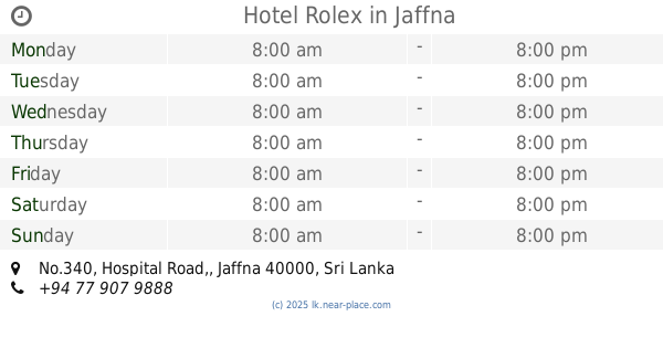
Hotel Rolex
No.340, Hospital Road,, Jaffna
Restaurant
read more
768 m
Dilan Hotel
Jaffna
Restaurant
read more
785 m
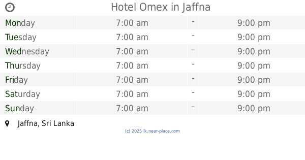
Hotel Omex
Jaffna
Restaurant
read more
831 m
Jo Hotel
jo hotel
Restaurant
read more
836 m
Prince Hotel
No-169, Power House Road,, யாழ்ப்பாணம்
Restaurant
read more
861 m
Vijaya Cool bar
bus stand, Jaffna
Restaurant
read more
899 m
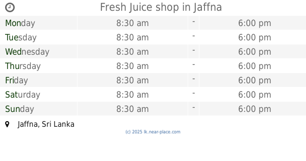
Fresh Juice shop
Jaffna
Restaurant
read more
932 m
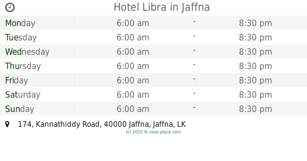
Hotel Libra
174 Kannathiddy Road, Jaffna
Restaurant
read more
937 m
Amul Restaurant
Jaffna
Restaurant
read more
946 m
Sehas hotel
Jaffna
Restaurant
read more
952 m
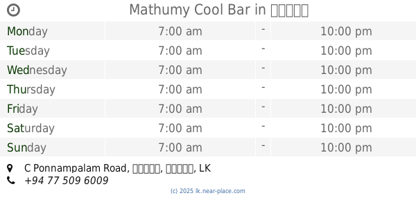
Mathumy Cool Bar
133, C Ponnampalam Road, யாழ்ப்பாணம்
Restaurant
read more
1.081 km
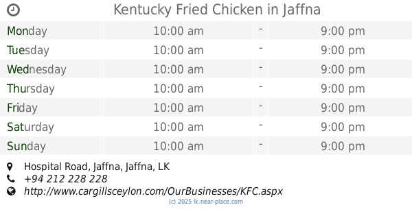
Kentucky Fried Chicken
Hospital Road, Jaffna
Restaurant
read more
1.268 km
Lovusi Hotel and Restaurant
No. 584 Hospital Road, Jaffna
Restaurant
read more
1.336 km
Pizza Hut
Hospital Road, Jaffna
Restaurant
read more
📑
all categories
Accounting
Administrative area level 1
Administrative area level 2
Airport
Amusement park
Aquarium
Art gallery
Atm
Bakery
Bank
Bar
Beauty salon
Bicycle store
Book store
Bowling alley
Bus station
Cafe
Campground
Car dealer
Car rental
Car repair
Car wash
Casino
Cemetery
Church
City hall
Clothing store
Colloquial area
Convenience store
Country
Courthouse
Dentist
Department store
Doctor
Electrician
Electronics store
Embassy
Finance
Fire station
Florist
Food
Funeral home
Furniture store
Gas station
General contractor
Grocery or supermarket
Gym
Hair care
Hardware store
Health
Hindu Temple
Home goods store
Hospital
Insurance agency
Intersection
Jewelry store
Laundry
Lawyer
Library
Light rail station
Liquor store
Local government office
Locality
Locksmith
Lodging
Meal delivery
Meal takeaway
Mosque
Movie rental
Movie theater
Moving company
Museum
Natural feature
Neighborhood
Night club
Painter
Park
Parking
Pet store
Pharmacy
Physiotherapist
Place of worship
Plumber
Point of interest
Police
Political
Post office
Premise
Real estate agency
Restaurant
Roofing contractor
Route
Rv park, camping
School
Shoe store
Shopping mall
Spa
Stadium
Storage
Store
Subpremise
Supermarket
Synagogue
Taxi stand
Train station
Transit station
Travel agency
University
Veterinary care
Zoo
administrative area level 3
sublocality level 1
sublocality level 2
↑