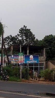
Restaurant nearby Hela Bojun
Sri Lanka
Restaurant nearby Hela Bojun
Hela Bojun
Sri Lanka
contacts phone
:
+94
Latitude:
6.9016086
, Longitude:
80.0087746
larger map & directions
read more
nearest Restaurant
526 m
Danya Foods
Sri Lanka
Restaurant
read more
925 m
Deemantha Food Center
Korathota
Restaurant
read more
1.446 km
Keth Ima Hotel
Korathota
Restaurant
read more
1.784 km
N N Catering
Dedigamuwa
Restaurant
read more
1.913 km
Sappayama restaurant
Kaduwela - Athurugiriya Road, Kaduwela
Restaurant
read more
1.949 km
sahan Hotel
Oruwala
Restaurant
read more
2.067 km
මිලේනියම් කැෆේ
B174, Kaduwela
Restaurant
read more
2.074 km
Sense food and juice bar
Shanthalokagama
Restaurant
read more
2.293 km
P&S
Nawagamuwa
Restaurant
read more
2.574 km
Pushpa chandra hotel & grosary
Sri sumanathissa mw, Nawagamuwa
Restaurant
read more
2.746 km
Perera & Sons
Sri Lanka
Restaurant
read more
2.753 km
Pallawala Hotel
Theakkawatta
Restaurant
read more
2.755 km
Gemi Gedara
Colombo - Hanwella Low Level Road
Restaurant
read more
2.869 km
Master Boat Reception Hall
AB10, Kolonnawa
Restaurant
read more
2.88 km
Grand Lavinia Restaurant
Kaduwela
Restaurant
read more
2.889 km
Anoma Hotel
Avissawella Road
Restaurant
read more
2.893 km
La Rosa Food Court
Sri Lanka
Restaurant
read more
2.937 km
Millennium Tyre
Sri Lanka
Restaurant
read more
3.353 km
Seven Star Restaurant
Sri Lanka
Restaurant
read more
3.408 km
New Santha Foods
Thaldiyawala
Restaurant
read more
3.421 km
Machan Athurugiriya
Kotte - Bope Road
Restaurant
read more
3.448 km
Domino's Pizza
Kotte - Bope Road
Restaurant
read more
3.478 km
Neluma Athurugiriya
No: 13, Borella Road, Athurugiriya
Restaurant
read more
3.51 km
Dragon Chinese Food
Sri Lanka
Restaurant
read more
3.568 km
Samro Reception Hall (Pvt) Ltd
660 Panagoda - Embulagama Road
Restaurant
read more
📑
all categories
Accounting
Administrative area level 1
Administrative area level 2
Airport
Amusement park
Aquarium
Art gallery
Atm
Bakery
Bank
Bar
Beauty salon
Bicycle store
Book store
Bowling alley
Bus station
Cafe
Campground
Car dealer
Car rental
Car repair
Car wash
Casino
Cemetery
Church
City hall
Clothing store
Colloquial area
Convenience store
Country
Courthouse
Dentist
Department store
Doctor
Electrician
Electronics store
Embassy
Finance
Fire station
Florist
Food
Funeral home
Furniture store
Gas station
General contractor
Grocery or supermarket
Gym
Hair care
Hardware store
Health
Hindu Temple
Home goods store
Hospital
Insurance agency
Intersection
Jewelry store
Laundry
Lawyer
Library
Light rail station
Liquor store
Local government office
Locality
Locksmith
Lodging
Meal delivery
Meal takeaway
Mosque
Movie rental
Movie theater
Moving company
Museum
Natural feature
Neighborhood
Night club
Painter
Park
Parking
Pet store
Pharmacy
Physiotherapist
Place of worship
Plumber
Point of interest
Police
Political
Post office
Premise
Real estate agency
Restaurant
Roofing contractor
Route
Rv park, camping
School
Shoe store
Shopping mall
Spa
Stadium
Storage
Store
Subpremise
Supermarket
Synagogue
Taxi stand
Train station
Transit station
Travel agency
University
Veterinary care
Zoo
administrative area level 3
sublocality level 1
sublocality level 2
↑