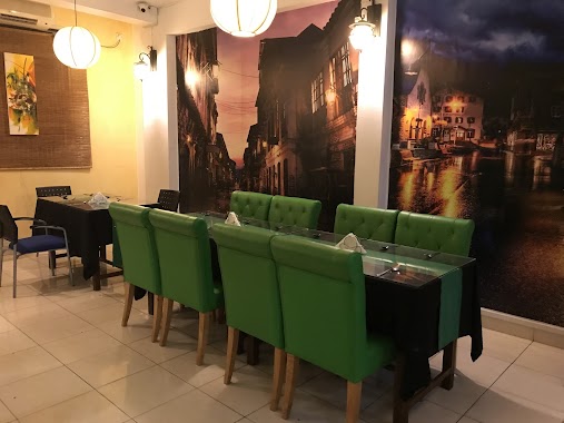
Restaurant nearby Hotel Opulent
Sri Lanka
Restaurant nearby Hotel Opulent
Hotel Opulent
255/1, B235, Moratuwa, Kalutara, LK Sri Lanka
contacts phone
:
+94
Latitude:
6.7255833
, Longitude:
79.9012262
larger map & directions
read more
nearest Restaurant
200 m
Candy Restaurant
New Galle Road, Moratuwa
Restaurant
read more
370 m
Krishani Kitchen & The Family Resturant
Walana, No 190, New Galle Road, Panadura
Restaurant
read more
389 m
Ecstasy Guest House
Moratuwa
Restaurant
read more
531 m
FoodTalk
Walana, Panadura
Restaurant
read more
588 m
Lakrasa Super Caterers
150 Old Galle Road, Panadura
Restaurant
read more
588 m
Lak-Rasa Super Restaurant
Galle Road, Panadura
Restaurant
read more
619 m
New Lakrasa Caterers
Pattiya North, Panadura
Restaurant
read more
620 m
New Lakrasa Caterers
236 Galle Road, Panadura
Restaurant
read more
645 m
King Chef
189 Galle Road, Panadura
Restaurant
read more
664 m
Nabiliya
Pattiya North, Panadura
Restaurant
read more
729 m
Chillys Take Away
Egoda Uyana, Central
Restaurant
read more
735 m
Chilis
No.2735, New Galle Road, Egodauyana, Mortuwa
Restaurant
read more
747 m
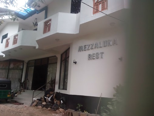
Mezzaluna Rest
12a Jaya Mawatha, Panadura
Restaurant
read more
748 m
Mango Mango
Galle Rd, Panadura
Restaurant
read more
757 m
Family Bakers
223, Galle Rd, Panadura
Restaurant
read more
873 m
JFC Restuarant
5 Cyril Jansz Road, Panadura
Restaurant
read more
876 m
Chilis
5/A, Panadura - Hirana Road, Panadura
Restaurant
read more
900 m
Binola Food Cabin
Walana, Panadura
Restaurant
read more
919 m
Sanka Restaurant
Old Colombo - Galle Road, Panadura
Restaurant
read more
919 m
Sanka Restaurant
Arthur V. Dias Mawatha, Panadura
Restaurant
read more
929 m
Gemi Uyana
322 Galle Road, Panadura
Restaurant
read more
979 m
Gemirasa Food Outlet
Bazaar North, Panadura
Restaurant
read more
991 m
Five Star Halal Chicken
Panadura - Hirana Road, Panadura
Restaurant
read more
1000 m
Kamrose Restaurant Panadura
6°43'08.9"N 79°54'27.1"E
Restaurant
read more
1.026 km
Kos mama Restaurant
Panadura - Hirana Road, Panadura
Restaurant
read more
📑
all categories
Accounting
Administrative area level 1
Administrative area level 2
Airport
Amusement park
Aquarium
Art gallery
Atm
Bakery
Bank
Bar
Beauty salon
Bicycle store
Book store
Bowling alley
Bus station
Cafe
Campground
Car dealer
Car rental
Car repair
Car wash
Casino
Cemetery
Church
City hall
Clothing store
Colloquial area
Convenience store
Country
Courthouse
Dentist
Department store
Doctor
Electrician
Electronics store
Embassy
Finance
Fire station
Florist
Food
Funeral home
Furniture store
Gas station
General contractor
Grocery or supermarket
Gym
Hair care
Hardware store
Health
Hindu Temple
Home goods store
Hospital
Insurance agency
Intersection
Jewelry store
Laundry
Lawyer
Library
Light rail station
Liquor store
Local government office
Locality
Locksmith
Lodging
Meal delivery
Meal takeaway
Mosque
Movie rental
Movie theater
Moving company
Museum
Natural feature
Neighborhood
Night club
Painter
Park
Parking
Pet store
Pharmacy
Physiotherapist
Place of worship
Plumber
Point of interest
Police
Political
Post office
Premise
Real estate agency
Restaurant
Roofing contractor
Route
Rv park, camping
School
Shoe store
Shopping mall
Spa
Stadium
Storage
Store
Subpremise
Supermarket
Synagogue
Taxi stand
Train station
Transit station
Travel agency
University
Veterinary care
Zoo
administrative area level 3
sublocality level 1
sublocality level 2
↑