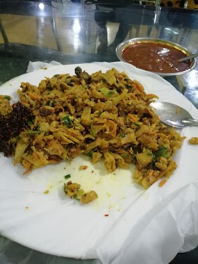
Restaurant nearby Owins Cafe
Sri Lanka
Restaurant nearby Owins Cafe
Owins Cafe
46, Colombo - Kandy Road, Peliyagoda, Gampaha, LK Sri Lanka
contacts phone
:
+94 112 916 254
Latitude:
6.9697922
, Longitude:
79.9138674
larger map & directions
read more
nearest Restaurant
98 m
Master Food
No.68, Kandy Road, Dalugama,, Kelaniya
Restaurant
read more
196 m
New Hotel & Bakery
A1, Peliyagoda
Restaurant
read more
276 m
Amila Bakers &Family Restaurant
41 Colombo - Kandy Road, Kiribathgoda
Restaurant
read more
281 m
Mother's Dish
408/2 Tyre Corporation Road, Peliyagoda
Restaurant
read more
398 m
New Amba Sewana Hotel
Peliyagoda
Restaurant
read more
475 m
Peach Net Hotel
Colombo - Kandy Road
Restaurant
read more
549 m
Sewon Burger
Sri Lanka
Restaurant
read more
568 m
Imihiri Foods
Dalugama
Restaurant
read more
575 m
Pronto Pizza
622/2 A1, Kelaniya
Restaurant
read more
587 m
Sarasavi food
Sri Lanka
Restaurant
read more
589 m
Mr.Cook
Dalugama
Restaurant
read more
609 m
Linza Restaurant And Takeaway
Kandy Road, Dalugama, Kelaniya
Restaurant
read more
631 m
Dish Restaurant
Nungamugoda, Peliyagoda
Restaurant
read more
830 m
Mindaa's Food
Wewalduwa Road, Dalugama
Restaurant
read more
885 m
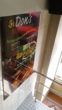
Don's Restaurant
Colombo - Kandy Rd, Bulugaha Junction, Kandy Road, Wattala
Restaurant
read more
910 m
Millennium Food Center
Dalugama
Restaurant
read more
921 m
Udara Sri Caters
856, Bulugaha Junction, A1, Dalugama
Restaurant
read more
933 m
Royal Family Restaurant
Kelaniya
Restaurant
read more
958 m
The Leaf Lamprais
639/9 1st Lane
Restaurant
read more
959 m
Chino Restaurant
Sri Lanka
Restaurant
read more
982 m
Soya Food
488 Nungamugoda Rd, Peliyagoda
Restaurant
read more
982 m
Soya Food
488 Nungamugoda Road, Peliyagoda
Restaurant
read more
989 m
Don's Bakers
328/E Old Kandy Road, Kelaniya
Restaurant
read more
998 m
Omik Foods
342 Waragoda Road, Kelaniya
Restaurant
read more
998 m
Suranga Hotel
Nungamugoda Road, Peliyagoda
Restaurant
read more
📑
all categories
Accounting
Administrative area level 1
Administrative area level 2
Airport
Amusement park
Aquarium
Art gallery
Atm
Bakery
Bank
Bar
Beauty salon
Bicycle store
Book store
Bowling alley
Bus station
Cafe
Campground
Car dealer
Car rental
Car repair
Car wash
Casino
Cemetery
Church
City hall
Clothing store
Colloquial area
Convenience store
Country
Courthouse
Dentist
Department store
Doctor
Electrician
Electronics store
Embassy
Finance
Fire station
Florist
Food
Funeral home
Furniture store
Gas station
General contractor
Grocery or supermarket
Gym
Hair care
Hardware store
Health
Hindu Temple
Home goods store
Hospital
Insurance agency
Intersection
Jewelry store
Laundry
Lawyer
Library
Light rail station
Liquor store
Local government office
Locality
Locksmith
Lodging
Meal delivery
Meal takeaway
Mosque
Movie rental
Movie theater
Moving company
Museum
Natural feature
Neighborhood
Night club
Painter
Park
Parking
Pet store
Pharmacy
Physiotherapist
Place of worship
Plumber
Point of interest
Police
Political
Post office
Premise
Real estate agency
Restaurant
Roofing contractor
Route
Rv park, camping
School
Shoe store
Shopping mall
Spa
Stadium
Storage
Store
Subpremise
Supermarket
Synagogue
Taxi stand
Train station
Transit station
Travel agency
University
Veterinary care
Zoo
administrative area level 3
sublocality level 1
sublocality level 2
↑