Restaurant nearby Sam's Sigiriya
Sri Lanka
Restaurant nearby Sam's Sigiriya
Sam's Sigiriya
Sigiriya Road, Sigiriya Sri Lanka
contacts phone
:
+94
Latitude:
7.9515502
, Longitude:
80.7531981
read more
nearest Restaurant
21 m
Sigiri Bird Villa
Sigiriya
Restaurant
read more
28 m
Rasta Rant Sigiriya
Inamaluwa - Sigiriya Road, Sigiriya
Restaurant
read more
71 m
Cool Cantina
Sigiriya Road, Sigiriya
Restaurant
read more
73 m
Croissant Hut
Inamaluwa - Sigiriya Road, Sigiriya
Restaurant
read more
82 m
D.H.S Fernando Restaurant
Sigiriya
Restaurant
read more
107 m
Wijesiri Family Resturant
Sigiriya
Restaurant
read more
118 m
Ahinsa Restaurant
Sigiriya
Restaurant
read more
120 m
Chooti Restaurant
Sigiriya
Restaurant
read more
131 m
Pradeep Resturant
Inamaluwa - Sigiriya Road, Sigiriya
Restaurant
read more
133 m
New Sigiri Cafe
Sigiriya
Restaurant
read more
134 m
Shenadi restaurant
Inamaluwa - Sigiriya Road, Sigiriya
Restaurant
read more
143 m
Senulya Restaurant
Sigiriya
Restaurant
read more
144 m
Family Restaurant
Sigiriya
Restaurant
read more
302 m
No Name Restaurant
Inamaluwa - Sigiriya Road, Sigiriya
Restaurant
read more
329 m
Maleesha Restaurant
4th mail post , sigiriya, Sigiriya
Restaurant
read more
329 m
Lario Resort
Sigiriya
Restaurant
read more
386 m
Nirwana Restaurant
Inamaluwa - Sigiriya Road, Sigiriya
Restaurant
read more
426 m
Cashew Nut Restaurant
Sigiriya Road, Sigiriya
Restaurant
read more
464 m
Lantharuma
Inamaluwa - Sigiriya Road, Sigiriya
Restaurant
read more
465 m
Gamagedara Village Foods
Sigiriya
Restaurant
read more
472 m
The Kitchen Restaurant
Sigiriya, Inamaluwa - Sigiriya Road, Sigiriya
Restaurant
read more
577 m
Hungry Lion Restaurant
Inamaluwa - Sigiriya Road, Sigiriya
Restaurant
read more
792 m
Mili's Restaurant
Hotel Road, Sigiriya
Restaurant
read more
885 m
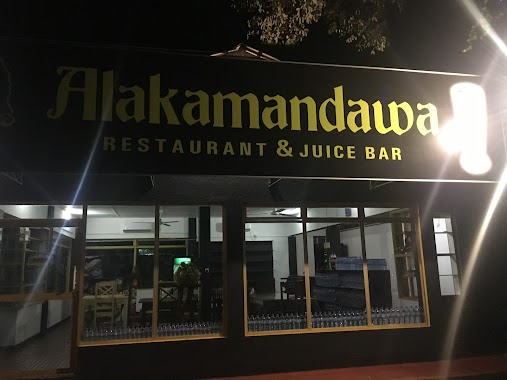
Alakamandawa Restaurant & Juice Bar
Sigiriya
Restaurant
read more
1.132 km
Jungle Nature Villa
kalapuraya,, Sigiriya
Restaurant
read more
📑
all categories
Accounting
Administrative area level 1
Administrative area level 2
Airport
Amusement park
Aquarium
Art gallery
Atm
Bakery
Bank
Bar
Beauty salon
Bicycle store
Book store
Bowling alley
Bus station
Cafe
Campground
Car dealer
Car rental
Car repair
Car wash
Casino
Cemetery
Church
City hall
Clothing store
Colloquial area
Convenience store
Country
Courthouse
Dentist
Department store
Doctor
Electrician
Electronics store
Embassy
Finance
Fire station
Florist
Food
Funeral home
Furniture store
Gas station
General contractor
Grocery or supermarket
Gym
Hair care
Hardware store
Health
Hindu Temple
Home goods store
Hospital
Insurance agency
Intersection
Jewelry store
Laundry
Lawyer
Library
Light rail station
Liquor store
Local government office
Locality
Locksmith
Lodging
Meal delivery
Meal takeaway
Mosque
Movie rental
Movie theater
Moving company
Museum
Natural feature
Neighborhood
Night club
Painter
Park
Parking
Pet store
Pharmacy
Physiotherapist
Place of worship
Plumber
Point of interest
Police
Political
Post office
Premise
Real estate agency
Restaurant
Roofing contractor
Route
Rv park, camping
School
Shoe store
Shopping mall
Spa
Stadium
Storage
Store
Subpremise
Supermarket
Synagogue
Taxi stand
Train station
Transit station
Travel agency
University
Veterinary care
Zoo
administrative area level 3
sublocality level 1
sublocality level 2
↑