Restaurant nearby Serendib Foods
Sri Lanka
Restaurant nearby Serendib Foods
Serendib Foods
253/1, High Level Road, 00500, Colombo, Colombo, LK Sri Lanka
contacts phone
:
+94
Latitude:
6.8732544
, Longitude:
79.8821028
larger map & directions
read more
nearest Restaurant
375 m
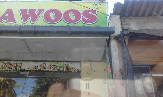
Grand Pila, New Pilawoos Hotel
Balapokuna Road, Colombo
Restaurant
read more
421 m
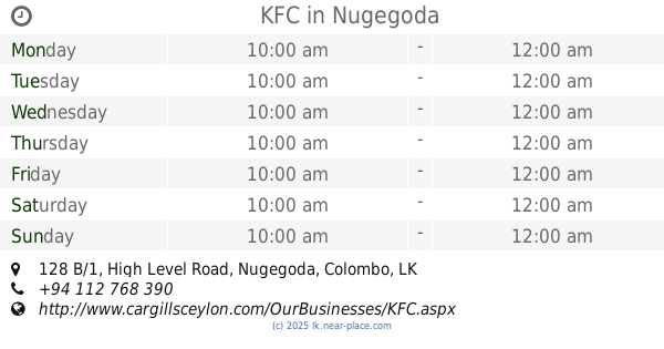
KFC
128 B/1 Avissawella Road, Nugegoda
Restaurant
read more
421 m
KFC
128 B/1 High Level Road, Nugegoda
Restaurant
read more
455 m
Happy Burger
230/1 High Level Rd, Nugegoda
Restaurant
read more
534 m
Shin Shio Chinese Restaurant
Dutugemunu Street, Nugegoda
Restaurant
read more
546 m
McDonald's Nugegoda
High Level Road, Colombo
Restaurant
read more
547 m
Curry Nation
Sri Lanka
Restaurant
read more
633 m
Udan Foods
Kohuwala, Nugegoda
Restaurant
read more
645 m
Dinesh Food Vegetarian Restaurant
Dutugemunu
Restaurant
read more
719 m
Top Form
150E Avissawella Road, Nugegoda
Restaurant
read more
724 m
Matara Bath Kade
B120, Nugegoda
Restaurant
read more
729 m
Savinra
121e South De S. Jayasinghe Mawatha, Nugegoda
Restaurant
read more
733 m
Big Bite Biriyani
169 Avissawella Road, Nugegoda
Restaurant
read more
733 m
Big Bite Biriyani
169 High Level Road, Nugegoda
Restaurant
read more
831 m
City Food
Nugegoda Flyover, Nugegoda
Restaurant
read more
859 m
Eat Right
# 42, Dutugamunu Street, Kohuwela
Restaurant
read more
908 m
Chopstick
Colombo
Restaurant
read more
919 m
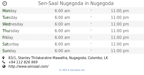
Sen-Saal Nugegoda
83/1 B120, Nugegoda
Restaurant
read more
946 m
Suwasetha
30 South De S. Jayasinghe Mawatha
Restaurant
read more
992 m
Hotel Mr. Milk
No. 180, High Level Road, Nugegoda
Restaurant
read more
1000 m
Rasa Bojun
Gangodawila, Nugegoda
Restaurant
read more
1.004 km
Pastry Home
22/1, Edmonton Road, Colombo
Restaurant
read more
1.013 km
The Couldron
Stratford Avenue, Colombo
Restaurant
read more
1.075 km
M.K.S. Restaurant
Nawala Road
Restaurant
read more
1.24 km
Sovereign German Restaurant
Sri Lanka
Restaurant
read more
📑
all categories
Accounting
Administrative area level 1
Administrative area level 2
Airport
Amusement park
Aquarium
Art gallery
Atm
Bakery
Bank
Bar
Beauty salon
Bicycle store
Book store
Bowling alley
Bus station
Cafe
Campground
Car dealer
Car rental
Car repair
Car wash
Casino
Cemetery
Church
City hall
Clothing store
Colloquial area
Convenience store
Country
Courthouse
Dentist
Department store
Doctor
Electrician
Electronics store
Embassy
Finance
Fire station
Florist
Food
Funeral home
Furniture store
Gas station
General contractor
Grocery or supermarket
Gym
Hair care
Hardware store
Health
Hindu Temple
Home goods store
Hospital
Insurance agency
Intersection
Jewelry store
Laundry
Lawyer
Library
Light rail station
Liquor store
Local government office
Locality
Locksmith
Lodging
Meal delivery
Meal takeaway
Mosque
Movie rental
Movie theater
Moving company
Museum
Natural feature
Neighborhood
Night club
Painter
Park
Parking
Pet store
Pharmacy
Physiotherapist
Place of worship
Plumber
Point of interest
Police
Political
Post office
Premise
Real estate agency
Restaurant
Roofing contractor
Route
Rv park, camping
School
Shoe store
Shopping mall
Spa
Stadium
Storage
Store
Subpremise
Supermarket
Synagogue
Taxi stand
Train station
Transit station
Travel agency
University
Veterinary care
Zoo
administrative area level 3
sublocality level 1
sublocality level 2
↑