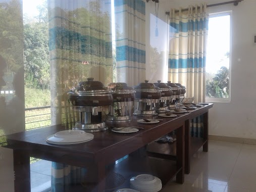
Restaurant nearby The Cave
Sri Lanka
Restaurant nearby The Cave
The Cave
Gampola Road, Gelioya, Kandy, LK Sri Lanka
contacts phone
:
+94
Latitude:
7.2114344
, Longitude:
80.5985913
larger map & directions
read more
nearest Restaurant
364 m
Ashik Hotel
Gelioya
Restaurant
read more
370 m
diba
buwalikada rod, Gelioya
Restaurant
read more
371 m
diba restaurant
Gelioya
Restaurant
read more
436 m
RIDGE One Restaurant
34/B,karamada, Gelioya
Restaurant
read more
460 m
Lakshitha Bake House
39 Colombo - Kandy Road, Gelioya
Restaurant
read more
488 m
Ridge One Restaurant.
Gampola Road, Gelioya
Restaurant
read more
613 m
Isuru Restaurant & Wedding Hall
Peradeniya - Badulla - Chenkaladi Highway, Gelioya
Restaurant
read more
613 m
Isuru Restaurant & Wedding Hall
A5, Gelioya
Restaurant
read more
809 m
Chef Bunty
Gelioya
Restaurant
read more
891 m
Manuja's Villa
152B, Pethiyagoda Road, Gelioya
Restaurant
read more
1.44 km
Lotus Park (The Lotus Resort)
Kandy 182/A/1, Polgahanga Weligalla, Gelioya
Restaurant
read more
1.44 km
The Lotus Resort
Kandy 182/A/1, Polgahanga Weligalla, Gelioya
Restaurant
read more
1.471 km
Sun Bird
Restaurant
read more
1.471 km
Sun Bird
Sri Lanka
Restaurant
read more
1.479 km
Hotel Nuwan
Hindagala-Naranwita-Gampola Road, Hindagala
Restaurant
read more
1.724 km
Thorana Bunglow
Mahakanda
Restaurant
read more
1.736 km
Garawi Inc.
Mahakanda
Restaurant
read more
1.801 km
Hela Bojun Rasa Piyasa
Peradeniya - Badulla - Chenkaladi Highway
Restaurant
read more
1.826 km
Delish Restaurant
Kovilakanda
Restaurant
read more
1.919 km
Nalaka Rest
Kovilakanda
Restaurant
read more
2.256 km
Kandyan Turquoise
276/A, Godapola, Koshinna, Gelioya
Restaurant
read more
2.421 km
Lanka Peter's House
Wariyagala - Illagolla Road, Nillamba
Restaurant
read more
2.476 km
Swastika Holiday Home
No. 12, New Wariyagala Estate,Wariyagala, Illagolla Road,Nillambe, Kandy
Restaurant
read more
2.946 km
Kande Gedara
Wariyagala - Illagolla Road
Restaurant
read more
2.951 km
Sudesh Hotel
Angunawala
Restaurant
read more
📑
all categories
Accounting
Administrative area level 1
Administrative area level 2
Airport
Amusement park
Aquarium
Art gallery
Atm
Bakery
Bank
Bar
Beauty salon
Bicycle store
Book store
Bowling alley
Bus station
Cafe
Campground
Car dealer
Car rental
Car repair
Car wash
Casino
Cemetery
Church
City hall
Clothing store
Colloquial area
Convenience store
Country
Courthouse
Dentist
Department store
Doctor
Electrician
Electronics store
Embassy
Finance
Fire station
Florist
Food
Funeral home
Furniture store
Gas station
General contractor
Grocery or supermarket
Gym
Hair care
Hardware store
Health
Hindu Temple
Home goods store
Hospital
Insurance agency
Intersection
Jewelry store
Laundry
Lawyer
Library
Light rail station
Liquor store
Local government office
Locality
Locksmith
Lodging
Meal delivery
Meal takeaway
Mosque
Movie rental
Movie theater
Moving company
Museum
Natural feature
Neighborhood
Night club
Painter
Park
Parking
Pet store
Pharmacy
Physiotherapist
Place of worship
Plumber
Point of interest
Police
Political
Post office
Premise
Real estate agency
Restaurant
Roofing contractor
Route
Rv park, camping
School
Shoe store
Shopping mall
Spa
Stadium
Storage
Store
Subpremise
Supermarket
Synagogue
Taxi stand
Train station
Transit station
Travel agency
University
Veterinary care
Zoo
administrative area level 3
sublocality level 1
sublocality level 2
↑