School nearby CO-OP Kids
Sri Lanka
School nearby CO-OP Kids
CO-OP Kids
Pilikuttuwa Road, Gampaha, Western Province, LK Sri Lanka
contacts phone
:
+94
Latitude:
7.0500553
, Longitude:
80.0370473
larger map & directions
read more
nearest School
6 m
Siwurulumulla Junior School
Sri Lanka
School
read more
1.428 km
Sri Sivali Mahavidyalaya
Gampaha
School
read more
1.749 km
Kristhuraja JrSchool
Weliweriya
School
read more
1.752 km
The Christ King College
Weliweriya
School
read more
2.019 km
Dambuwa junior school
Gampaha
School
read more
2.09 km
Buthpitiya Maha Vidyalaya
Wathurugama Road
School
read more
2.272 km
St. Anthony's Sunday School
Weliweriya East, Weliweriya
School
read more
2.296 km
Kimbulgoda maha vidyalaya
Wathurugama Road, Gampaha
School
read more
2.319 km
Ranliya Institute (Pvt) Ltd.
Nedungamuwa Sramadana Mawatha, Nedungamuwa
School
read more
2.337 km
Neelamahara Kanishta Vidyalaya
Neelamahara
School
read more
2.382 km
Buthpitiya Junior School
Wathurugama Road
School
read more
2.464 km
Great Royal Pre School
Sri Lanka
School
read more
2.467 km
Kahatana Junior School
Kahatana
School
read more
2.481 km
kahatana kanishta vidyalaya
Aramangoda
School
read more
2.644 km
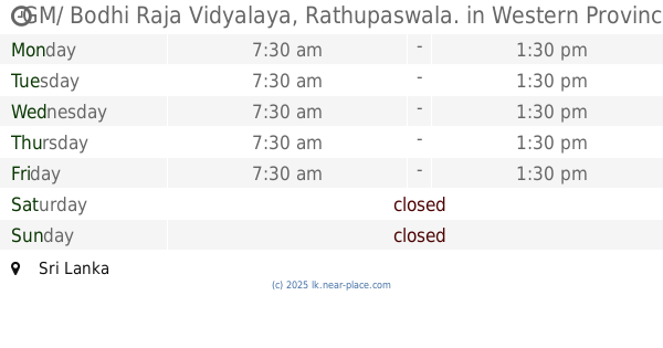
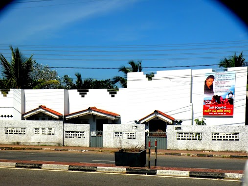
GM/ Bodhi Raja Vidyalaya, Rathupaswala.
Sri Lanka
School
read more
2.654 km
Bodiraja Kanista Vidyalaya
Weliweriya - Gampaha Road
School
read more
2.755 km
Sneha Sewana
Walaw Watta Road, Madampe
School
read more
2.992 km
Madduma Bandara Maha Vidyalaya
Weliweriya
School
read more
3.165 km
Sangabodhi Junior School
Sri Lanka
School
read more
3.193 km
Mahabodhi Primary School
Henegama
School
read more
3.22 km
Star Angle Pre School
Embaraluwa South1
School
read more
3.452 km
Embaraluwa Maha Vidyalaya
welivariya
School
read more
3.478 km
Music and Drama Schools
Yakkala South, Gampaha
School
read more
3.584 km
Keppetipola Maha Vidyalaya
Gampaha
School
read more
3.588 km
Keppetipola Primary School, Mirisawatte, Gampaha
Gampaha
School
read more
📑
all categories
Accounting
Administrative area level 1
Administrative area level 2
Airport
Amusement park
Aquarium
Art gallery
Atm
Bakery
Bank
Bar
Beauty salon
Bicycle store
Book store
Bowling alley
Bus station
Cafe
Campground
Car dealer
Car rental
Car repair
Car wash
Casino
Cemetery
Church
City hall
Clothing store
Colloquial area
Convenience store
Country
Courthouse
Dentist
Department store
Doctor
Electrician
Electronics store
Embassy
Finance
Fire station
Florist
Food
Funeral home
Furniture store
Gas station
General contractor
Grocery or supermarket
Gym
Hair care
Hardware store
Health
Hindu Temple
Home goods store
Hospital
Insurance agency
Intersection
Jewelry store
Laundry
Lawyer
Library
Light rail station
Liquor store
Local government office
Locality
Locksmith
Lodging
Meal delivery
Meal takeaway
Mosque
Movie rental
Movie theater
Moving company
Museum
Natural feature
Neighborhood
Night club
Painter
Park
Parking
Pet store
Pharmacy
Physiotherapist
Place of worship
Plumber
Point of interest
Police
Political
Post office
Premise
Real estate agency
Restaurant
Roofing contractor
Route
Rv park, camping
School
Shoe store
Shopping mall
Spa
Stadium
Storage
Store
Subpremise
Supermarket
Synagogue
Taxi stand
Train station
Transit station
Travel agency
University
Veterinary care
Zoo
administrative area level 3
sublocality level 1
sublocality level 2
↑