School nearby Goodsepared college
Sri Lanka
School nearby Goodsepared college
Goodsepared college
Bar Road, Batticaloa, Batticaloa, LK Sri Lanka
contacts phone
:
+94
Latitude:
7.7362289
, Longitude:
81.6978636
larger map & directions
read more
nearest School
Goodsepared college
B46, Batticaloa
School
read more
246 m
AAT Centre Batticalo
Mamangam Road, Batticaloa
School
read more
357 m
St. Lourdes Nursery School
Koolavadi East, Batticaloa
School
read more
450 m
mamngeswarar vidyalayam
Mamangam Road, Batticaloa
School
read more
451 m
Mamangam kovil
Batticaloa
School
read more
451 m
Mamangam kovil
Madakalapuwa
School
read more
834 m
Navalady Primary School
School
read more
909 m
Amirthakaly Sri Sithy Vinayagar Maha Vidyalayam
B46, Batticaloa
School
read more
1.032 km
shining stars preschool
Batticaloa
School
read more
1.231 km
Karuveppenkerny School
Jayanthipuram, Batticaloa
School
read more
1.235 km
Arunothaya Vidyalayam
Rosairo's Lane, Batticaloa
School
read more
1.237 km
Lahira Vidyalaya
Veddukadu
School
read more
1.361 km
Singala Maha Vid.
Thamaraikerny, Batticaloa
School
read more
1.377 km
Koddamunai Kanishta Vidyalayam Batticaloa
Batticaloa
School
read more
1.588 km
St Theresa's Orphanage
Batticaloa
School
read more
1.589 km
St.Theresa's Girls Vidyalayam
Uppodai Lake Road, Batticaloa
School
read more
1.73 km
Eastern Hotel School
11/7, B27, Batticaloa
School
read more
1.753 km
Holy Family Convent
Batticaloa
School
read more
1.802 km
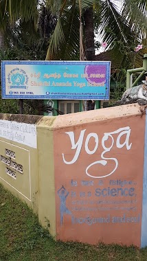
Shakthi Ananda Yoga School
Iruthayapuram, Batticaloa
School
read more
1.826 km
Good Shepherd College
Batticaloa
School
read more
1.865 km
Sarasvathi Vidjalaya
New Boundary Road, Batticaloa
School
read more
1.916 km
BECS College
Iruthayapuram, Batticaloa
School
read more
1.919 km
BCES College
Urani Road, Batticaloa
School
read more
1.931 km
St.Sebastian Tamil Vidyalayam
Saint Sebastian Street, Batticaloa
School
read more
2.472 km
Vigneshwara Vidyalayam
Pumping Station Road, Palameenmadu, Mugathuwaram, Batticaloa, Batticaloa
School
read more
📑
all categories
Accounting
Administrative area level 1
Administrative area level 2
Airport
Amusement park
Aquarium
Art gallery
Atm
Bakery
Bank
Bar
Beauty salon
Bicycle store
Book store
Bowling alley
Bus station
Cafe
Campground
Car dealer
Car rental
Car repair
Car wash
Casino
Cemetery
Church
City hall
Clothing store
Colloquial area
Convenience store
Country
Courthouse
Dentist
Department store
Doctor
Electrician
Electronics store
Embassy
Finance
Fire station
Florist
Food
Funeral home
Furniture store
Gas station
General contractor
Grocery or supermarket
Gym
Hair care
Hardware store
Health
Hindu Temple
Home goods store
Hospital
Insurance agency
Intersection
Jewelry store
Laundry
Lawyer
Library
Light rail station
Liquor store
Local government office
Locality
Locksmith
Lodging
Meal delivery
Meal takeaway
Mosque
Movie rental
Movie theater
Moving company
Museum
Natural feature
Neighborhood
Night club
Painter
Park
Parking
Pet store
Pharmacy
Physiotherapist
Place of worship
Plumber
Point of interest
Police
Political
Post office
Premise
Real estate agency
Restaurant
Roofing contractor
Route
Rv park, camping
School
Shoe store
Shopping mall
Spa
Stadium
Storage
Store
Subpremise
Supermarket
Synagogue
Taxi stand
Train station
Transit station
Travel agency
University
Veterinary care
Zoo
administrative area level 3
sublocality level 1
sublocality level 2
↑