School nearby Rainbow World Preschool
Sri Lanka
School nearby Rainbow World Preschool
Rainbow World Preschool
Bodhi Rukkarama Mawatha, 20000, Kandy, Kandy, LK Sri Lanka
contacts phone
:
+94
Latitude:
7.2950142
, Longitude:
80.621942
larger map & directions
read more
nearest School
15 m
Rainbow World Maritime Training Center
Kandy
School
read more
330 m
School for the Hearing & Visual Impaired
Dodamwala
School
read more
511 m
Lewla Dodanwala Vidyalaya
Srimath Kuda Rathwatta Mawawtha, Kandy
School
read more
896 m
Don Bosco
3/2 Bahirawakanda Road, Kandy
School
read more
919 m
THE FIRST INTERNATIONAL
Kandy
School
read more
931 m
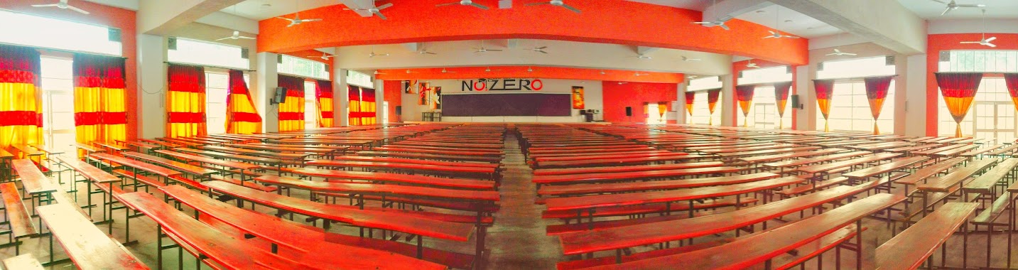
No. Zero Institute
Kandy
School
read more
991 m
Edexcel Fast Track
George E. de Silva Mawatha, Kandy
School
read more
992 m
Good Shepherd's Convent
A B Damunupola Mawatha, Kandy
School
read more
993 m
Princeton
37 Katukelle Lake Road, Kandy
School
read more
995 m
The First Kandyan International
200/12/c Fedric E. de Silva Lane, Kandy
School
read more
1.004 km
Alshariaa Institute
Kandy
School
read more
1.008 km
Child Action Lanka - Child Development Centre
Kandy
School
read more
1.015 km
Masjidh
15 George E De Silva Mawatha, Kandy
School
read more
1.016 km
Ananda Vidyalaya
George E de Silva Mawatha, Kandy
School
read more
1.033 km
Viharamahadevi Balika Vidyalaya
Peradeniya Road, Kandy
School
read more
1.048 km
Girls' High School
Kandy
School
read more
1.073 km
Hindu Senior Vidyalayam
K | Hindu Senior Vidyalayam, 138 Peradeniya Road, Kandy
School
read more
1.082 km
Kandy language center
1/1, 321, Colombo - Kandy Road, Kandy
School
read more
1.086 km
ANC Education
322 Peradeniya Road, Kandy
School
read more
1.089 km
Royal Wisdom College
S.W.R.D.Bandaranayake Mawatha, Kandy
School
read more
1.181 km
Sipla Education (Pvt) Ltd
Kandy
School
read more
1.195 km
Kandy Chess School
No.30, Sambodhi mawatha,, Kandy
School
read more
1.256 km
Rasindew Maha Vidyalaya
Deiyannewela
School
read more
1.258 km
Nightingale Nursing School
Kandy
School
read more
1.327 km
Gohagoda Maha Vidyalaya
Gohagoda
School
read more
📑
all categories
Accounting
Administrative area level 1
Administrative area level 2
Airport
Amusement park
Aquarium
Art gallery
Atm
Bakery
Bank
Bar
Beauty salon
Bicycle store
Book store
Bowling alley
Bus station
Cafe
Campground
Car dealer
Car rental
Car repair
Car wash
Casino
Cemetery
Church
City hall
Clothing store
Colloquial area
Convenience store
Country
Courthouse
Dentist
Department store
Doctor
Electrician
Electronics store
Embassy
Finance
Fire station
Florist
Food
Funeral home
Furniture store
Gas station
General contractor
Grocery or supermarket
Gym
Hair care
Hardware store
Health
Hindu Temple
Home goods store
Hospital
Insurance agency
Intersection
Jewelry store
Laundry
Lawyer
Library
Light rail station
Liquor store
Local government office
Locality
Locksmith
Lodging
Meal delivery
Meal takeaway
Mosque
Movie rental
Movie theater
Moving company
Museum
Natural feature
Neighborhood
Night club
Painter
Park
Parking
Pet store
Pharmacy
Physiotherapist
Place of worship
Plumber
Point of interest
Police
Political
Post office
Premise
Real estate agency
Restaurant
Roofing contractor
Route
Rv park, camping
School
Shoe store
Shopping mall
Spa
Stadium
Storage
Store
Subpremise
Supermarket
Synagogue
Taxi stand
Train station
Transit station
Travel agency
University
Veterinary care
Zoo
administrative area level 3
sublocality level 1
sublocality level 2
↑