School nearby urani saraswathy vidyalayam
Sri Lanka
School nearby urani saraswathy vidyalayam
urani saraswathy vidyalayam
Iruthayapuram, Batticaloa, Sri Lanka
contacts phone
:
+94
Latitude:
7.7319279
, Longitude:
81.6783146
larger map & directions
read more
nearest School
2 m
Sinna Urani School
Batticaloa
School
read more
2 m
Sinna Urani School
Madakalapuwa
School
read more
406 m
Batticaloa
Trincomalee Highway, Batticaloa
School
read more
408 m
Karayakkantheevu Ganeshar Vidyalayam
Batticaloa
School
read more
408 m
betticalo hindu college
Batticaloa
School
read more
408 m
Vinsan College
Batticaloa
School
read more
483 m
ajitharul
Trincomalee Highway, Batticaloa
School
read more
492 m
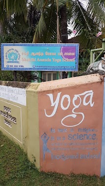
Shakthi Ananda Yoga School
Iruthayapuram, Batticaloa
School
read more
510 m
BCES College
Urani Road, Batticaloa
School
read more
514 m
BECS College
Iruthayapuram, Batticaloa
School
read more
923 m
Ceylon Missionary Church
No, 625/4 Trinco Road, Batticaloa
School
read more
971 m
Sarasvathi Vidjalaya
New Boundary Road, Batticaloa
School
read more
975 m
Karuveppenkerny School
Jayanthipuram, Batticaloa
School
read more
977 m
BT/ uranisaraswathy vidyalayam
New Boundary Road, Batticaloa
School
read more
983 m
Medical Facility Hostel
Kokkuvil, Batticaloa
School
read more
1.038 km
Pillayaradi Vidyalaya
Trincomalee Highway, Batticaloa
School
read more
1.173 km
Mencafep Batticaloa
46/2, Mylvakanam Road, Batticaloa
School
read more
1.431 km
Kokkuvil Vigneswvera Vidyalaya
Batticaloa
School
read more
1.757 km
Mamangam kovil
Madakalapuwa
School
read more
1.757 km
Mamangam kovil
Batticaloa
School
read more
1.759 km
Arunothaya Vidyalayam
Rosairo's Lane, Batticaloa
School
read more
1.771 km
mamngeswarar vidyalayam
Mamangam Road, Batticaloa
School
read more
2.044 km
Sri Murugan Vidyalayam, Thirupperunthurai
Thiruperunthurai 11th Cross Road, Batticaloa
School
read more
2.076 km
Amirthakaly Sri Sithy Vinayagar Maha Vidyalayam
B46, Batticaloa
School
read more
2.164 km
Holy Family Convent
Batticaloa
School
read more
📑
all categories
Accounting
Administrative area level 1
Administrative area level 2
Airport
Amusement park
Aquarium
Art gallery
Atm
Bakery
Bank
Bar
Beauty salon
Bicycle store
Book store
Bowling alley
Bus station
Cafe
Campground
Car dealer
Car rental
Car repair
Car wash
Casino
Cemetery
Church
City hall
Clothing store
Colloquial area
Convenience store
Country
Courthouse
Dentist
Department store
Doctor
Electrician
Electronics store
Embassy
Finance
Fire station
Florist
Food
Funeral home
Furniture store
Gas station
General contractor
Grocery or supermarket
Gym
Hair care
Hardware store
Health
Hindu Temple
Home goods store
Hospital
Insurance agency
Intersection
Jewelry store
Laundry
Lawyer
Library
Light rail station
Liquor store
Local government office
Locality
Locksmith
Lodging
Meal delivery
Meal takeaway
Mosque
Movie rental
Movie theater
Moving company
Museum
Natural feature
Neighborhood
Night club
Painter
Park
Parking
Pet store
Pharmacy
Physiotherapist
Place of worship
Plumber
Point of interest
Police
Political
Post office
Premise
Real estate agency
Restaurant
Roofing contractor
Route
Rv park, camping
School
Shoe store
Shopping mall
Spa
Stadium
Storage
Store
Subpremise
Supermarket
Synagogue
Taxi stand
Train station
Transit station
Travel agency
University
Veterinary care
Zoo
administrative area level 3
sublocality level 1
sublocality level 2
↑