Shopping mall nearby Lak Sathosa
Sri Lanka
Shopping mall nearby Lak Sathosa
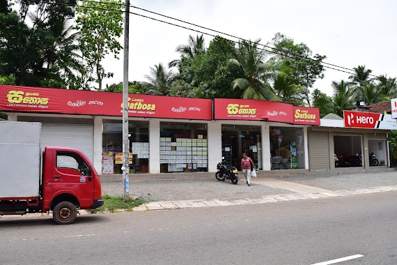
Lak Sathosa
B304, Kalutara, Western Province, LK Sri Lanka
contacts phone
:
+94
Latitude:
6.5536786
, Longitude:
80.0188643
larger map & directions
read more
nearest Shopping mall
7 m
Fashion Palace
Kalutara
Shopping mall
read more
13 m
Fashion Palace
Kalutara-Matugama Road
Shopping mall
read more
95 m
Shashini Stores
Kalutara
Shopping mall
read more
1.623 km
Janaka Stores,Udawattagoda,Matugama Road,Dodangoda,Kalutara.
Kalutara
Shopping mall
read more
1.728 km
Udara Trade Centre
Kalutara
Shopping mall
read more
2.021 km
Thilakarathna Stores
Katukurunda
Shopping mall
read more
2.094 km
Gunapala Stores
Gallassa, Katukurunda
Shopping mall
read more
2.163 km
Mahathun Stores
Gallassa, Katukurunda
Shopping mall
read more
2.206 km
Peththa Stores
Weniwelketiya
Shopping mall
read more
2.482 km
Jayasiri Stores
Bombuwala
Shopping mall
read more
2.499 km
Ambasewana Stores
Weniwelketiya
Shopping mall
read more
2.62 km
Agro Care
Bombuwala
Shopping mall
read more
2.959 km
Somasiri Stores
Kajudoowawatta
Shopping mall
read more
3.332 km
commercial electronics
Kalutara-Matugama Road
Shopping mall
read more
3.549 km
Sampath Stores
Fullerton West
Shopping mall
read more
4.337 km
Bhupani wholesale Mart
Henatiyangala Road, Kalutara
Shopping mall
read more
5.298 km
Nishan Products
Unnamed Road, Kalutara
Shopping mall
read more
5.965 km
MNJ marketing
Katukurunda - Neboda Road, Thebuwana
Shopping mall
read more
6.076 km
Nilanthi Stores
Thebuwana
Shopping mall
read more
6.418 km
Ikroma
A2, Maggona
Shopping mall
read more
6.874 km
Photofine Building
A2, Kalutara
Shopping mall
read more
8.032 km
Sathosa Kalutara North
Colombo - Galle Main Road
Shopping mall
read more
9.466 km
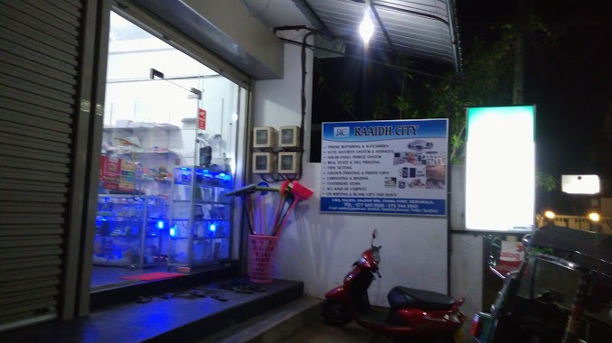
RAAIDH CITY
Beruwala
Shopping mall
read more
10.884 km
Bhupani Traders (Pvt) Ltd
96, Kalutara-Matugama Road, Matugama
Shopping mall
read more
12.537 km
B K Center
Dharga Town
Shopping mall
read more
📑
all categories
Accounting
Administrative area level 1
Administrative area level 2
Airport
Amusement park
Aquarium
Art gallery
Atm
Bakery
Bank
Bar
Beauty salon
Bicycle store
Book store
Bowling alley
Bus station
Cafe
Campground
Car dealer
Car rental
Car repair
Car wash
Casino
Cemetery
Church
City hall
Clothing store
Colloquial area
Convenience store
Country
Courthouse
Dentist
Department store
Doctor
Electrician
Electronics store
Embassy
Finance
Fire station
Florist
Food
Funeral home
Furniture store
Gas station
General contractor
Grocery or supermarket
Gym
Hair care
Hardware store
Health
Hindu Temple
Home goods store
Hospital
Insurance agency
Intersection
Jewelry store
Laundry
Lawyer
Library
Light rail station
Liquor store
Local government office
Locality
Locksmith
Lodging
Meal delivery
Meal takeaway
Mosque
Movie rental
Movie theater
Moving company
Museum
Natural feature
Neighborhood
Night club
Painter
Park
Parking
Pet store
Pharmacy
Physiotherapist
Place of worship
Plumber
Point of interest
Police
Political
Post office
Premise
Real estate agency
Restaurant
Roofing contractor
Route
Rv park, camping
School
Shoe store
Shopping mall
Spa
Stadium
Storage
Store
Subpremise
Supermarket
Synagogue
Taxi stand
Train station
Transit station
Travel agency
University
Veterinary care
Zoo
administrative area level 3
sublocality level 1
sublocality level 2
↑