Store nearby Jayathunga Farm
Sri Lanka
Store nearby Jayathunga Farm
Jayathunga Farm
Katuneriya, Sri Lanka
contacts phone
:
+94
Latitude:
7.3635213
, Longitude:
79.834003
larger map & directions
read more
nearest Store
132 m
Sebastian building
Katuneriya School Playground, Puttalam Road, Katuneriya
Store
read more
319 m
DILSHAN House
hiu fernando mawatha katuneriya
Store
read more
337 m
Rishitha Trading
7°21'58. 79°49'58., 8 4th Lane, Vavuniya
Store
read more
491 m
මෙට්කෝ කොම්පැනි.සහ වර්ක් සොප්
Katuneriya
Store
read more
838 m
Kumar Plastic
Katuneriya
Store
read more
842 m
Sheran Mini Super
Katuneriya
Store
read more
870 m
anne motors katuneriya
Oruwella Road, Katuneriya
Store
read more
991 m
Shiron Communication
Katuneriya
Store
read more
1.093 km
Seafood Exporters in Sri Lanka
7.373073, 79.836334, Saint Jude Road, Katuneriya
Store
read more
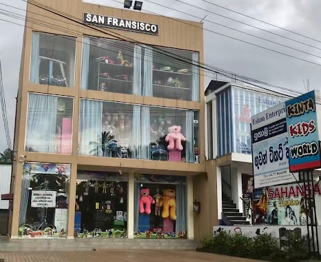
1.247 km
Kinta Kids World
Wennappuwa
Store
read more
1.392 km
Rosa Kusum Printers
Rosa Kusum Mawatha, Wennappuwa
Store
read more
1.399 km
Texas Automobiles International (PVT) LTD.
Wennappuwa
Store
read more
1.4 km
Kanthi Cream House
Chilaw - Colombo Main Road, Wennappuwa
Store
read more
1.402 km
See U
Katuneriya
Store
read more
1.479 km
Nirosha Motors
Wennappuwa
Store
read more
1.857 km
Spice Shop
14,dammikagama, dematapitiya, Lunuwila
Store
read more
1.86 km
Chamrith Tile Factory
Wennappuwa
Store
read more
1.869 km
Micro Tech
Wennappuwa
Store
read more
2.043 km
GDI Lanka
No.10/1, New Road, Wennappuwa
Store
read more
2.057 km
Sahansa Farm House
Wennappuwa
Store
read more
2.059 km
Yathna Motors
Wennappuwa
Store
read more
2.069 km
Sadun Self Corner
Wennappuwa
Store
read more
2.158 km
Wood Sellers
Wennappuwa
Store
read more
2.166 km
Cheap Store
Wennappuwa
Store
read more
2.248 km
TNR Steel
TNR Steel 532/2A, Suduwella Junction, New Road, Wennappuwa.
Store
read more
📑
all categories
Accounting
Administrative area level 1
Administrative area level 2
Airport
Amusement park
Aquarium
Art gallery
Atm
Bakery
Bank
Bar
Beauty salon
Bicycle store
Book store
Bowling alley
Bus station
Cafe
Campground
Car dealer
Car rental
Car repair
Car wash
Casino
Cemetery
Church
City hall
Clothing store
Colloquial area
Convenience store
Country
Courthouse
Dentist
Department store
Doctor
Electrician
Electronics store
Embassy
Finance
Fire station
Florist
Food
Funeral home
Furniture store
Gas station
General contractor
Grocery or supermarket
Gym
Hair care
Hardware store
Health
Hindu Temple
Home goods store
Hospital
Insurance agency
Intersection
Jewelry store
Laundry
Lawyer
Library
Light rail station
Liquor store
Local government office
Locality
Locksmith
Lodging
Meal delivery
Meal takeaway
Mosque
Movie rental
Movie theater
Moving company
Museum
Natural feature
Neighborhood
Night club
Painter
Park
Parking
Pet store
Pharmacy
Physiotherapist
Place of worship
Plumber
Point of interest
Police
Political
Post office
Premise
Real estate agency
Restaurant
Roofing contractor
Route
Rv park, camping
School
Shoe store
Shopping mall
Spa
Stadium
Storage
Store
Subpremise
Supermarket
Synagogue
Taxi stand
Train station
Transit station
Travel agency
University
Veterinary care
Zoo
administrative area level 3
sublocality level 1
sublocality level 2
↑