Cafe nearby C.P. Hotel
Sri Lanka
Cafe nearby C.P. Hotel
C.P. Hotel
Avissawella Road, Angoda, Colombo, LK Sri Lanka
contacts phone
:
+94
Latitude:
6.9356505
, Longitude:
79.9249179
larger map & directions
read more
nearest Cafe
47 m
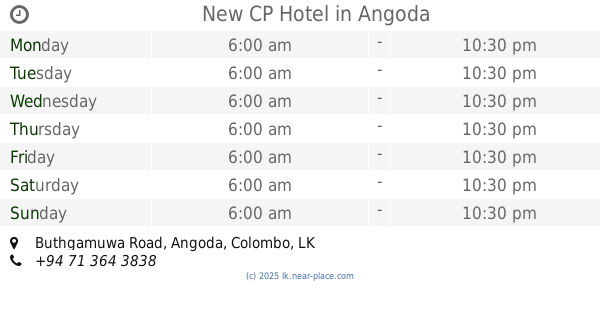
New CP Hotel
Super Market, 13, Buthgamuwa Road, Angoda
Cafe
read more
83 m
Isuru Tasty Shop
309/C Siri Sumana Mawatha, Angoda
Cafe
read more
700 m
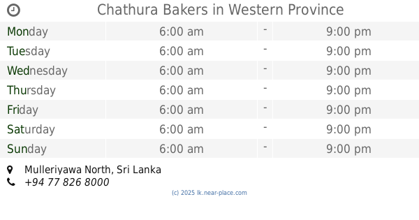
Chathura Bakers
Mulleriyawa North
Cafe
read more
1.284 km
Sandareka
Mahawatta Road
Cafe
read more
1.558 km
Rose Apple Fresh Juice Bar
169/7 Walpola Road, Angoda
Cafe
read more
1.567 km
Thambapanni Tea (Pvt) Ltd
No 75, Avissawella Road< Mahabuthgamuwa, Angoda
Cafe
read more
1.66 km
Remarko Bakers
Sri Lanka
Cafe
read more
1.719 km
Aayu Healthy Food Outlet
කොළොන්නාව - අංගොඩ පාර, Sri Jayawardenepura Kotte
Cafe
read more
1.731 km
Unity The Game Station
B231, Kotikawatta
Cafe
read more
1.731 km
Unity The Game Station
කොළොන්නාව - අංගොඩ පාර, Kotikawatta
Cafe
read more
1.796 km
Upul Bakery
61, Kuda Buthgamuwa Road, Angoda
Cafe
read more
1.993 km
MR.RICE
Gonawala West, Peliyagoda
Cafe
read more
2.049 km
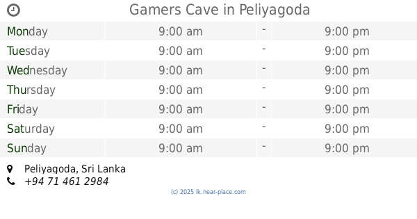
Gamers Cave
Peliyagoda
Cafe
read more
2.063 km
Randy Tea
Randy Tea Ltd., 79 Biyagama Road, Gonawala
Cafe
read more
2.104 km
Wish Bakers
Samanala Place
Cafe
read more
2.249 km
Jeevani Bakery
340 Biyagama Road, Peliyagoda
Cafe
read more
2.453 km
Cake Factory
No.25, Buthgamuwa Road,, ශ්රී ජයවර්ධනපුර කෝට්ටේ
Cafe
read more
2.497 km
Come to My Home
No 252/4A, Avissawella Road, Wellampitiya
Cafe
read more
2.623 km
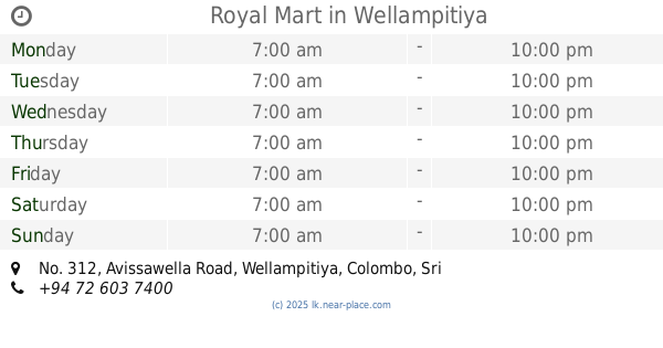
Royal Mart
No. 312, Avissawella Road, Wellampitiya, Colombo, Sri Lanka, Wellampitiya
Cafe
read more
2.717 km
Jayam Those Cafe
Megoda Kolonnawa
Cafe
read more
2.873 km
La Montgana Resort
No 171 Kitelella Rd, Ella
Cafe
read more
3.08 km
Bread Chief Bakery
Nungamugoda Road, Peliyagoda
Cafe
read more
3.516 km
Hot Hot Soup
Biyagama Road, Peliyagoda
Cafe
read more
3.878 km
The Fab
Kotte - Bope Road, Battaramulla
Cafe
read more
4.536 km
The Kéik
46/15, Mosque Lane, Sri Jayawardenepura Kotte
Cafe
read more
📑
all categories
Accounting
Administrative area level 1
Administrative area level 2
Airport
Amusement park
Aquarium
Art gallery
Atm
Bakery
Bank
Bar
Beauty salon
Bicycle store
Book store
Bowling alley
Bus station
Cafe
Campground
Car dealer
Car rental
Car repair
Car wash
Casino
Cemetery
Church
City hall
Clothing store
Colloquial area
Convenience store
Country
Courthouse
Dentist
Department store
Doctor
Electrician
Electronics store
Embassy
Finance
Fire station
Florist
Food
Funeral home
Furniture store
Gas station
General contractor
Grocery or supermarket
Gym
Hair care
Hardware store
Health
Hindu Temple
Home goods store
Hospital
Insurance agency
Intersection
Jewelry store
Laundry
Lawyer
Library
Light rail station
Liquor store
Local government office
Locality
Locksmith
Lodging
Meal delivery
Meal takeaway
Mosque
Movie rental
Movie theater
Moving company
Museum
Natural feature
Neighborhood
Night club
Painter
Park
Parking
Pet store
Pharmacy
Physiotherapist
Place of worship
Plumber
Point of interest
Police
Political
Post office
Premise
Real estate agency
Restaurant
Roofing contractor
Route
Rv park, camping
School
Shoe store
Shopping mall
Spa
Stadium
Storage
Store
Subpremise
Supermarket
Synagogue
Taxi stand
Train station
Transit station
Travel agency
University
Veterinary care
Zoo
administrative area level 3
sublocality level 1
sublocality level 2
↑