Cemetery nearby Oruthota Cemetry
Sri Lanka
Cemetery nearby Oruthota Cemetry
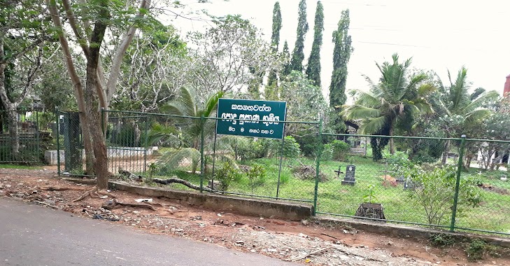
Oruthota Cemetry
Gampaha, Sri Lanka
contacts phone
:
+94
Latitude:
7.077146
, Longitude:
79.9854459
larger map & directions
read more
nearest Cemetery
1.4 km
Roman Catholic Cemetery
Gampaha
Cemetery
read more
1.646 km
Gampaha Medagama Cemetery
Gampaha
Cemetery
read more
1.825 km
Yagoda Cemetery
Sri Lanka
Cemetery
read more
1.971 km
Akaravita Public Cemetery
Gampaha
Cemetery
read more
1.984 km
PublicCemetery
Gampaha
Cemetery
read more
2.718 km
Kasagahawatta Cemetery
Kalyani Road, Gampaha
Cemetery
read more
2.743 km
Kasagahawatta Cemetery
Medagama
Cemetery
read more
2.745 km
Madagama Cemetery
Gampaha
Cemetery
read more
2.97 km
Bandiyamulla Cemetery
Colombo Road, Gampaha
Cemetery
read more
3.612 km
Thibbatugoda Budhist public Cemetery
Sri Lanka
Cemetery
read more
3.763 km
Public Cemetery
Galahitiyawa
Cemetery
read more
3.888 km
Public Cemetery
Ganemulla
Cemetery
read more
3.899 km
Polhena Cemetery
Sri Lanka
Cemetery
read more
3.958 km
Kuda Bollatha Cemetery
Sri Lanka
Cemetery
read more
4.755 km
Ibulkate Cemetery
Sri Lanka
Cemetery
read more
5.251 km
Welikada Baptist Church Cemetery
Mabima
Cemetery
read more
5.464 km
Batuwatta Cemetary
Batuwatta
Cemetery
read more
5.468 km
General Cemetery Heenpanwila
Weliweriya - Gampaha Road, Weliweriya
Cemetery
read more
5.499 km
batuwatta cemerty
Batuwatta East, Batuwatta
Cemetery
read more
6.141 km
Roman Catholic Cemetery
132/24 B New Kandy Road, Weliweriya
Cemetery
read more
6.144 km
Weliweriya Christian Cemetery
Weliweriya
Cemetery
read more
6.2 km
cemetery - Weliveriya
132/24 B New Kandy Road, Weliweriya
Cemetery
read more
6.203 km
General Cemetery & Crematorium
132/24 B New Kandy Road, Weliweriya
Cemetery
read more
6.21 km
Weliweriya Buddhist Cemetery
Weliweriya
Cemetery
read more
6.321 km
Cemetery
Narangoda Paluwa
Cemetery
read more
📑
all categories
Accounting
Administrative area level 1
Administrative area level 2
Airport
Amusement park
Aquarium
Art gallery
Atm
Bakery
Bank
Bar
Beauty salon
Bicycle store
Book store
Bowling alley
Bus station
Cafe
Campground
Car dealer
Car rental
Car repair
Car wash
Casino
Cemetery
Church
City hall
Clothing store
Colloquial area
Convenience store
Country
Courthouse
Dentist
Department store
Doctor
Electrician
Electronics store
Embassy
Finance
Fire station
Florist
Food
Funeral home
Furniture store
Gas station
General contractor
Grocery or supermarket
Gym
Hair care
Hardware store
Health
Hindu Temple
Home goods store
Hospital
Insurance agency
Intersection
Jewelry store
Laundry
Lawyer
Library
Light rail station
Liquor store
Local government office
Locality
Locksmith
Lodging
Meal delivery
Meal takeaway
Mosque
Movie rental
Movie theater
Moving company
Museum
Natural feature
Neighborhood
Night club
Painter
Park
Parking
Pet store
Pharmacy
Physiotherapist
Place of worship
Plumber
Point of interest
Police
Political
Post office
Premise
Real estate agency
Restaurant
Roofing contractor
Route
Rv park, camping
School
Shoe store
Shopping mall
Spa
Stadium
Storage
Store
Subpremise
Supermarket
Synagogue
Taxi stand
Train station
Transit station
Travel agency
University
Veterinary care
Zoo
administrative area level 3
sublocality level 1
sublocality level 2
↑