Church nearby Believers Estern Church
Sri Lanka
Church nearby Believers Estern Church
Believers Estern Church
Urumpirai South Sri Lanka
contacts phone
:
+94
Latitude:
9.7108023
, Longitude:
80.0467186
read more
nearest Church
643 m
Holy Immanuel Church
Palali Road, Urumpirai West
Church
read more
923 m
Holy Immanuel Church,Urumpirai
Urumpirai North
Church
read more
1.436 km
Assembly of God - Kondavil
Kondavil
Church
read more
1.929 km
Kopay Church
Jaffna
Church
read more
1.966 km
St Michael Church
Urumpirai east
Church
read more
2.041 km
St. Mary's Church, Kopay South
AB20, Jaffna
Church
read more
2.354 km
St. Mary's Church Kopay
Jaffna
Church
read more
2.544 km
Potpathy Church
Kokuvil East
Church
read more
3.22 km
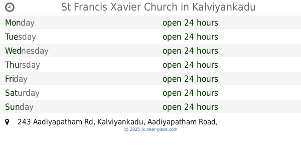
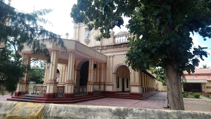
St Francis Xavier Church
243 Aadiyapatham Rd, Kalviyankadu Aadiyapatham Road, Kalviyankadu
Church
read more
3.564 km
New Living Flame Church
Kopay, Irupalai, Jaffna
Church
read more
3.642 km
Kokuvil Church
Jaffna-Kankesanturai Road
Church
read more
3.654 km
Home of Calvary
89,, Brown Road, Kokuvil East
Church
read more
3.715 km
House of Prayer - Srilanka
Jaffna
Church
read more
4.158 km
Prayer Center Full Gospel Church
Sabapathy Lane, Jaffna
Church
read more
4.249 km
Holy Family Church
Uduvil
Church
read more
4.401 km
Rainbow Church
Singam lane, Uduvil
Church
read more
4.543 km
St. Anthony's Catholic Church
Puttur-Kantarodai Road, Chunnakam
Church
read more
4.67 km
Suba
Jaffna
Church
read more
4.911 km
St Benedict's Church ශාන්ත බෙනඩික්ට්ස් පල්ලිය
Jaffna
Church
read more
4.952 km
OLR Church
Uyarapulam, Anaicoddai,, யாழ்ப்பாணம்
Church
read more
5.039 km
St. Joseph's Church, Alady
Alady, Uduvil-Manipay Rd, Uduvil Road, Uduvil
Church
read more
5.345 km
Mary church
Jaffna
Church
read more
6.119 km
St.Mary's Church
Araly North-South Rd, Araly
Church
read more
6.34 km
St.John's Baptist Church
Hospital Road, Jaffna
Church
read more
6.631 km
The Salvation Army Shalom Children Home
A9, Chavakachcheri
Church
read more
📑
all categories
Accounting
Administrative area level 1
Administrative area level 2
Airport
Amusement park
Aquarium
Art gallery
Atm
Bakery
Bank
Bar
Beauty salon
Bicycle store
Book store
Bowling alley
Bus station
Cafe
Campground
Car dealer
Car rental
Car repair
Car wash
Casino
Cemetery
Church
City hall
Clothing store
Colloquial area
Convenience store
Country
Courthouse
Dentist
Department store
Doctor
Electrician
Electronics store
Embassy
Finance
Fire station
Florist
Food
Funeral home
Furniture store
Gas station
General contractor
Grocery or supermarket
Gym
Hair care
Hardware store
Health
Hindu Temple
Home goods store
Hospital
Insurance agency
Intersection
Jewelry store
Laundry
Lawyer
Library
Light rail station
Liquor store
Local government office
Locality
Locksmith
Lodging
Meal delivery
Meal takeaway
Mosque
Movie rental
Movie theater
Moving company
Museum
Natural feature
Neighborhood
Night club
Painter
Park
Parking
Pet store
Pharmacy
Physiotherapist
Place of worship
Plumber
Point of interest
Police
Political
Post office
Premise
Real estate agency
Restaurant
Roofing contractor
Route
Rv park, camping
School
Shoe store
Shopping mall
Spa
Stadium
Storage
Store
Subpremise
Supermarket
Synagogue
Taxi stand
Train station
Transit station
Travel agency
University
Veterinary care
Zoo
administrative area level 3
sublocality level 1
sublocality level 2
↑