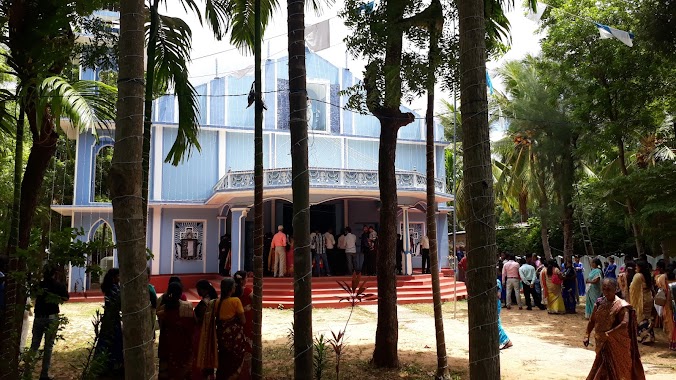
Church nearby St.Josephs Church
Sri Lanka
Church nearby St.Josephs Church
St.Josephs Church
Alaveddi Road, Jaffna, Northern Province, LK Sri Lanka
contacts phone
:
+94
Latitude:
9.7673141
, Longitude:
80.0111423
larger map & directions
read more
nearest Church
1.158 km
Alaveddy CACM Church
Church
read more
1.402 km
Ebenezer Prayer Church
Sri Lanka
Church
read more
1.541 km
St. Xavier Church Kulamankal
kulamankal mallakam, Jaffna
Church
read more
1.904 km
Our Lady Of Miracles, Mallakam, Church Lane
Jaffna
Church
read more
1.904 km
Our Lady Of Miracles, Mallakam, Church Lane
Dżafna
Church
read more
2.451 km
Rhema Power Ministries
Rhema lane
Church
read more
2.846 km
ශාන්ත අන්තෝනි පල්ලිය
Puttur-Kantarodai Road, Chunnakam
Church
read more
2.861 km
St. Anthony's Catholic Church
Puttur-Kantarodai Road, Chunnakam
Church
read more
2.872 km
St John's Church
Vallai-Tellipplai-Araly Rd
Church
read more
2.872 km
St John's Church
Vallai-Tellippalai-Araly Road
Church
read more
3.079 km
St. Antony's Church
Vallai-Tellippalai-Araly Rd
Church
read more
3.079 km
St. Antony's Church
Vallai-Tellippalai-Araly Road
Church
read more
3.331 km
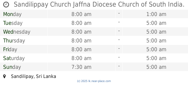
Sandilippay Church Jaffna Diocese Church of South India.
Sandilipay
Church
read more
3.359 km
Small Thiresa
Sandilipay
Church
read more
3.612 km
Velankanni Matha Church
Sandilipay
Church
read more
3.657 km
St. Mary's Church, Pandatharippu
Pandatharippu
Church
read more
3.807 km
St. Antony's Church, Pandatharippu
Pandatharippu
Church
read more
3.811 km
Rainbow Church
Singam lane, Uduvil
Church
read more
3.927 km
St. Joseph's Church, Alady
Alady, Uduvil-Manipay Rd, Uduvil Road, Uduvil
Church
read more
4.04 km
St. Jude's Church
College Lane, Ilavalai
Church
read more
4.157 km
Holy Family Church
Uduvil
Church
read more
4.636 km
Keerimalai Church
Keerimalai Road, Kankesanturai
Church
read more
4.82 km
Church of the American Ceylon Mission
AB17, Manipay
Church
read more
5.355 km
St.Antonys Church
Mathagal Road
Church
read more
6.136 km
St Michael Church
Urumpirai east
Church
read more
📑
all categories
Accounting
Administrative area level 1
Administrative area level 2
Airport
Amusement park
Aquarium
Art gallery
Atm
Bakery
Bank
Bar
Beauty salon
Bicycle store
Book store
Bowling alley
Bus station
Cafe
Campground
Car dealer
Car rental
Car repair
Car wash
Casino
Cemetery
Church
City hall
Clothing store
Colloquial area
Convenience store
Country
Courthouse
Dentist
Department store
Doctor
Electrician
Electronics store
Embassy
Finance
Fire station
Florist
Food
Funeral home
Furniture store
Gas station
General contractor
Grocery or supermarket
Gym
Hair care
Hardware store
Health
Hindu Temple
Home goods store
Hospital
Insurance agency
Intersection
Jewelry store
Laundry
Lawyer
Library
Light rail station
Liquor store
Local government office
Locality
Locksmith
Lodging
Meal delivery
Meal takeaway
Mosque
Movie rental
Movie theater
Moving company
Museum
Natural feature
Neighborhood
Night club
Painter
Park
Parking
Pet store
Pharmacy
Physiotherapist
Place of worship
Plumber
Point of interest
Police
Political
Post office
Premise
Real estate agency
Restaurant
Roofing contractor
Route
Rv park, camping
School
Shoe store
Shopping mall
Spa
Stadium
Storage
Store
Subpremise
Supermarket
Synagogue
Taxi stand
Train station
Transit station
Travel agency
University
Veterinary care
Zoo
administrative area level 3
sublocality level 1
sublocality level 2
↑