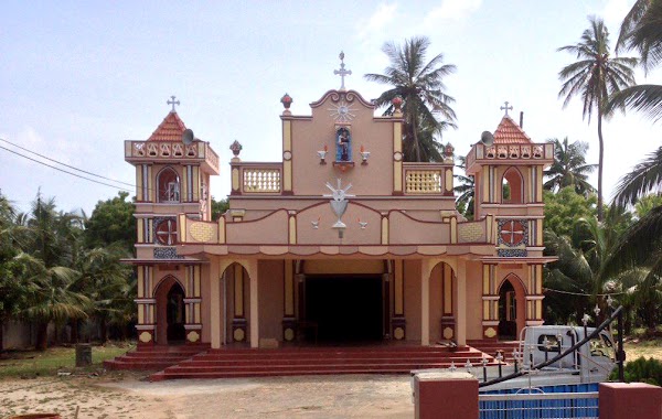
Church nearby St.Mary's
Sri Lanka
Church nearby St.Mary's
St.Mary's
Kandy - Jaffna Highway Sri Lanka
contacts phone
:
+94
Latitude:
9.6725734
, Longitude:
80.2480581
read more
nearest Church
481 m
St.Nicholas Club
A9
Church
read more
483 m
Church of South Indian
Usan Road-1st Cross Street
Church
read more
521 m
St.Nicholas
A9 Kandy - Jaffna Highway
Church
read more
755 m
Velankanni St.Mery's
A9
Church
read more
1.447 km
St. Mary’s Church
Thavasikulam, Mirusuvil
Church
read more
3.309 km
Kachchai Church
Jaffna
Church
read more
3.703 km
Allarai St.Mary's Church.
Jaffna
Church
read more
6.328 km
Muhamalai Church
Kandy Highway Muhamalai, A9, Jaffna
Church
read more
6.634 km
Anthoniyar Kovil
Anthoniyar Kovil - Varani Rd, Manthuvil
Church
read more
8.513 km
St.likoryar church
Chavakachcheri
Church
read more
9.002 km
Annavelankany Matha Kovil, Kudathanai
Church
read more
9.575 km
Church Chavakachcheri
Chavakachcheri
Church
read more
11.068 km
St. Andrew Church
A9, Pachchilapalli
Church
read more
11.147 km
St.Anthony'S Church (Old, 1894 Built)
Manalkaadu, Jaffna
Church
read more
12.628 km
Sr.Antony's Church
Pachchilapalli
Church
read more
13.716 km
Thalayadi Parish
St. Philip Neri Church, Chempianpattu,, Jaffna
Church
read more
13.719 km
St. Philip Neri's Church
chempianpattu,
Church
read more
14.33 km
St.Mary's Church
Karaveddi
Church
read more
14.823 km
Maranatha Church
Karaveddi
Church
read more
17.435 km
Church of South India
Udupiddy Vallai-Uduppiddi-Valvedditturai Road, Nelliady
Church
read more
17.454 km
Roman Catholic Church
Udupiddy B438, Nelliady
Church
read more
17.63 km
Church
Vallai-Uduppiddi-Valvedditturai Road, Nelliady
Church
read more
18.355 km
Atchuvely St Antony's Church
Atchuvely North, AB32 Vallai-Tellippalai-Araly Road
Church
read more
18.672 km
Church of South India,Atchuvely
AtchuvelyJaffna
Church
read more
19.174 km
St. Joseph's Church, Thenmoolai, Atchuvely
Vallai-Tellippalai-Araly Road
Church
read more
📑
all categories
Accounting
Administrative area level 1
Administrative area level 2
Airport
Amusement park
Aquarium
Art gallery
Atm
Bakery
Bank
Bar
Beauty salon
Bicycle store
Book store
Bowling alley
Bus station
Cafe
Campground
Car dealer
Car rental
Car repair
Car wash
Casino
Cemetery
Church
City hall
Clothing store
Colloquial area
Convenience store
Country
Courthouse
Dentist
Department store
Doctor
Electrician
Electronics store
Embassy
Finance
Fire station
Florist
Food
Funeral home
Furniture store
Gas station
General contractor
Grocery or supermarket
Gym
Hair care
Hardware store
Health
Hindu Temple
Home goods store
Hospital
Insurance agency
Intersection
Jewelry store
Laundry
Lawyer
Library
Light rail station
Liquor store
Local government office
Locality
Locksmith
Lodging
Meal delivery
Meal takeaway
Mosque
Movie rental
Movie theater
Moving company
Museum
Natural feature
Neighborhood
Night club
Painter
Park
Parking
Pet store
Pharmacy
Physiotherapist
Place of worship
Plumber
Point of interest
Police
Political
Post office
Premise
Real estate agency
Restaurant
Roofing contractor
Route
Rv park, camping
School
Shoe store
Shopping mall
Spa
Stadium
Storage
Store
Subpremise
Supermarket
Synagogue
Taxi stand
Train station
Transit station
Travel agency
University
Veterinary care
Zoo
administrative area level 3
sublocality level 1
sublocality level 2
↑