Hospital nearby Colombo North Teaching Hospital
Sri Lanka
Hospital nearby Colombo North Teaching Hospital
Colombo North Teaching Hospital
Colombo, Sri Lanka
contacts phone
:
+94 112 959 261
Latitude:
7.0294275
, Longitude:
79.9247356
larger map & directions
read more
nearest Hospital
Colombo North Teaching Hospital
Kolombo
Hospital
read more
73 m
Colombo North Teaching Hospital, Ragama
Ragama
Hospital
read more
84 m
Colombo North Teaching Hospital
Hospital Inner Road, Ragama
Hospital
read more
100 m
OPD, Clinic
Ragama
Hospital
read more
111 m
Colombo North Teaching Hospital - Ragama
North Teaching Hospital, කොළඹ
Hospital
read more
172 m
North Colombo Teaching Hospital Ragama
Hospital Inner Road, Ragama
Hospital
read more
248 m
Jmo's Office
UDA Road, Ragama
Hospital
read more
348 m
MDT Unit, Ragama Medical Fauculty
Faculty Lane, Ragama
Hospital
read more
385 m
Oral, Maxillofacial and Dental Clinic/ Channeling Center
Thewatta Road, Ragama
Hospital
read more
402 m
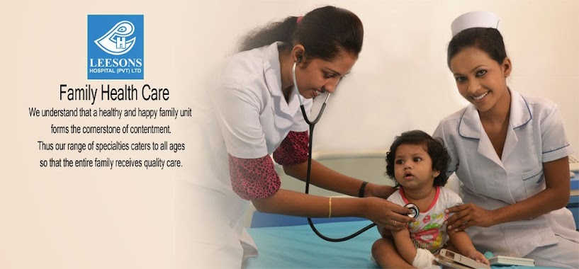
Leesons Hospital
33, Thewatta Road, Ragama
Hospital
read more
410 m
Suwasarana Hospital
769/A, Thewatte Road, Ragama
Hospital
read more
417 m
Liver Transplantation Service
Annasihena Road, Ragama
Hospital
read more
489 m
Browns Hospital
43, Ragama Road, Ragama
Hospital
read more
532 m
RVS
Gampaha
Hospital
read more
659 m
Ranawiru Sewana-Army Hospital
Sri Lanka
Hospital
read more
688 m
Rheumatology and Rehabitation Hospital
Rehabiltation Hospital Road
Hospital
read more
699 m
Osumadura Ayurvedic
B13, Batuwatta
Hospital
read more
722 m
Rehabilitation Hospital Ragama
Gampaha
Hospital
read more
739 m
Rehabilitation hospital Quats
Gampaha
Hospital
read more
780 m
Medical Centre
Ragama
Hospital
read more
795 m
Ragama Ayurveda Medical Center
No. 836/A, Thewatta Road, Ragama
Hospital
read more
985 m
Exceed Prosthetics and Orthotics
168, Ekamuthu Mawatha, Kadawatha, Ragama Road, Ragama
Hospital
read more
985 m
Exceed Prosthetics and Orthotics
4th Lane, Eldeniya
Hospital
read more
1.509 km
Sethro Medical Center
295/4, Delpe junction, Kadawata Road, Ragama, B13
Hospital
read more
1.946 km
Kadum Bidum Ayruvedic Center
Wihara Mawatha, Narangoda Paluwa
Hospital
read more
📑
all categories
Accounting
Administrative area level 1
Administrative area level 2
Airport
Amusement park
Aquarium
Art gallery
Atm
Bakery
Bank
Bar
Beauty salon
Bicycle store
Book store
Bowling alley
Bus station
Cafe
Campground
Car dealer
Car rental
Car repair
Car wash
Casino
Cemetery
Church
City hall
Clothing store
Colloquial area
Convenience store
Country
Courthouse
Dentist
Department store
Doctor
Electrician
Electronics store
Embassy
Finance
Fire station
Florist
Food
Funeral home
Furniture store
Gas station
General contractor
Grocery or supermarket
Gym
Hair care
Hardware store
Health
Hindu Temple
Home goods store
Hospital
Insurance agency
Intersection
Jewelry store
Laundry
Lawyer
Library
Light rail station
Liquor store
Local government office
Locality
Locksmith
Lodging
Meal delivery
Meal takeaway
Mosque
Movie rental
Movie theater
Moving company
Museum
Natural feature
Neighborhood
Night club
Painter
Park
Parking
Pet store
Pharmacy
Physiotherapist
Place of worship
Plumber
Point of interest
Police
Political
Post office
Premise
Real estate agency
Restaurant
Roofing contractor
Route
Rv park, camping
School
Shoe store
Shopping mall
Spa
Stadium
Storage
Store
Subpremise
Supermarket
Synagogue
Taxi stand
Train station
Transit station
Travel agency
University
Veterinary care
Zoo
administrative area level 3
sublocality level 1
sublocality level 2
↑