Lodging nearby Mada Midula Hotel
Sri Lanka
Lodging nearby Mada Midula Hotel
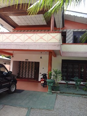
Mada Midula Hotel
Pahala Bomiriya, Sri Lanka
contacts phone
:
+94 77 758 8855
Latitude:
6.9373006
, Longitude:
79.9889093
larger map & directions
read more
nearest Lodging
306 m
La Rose Hotel Biyagama
No:158/11, New Kandy Road,, Biyagama
Lodging
read more
328 m
Hotel Ramanka
156/3, Bandarawatta, ニュー・カンディー・ロード, කඩුවෙල
Lodging
read more
394 m
La Rose Hotel
No: 155/1 F, New Kandy Road,, Bandarawatta,, Kaduwela
Lodging
read more
696 m
La Rose Guest House
476/4, Malwatta Road, Kaduwela
Lodging
read more
715 m
Dilara Nawahiru Hall
Malwana Road
Lodging
read more
764 m
New Biyagama Village
130 B214, Biyagama
Lodging
read more
857 m
Crossroads Villa
142/7, Colombo Road
Lodging
read more
871 m
Conference Hotel Colombo
Malwana Road
Lodging
read more
989 m
Hotel Teak Garden
No: 506E, Colombo Road., Kaduwela
Lodging
read more
1.19 km
Hotel Little Hut
Sri Lanka
Lodging
read more
1.259 km
Alina Hotel
kaduwela, Avissawella Road
Lodging
read more
1.265 km
The River Edge
157 Kaduwela Road, Kaduwela
Lodging
read more
1.291 km
Sudeepa Hotel
Hewagama, Kaduwela
Lodging
read more
1.325 km
Royal Resort
Kaduwela
Lodging
read more
1.356 km
Navindu Hotel
Rajasinghe Mawatha, Kaduwela
Lodging
read more
1.855 km
New Kelani Nadee Holiday Home
Sri Lanka
Lodging
read more
1.892 km
Lovely Guest House
Sri Lanka
Lodging
read more
1.946 km
Tranquil Villa
Kaduwela
Lodging
read more
1.969 km
Samadi Hotel
Malwana Road
Lodging
read more
2.087 km
River frount
133 Kaduwela Road, Kaduwela
Lodging
read more
2.18 km
Serene Hostels
No.225 / 84 Vihara Lane, Kaduwela
Lodging
read more
2.199 km
The Serene Court Housing Scheme
The Serene Court Housing Scheme, Kaduwela
Lodging
read more
2.37 km
Gurugedara Girls Hostel
Vihara Lane, Kaduwela
Lodging
read more
2.496 km
Hotel Limara
Sri Lanka
Lodging
read more
2.496 km
Hotel Limara
102/G2 New Kandy Road, Kaduwela
Lodging
read more
📑
all categories
Accounting
Administrative area level 1
Administrative area level 2
Airport
Amusement park
Aquarium
Art gallery
Atm
Bakery
Bank
Bar
Beauty salon
Bicycle store
Book store
Bowling alley
Bus station
Cafe
Campground
Car dealer
Car rental
Car repair
Car wash
Casino
Cemetery
Church
City hall
Clothing store
Colloquial area
Convenience store
Country
Courthouse
Dentist
Department store
Doctor
Electrician
Electronics store
Embassy
Finance
Fire station
Florist
Food
Funeral home
Furniture store
Gas station
General contractor
Grocery or supermarket
Gym
Hair care
Hardware store
Health
Hindu Temple
Home goods store
Hospital
Insurance agency
Intersection
Jewelry store
Laundry
Lawyer
Library
Light rail station
Liquor store
Local government office
Locality
Locksmith
Lodging
Meal delivery
Meal takeaway
Mosque
Movie rental
Movie theater
Moving company
Museum
Natural feature
Neighborhood
Night club
Painter
Park
Parking
Pet store
Pharmacy
Physiotherapist
Place of worship
Plumber
Point of interest
Police
Political
Post office
Premise
Real estate agency
Restaurant
Roofing contractor
Route
Rv park, camping
School
Shoe store
Shopping mall
Spa
Stadium
Storage
Store
Subpremise
Supermarket
Synagogue
Taxi stand
Train station
Transit station
Travel agency
University
Veterinary care
Zoo
administrative area level 3
sublocality level 1
sublocality level 2
↑