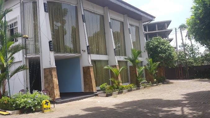
Lodging nearby Ruwan Karunaratne
Sri Lanka
Lodging nearby Ruwan Karunaratne
Ruwan Karunaratne
Suhada Mawatha, Yakkala, Gampaha, LK Sri Lanka
contacts phone
:
+94 332 239 003
Latitude:
7.0862231
, Longitude:
80.0296237
larger map & directions
read more
nearest Lodging
271 m
S.A.N Subasinghe
No.117, Yakkala
Lodging
read more
545 m
Seneveretna Boys Hostel
Yakkala
Lodging
read more
711 m
Hotel Nature Gardens
31 Colombo - Kandy Road, Yakkala
Lodging
read more
712 m
Hotel Nature Gardens
Yakkala
Lodging
read more
786 m
Hotel Asela- Reception Hall
Yakkala - Radawana Road, Yakkala
Lodging
read more
1.407 km
Hotel Tayaro King
4th Lane, Werellawaththa,Yakkala, Gampaha
Lodging
read more
1.424 km
Wps Rathnasiri
hansagiri rd, 50a/61 7th Lane, Gampaha
Lodging
read more
1.524 km
Hansagiri House
305/5/1 Hansagiri Rd, Gampaha
Lodging
read more
1.688 km
The Orchard Inn
77/5, Samanabadde, Thiththapaththara
Lodging
read more
1.797 km
Sathhada Reception Hall
1d, Bemmulla
Lodging
read more
1.925 km
Fern Shade Reception Hall
Wathurugama Road, Gampaha
Lodging
read more
2.087 km
Eknara Holiday Bungalow
Sirimal Uyana Road, Gampaha
Lodging
read more
2.348 km
Sisila Hotel
Sri Lanka
Lodging
read more
2.348 km
Sisila Hotel
Lodging
read more
2.468 km
Benthara Hotel
Gampaha
Lodging
read more
2.527 km
Hotel Sanara
211 A1
Lodging
read more
2.592 km
The Private Cottage
Yakkala
Lodging
read more
2.63 km
Madu Thushari hotel
A1, Gampaha
Lodging
read more
2.718 km
Budget Hostel Near Airport
VeyangodaNo 212, Aluthgama Bogamuwa Yakkala
Lodging
read more
2.718 km
Budget Hostel Near Airport
No 212, Aluthgama Bogamuwa Yakkala, Veyangoda
Lodging
read more
2.83 km
Amaya Greens
Weerangula Road
Lodging
read more
3.28 km
Linrose Hotel
Bemmulla
Lodging
read more
3.28 km
Linrose Hotel
175/1 Kandy road Bogamuwa, Yakkala
Lodging
read more
3.286 km
Hotel Dhanalee
66 New Kandy Road, Balummahara
Lodging
read more
3.532 km
Lion Foot Gallery Hotel
Kandy Road, Kalagedihena
Lodging
read more
📑
all categories
Accounting
Administrative area level 1
Administrative area level 2
Airport
Amusement park
Aquarium
Art gallery
Atm
Bakery
Bank
Bar
Beauty salon
Bicycle store
Book store
Bowling alley
Bus station
Cafe
Campground
Car dealer
Car rental
Car repair
Car wash
Casino
Cemetery
Church
City hall
Clothing store
Colloquial area
Convenience store
Country
Courthouse
Dentist
Department store
Doctor
Electrician
Electronics store
Embassy
Finance
Fire station
Florist
Food
Funeral home
Furniture store
Gas station
General contractor
Grocery or supermarket
Gym
Hair care
Hardware store
Health
Hindu Temple
Home goods store
Hospital
Insurance agency
Intersection
Jewelry store
Laundry
Lawyer
Library
Light rail station
Liquor store
Local government office
Locality
Locksmith
Lodging
Meal delivery
Meal takeaway
Mosque
Movie rental
Movie theater
Moving company
Museum
Natural feature
Neighborhood
Night club
Painter
Park
Parking
Pet store
Pharmacy
Physiotherapist
Place of worship
Plumber
Point of interest
Police
Political
Post office
Premise
Real estate agency
Restaurant
Roofing contractor
Route
Rv park, camping
School
Shoe store
Shopping mall
Spa
Stadium
Storage
Store
Subpremise
Supermarket
Synagogue
Taxi stand
Train station
Transit station
Travel agency
University
Veterinary care
Zoo
administrative area level 3
sublocality level 1
sublocality level 2
↑