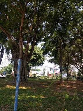
Park nearby The Wet Water Park
Sri Lanka
Park nearby The Wet Water Park
The Wet Water Park
Nawala Road, 11222, Sri Jayawardenepura Kotte, Colombo, LK Sri Lanka
contacts phone
:
+94
Latitude:
6.8932691
, Longitude:
79.8894084
larger map & directions
read more
nearest Park
391 m
Nawala Cemetery
Sri Lanka
Park
read more
671 m
Children's Park
East
Park
read more
1.036 km
Mahawatte Playground
Dabare Lane, Colombo
Park
read more
1.371 km
Diyawanna Childrens' Park
Nugegoda
Park
read more
1.478 km
Adventure SEALs
No 3, Vijaya Kumaratunga Mawatha, Colombo
Park
read more
1.534 km
Queen's Park Residencies
Sri Lanka
Park
read more
1.64 km
Nawala walking track
B307, Sri Jayawardenepura Kotte
Park
read more
1.643 km
Weli Park
Nawala Road, Sri Jayawardenepura Kotte
Park
read more
1.656 km
Urban Wetland Park
Nugegoda West
Park
read more
1.661 km
Urban Wetland Park (Nugegoda)
Ethul Kotte
Park
read more
1.839 km
Sri Parakumba Peace Park
Sri Jayawardenepura Mawatha, Sri Jayawardenepura Kotte
Park
read more
1.879 km
Sandru
Kirulapone, Colombo
Park
read more
1.909 km
Cotta Park
Sri Jayawardenepura Kotte
Park
read more
1.913 km
Cotta Park
Kolombo
Park
read more
1.913 km
Cotta Park
Colombo
Park
read more
2.077 km
Adventure SEALs
151/1B Dudley Senanayake Mawatha, Colombo
Park
read more
2.218 km
The Waters Edge Park
Sri Jayawardenepura Mawatha, Sri Jayawardenepura Kotte
Park
read more
2.223 km
Linear Park - Diyawannawa
Sri Jayawardenepura Kotte
Park
read more
2.342 km
Darul Khair
149 Kynsey Road, Colombo
Park
read more
2.493 km
Esala Children's Park
Kolombo
Park
read more
2.518 km
Mirihana Police Grounds
Nugegoda
Park
read more
2.577 km
Diyatha Uyana
Kaduwela Road, Sri Jayawardenepura Kotte
Park
read more
2.667 km
Wonder World Kids Park
445 Havelock Road, Colombo
Park
read more
2.7 km
Pond Around The Speaker's Residence
Rajamalwatta
Park
read more
2.78 km
Attune Gregory's Road Car Park
00700, 29 ආර්.ජී. සේනානායක මාවත, කොළඹ
Park
read more
📑
all categories
Accounting
Administrative area level 1
Administrative area level 2
Airport
Amusement park
Aquarium
Art gallery
Atm
Bakery
Bank
Bar
Beauty salon
Bicycle store
Book store
Bowling alley
Bus station
Cafe
Campground
Car dealer
Car rental
Car repair
Car wash
Casino
Cemetery
Church
City hall
Clothing store
Colloquial area
Convenience store
Country
Courthouse
Dentist
Department store
Doctor
Electrician
Electronics store
Embassy
Finance
Fire station
Florist
Food
Funeral home
Furniture store
Gas station
General contractor
Grocery or supermarket
Gym
Hair care
Hardware store
Health
Hindu Temple
Home goods store
Hospital
Insurance agency
Intersection
Jewelry store
Laundry
Lawyer
Library
Light rail station
Liquor store
Local government office
Locality
Locksmith
Lodging
Meal delivery
Meal takeaway
Mosque
Movie rental
Movie theater
Moving company
Museum
Natural feature
Neighborhood
Night club
Painter
Park
Parking
Pet store
Pharmacy
Physiotherapist
Place of worship
Plumber
Point of interest
Police
Political
Post office
Premise
Real estate agency
Restaurant
Roofing contractor
Route
Rv park, camping
School
Shoe store
Shopping mall
Spa
Stadium
Storage
Store
Subpremise
Supermarket
Synagogue
Taxi stand
Train station
Transit station
Travel agency
University
Veterinary care
Zoo
administrative area level 3
sublocality level 1
sublocality level 2
↑