Park nearby Urban Council Children Park
Sri Lanka
Park nearby Urban Council Children Park
Urban Council Children Park
Pandaravanniyan Road, Vavuniya Sri Lanka
contacts phone
:
+94
Latitude:
8.7588106
, Longitude:
80.501948
read more
nearest Park
Urban Council children park
Tharmalingam Road, Vavuniya
Park
read more
631 m
Vavuniya Park
Vavuniya
Park
read more
631 m
Vavuniya Park
Distrito de Vavuniya
Park
read more
642 m
Vavuniya Park New Entramce
Park Road, Vavuniya
Park
read more
1.029 km
Young Stars Spots Club Play Ground
Kurumankadu
Park
read more
1.3 km
Childrens Park
UC Quatas Road, Vavuniya
Park
read more
7.3 km
Marutha Nilam மருதநிலம்
Vavuniya
Park
read more
11.175 km
Vavuniya Campus Play ground
Salambaikkulam,, Nelumkulama
Park
read more
23.873 km
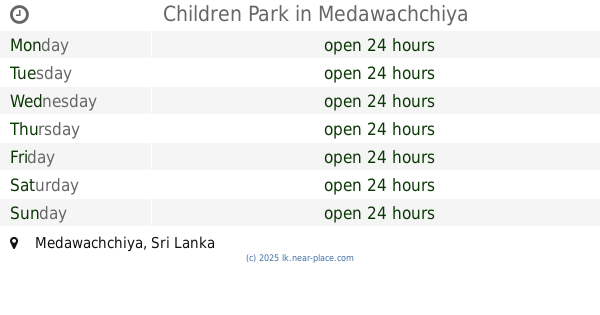
Children Park
Medawachchiya
Park
read more
24.517 km
Medawachchiya City Clock Tower
Kandy - Jaffna Highway, Medawachchiya
Park
read more
39.182 km
horowupothana National Park
Anuradhapura
Park
read more
39.269 km
Horowpothana National Park
Distrito de Anuradhapura
Park
read more
42.71 km
Yan Oya Reservoir
Anuradhapura
Park
read more
44.428 km
University Park
Mihintale
Park
read more
44.856 km
Lovers Corner පැණිමුල්ල
Trincomalee Road, Mihintale
Park
read more
46.205 km
Dhammachethiya Meditation Monestry
Watawandana Road, Anuradhapura
Park
read more
48.392 km
Kiliyan Garden
Mullaitivu
Park
read more
48.435 km
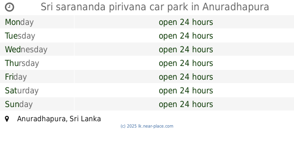
Sri sarananda pirivana car park
Anuradhapura
Park
read more
48.44 km
Stage 1 Urban Park
Distrito de Anuradhapura
Park
read more
48.517 km
Stage 1 Children's Park
Anuradhapura
Park
read more
48.803 km
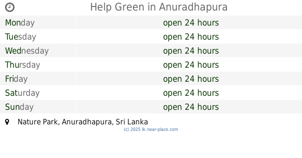
Help Green
Nature Park, Anuradhapura
Park
read more
50.234 km
Childrens Park
Anuradhapura
Park
read more
54.112 km
Lake View Park
Mullaitivu
Park
read more
54.448 km
Kokkilai Sanctuary
Sri Lanka
Park
read more
60.206 km
Park Narodowy Wilpattu
Sri Lanka
Park
read more
📑
all categories
Accounting
Administrative area level 1
Administrative area level 2
Airport
Amusement park
Aquarium
Art gallery
Atm
Bakery
Bank
Bar
Beauty salon
Bicycle store
Book store
Bowling alley
Bus station
Cafe
Campground
Car dealer
Car rental
Car repair
Car wash
Casino
Cemetery
Church
City hall
Clothing store
Colloquial area
Convenience store
Country
Courthouse
Dentist
Department store
Doctor
Electrician
Electronics store
Embassy
Finance
Fire station
Florist
Food
Funeral home
Furniture store
Gas station
General contractor
Grocery or supermarket
Gym
Hair care
Hardware store
Health
Hindu Temple
Home goods store
Hospital
Insurance agency
Intersection
Jewelry store
Laundry
Lawyer
Library
Light rail station
Liquor store
Local government office
Locality
Locksmith
Lodging
Meal delivery
Meal takeaway
Mosque
Movie rental
Movie theater
Moving company
Museum
Natural feature
Neighborhood
Night club
Painter
Park
Parking
Pet store
Pharmacy
Physiotherapist
Place of worship
Plumber
Point of interest
Police
Political
Post office
Premise
Real estate agency
Restaurant
Roofing contractor
Route
Rv park, camping
School
Shoe store
Shopping mall
Spa
Stadium
Storage
Store
Subpremise
Supermarket
Synagogue
Taxi stand
Train station
Transit station
Travel agency
University
Veterinary care
Zoo
administrative area level 3
sublocality level 1
sublocality level 2
↑