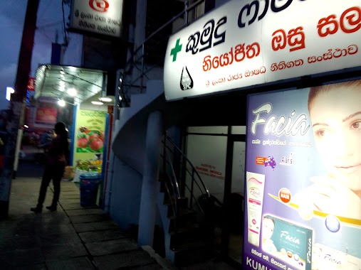
Pharmacy nearby Smarasinghe Pharmacy
Sri Lanka
Pharmacy nearby Smarasinghe Pharmacy
Smarasinghe Pharmacy
B13, Neligama, Gampaha, LK Sri Lanka
contacts phone
:
+94
Latitude:
7.0189273
, Longitude:
79.9374801
larger map & directions
read more
nearest Pharmacy
361 m
Dove Pharmacy
B13
Pharmacy
read more
1.98 km
Ragama Pharmacy 2
Ragama
Pharmacy
read more
2.044 km
New Soorigama Pharmacy
Sri Lanka
Pharmacy
read more
2.086 km
Ragama Phamacy
34, Thewatta Road, Ragama
Pharmacy
read more
2.184 km
New City Pharmacy
Thewatta Road, Ragama
Pharmacy
read more
2.195 km
Isura Pharmacy
Ragama
Pharmacy
read more
2.237 km
Rajya Osu Sala (SPC)
State Pharmaceuticals Corporation, Mahabage Road, Ragama,
Pharmacy
read more
2.329 km
Isuru Pharmacy
No.175/1, Ragama Road, Kadawatha
Pharmacy
read more
2.417 km
Pasyale Ayurveda Osu (PVT) LTD.
Gampaha
Pharmacy
read more
2.515 km
Sulalitha Pharmacy
27, A1, Kadawatha
Pharmacy
read more
2.515 km
Sulalitha Pharmacy
27, Kandy Road, Kadawatha
Pharmacy
read more
2.61 km
Kumudu Pharmacy
135/5, Kandy Road, Kadawatha
Pharmacy
read more
3.156 km
Sanura Pharmacy
B460, Wattala
Pharmacy
read more
3.283 km
Enderamulla Pharmacy
117 Vijaya Kumarathunga Mawatha, Wattala
Pharmacy
read more
3.283 km
Enderamulla Pharmacy
Sri Lanka
Pharmacy
read more
3.284 km
Y-Sen (Pvt) Ltd
Peralanda Road, Ragama
Pharmacy
read more
3.294 km
Milan Pharmacy
Vijaya Kumarathunga Mawatha, Wattala
Pharmacy
read more
3.303 km
Sampath Pharmacy
Fonseka Villa, B13, Ragama
Pharmacy
read more
3.532 km
Enderamulla Dispensary
292 B460, Wattala
Pharmacy
read more
3.532 km
Enderamulla Dispensary
Sri Lanka
Pharmacy
read more
3.581 km
Peralanda Pharmacy
Peralanda Road, Ragama
Pharmacy
read more
3.72 km
නවලෝක ඔසු හළ
300 B460, Wattala
Pharmacy
read more
4.477 km
Cetus Pharmacy
38/3 Makola Road, Gonawala
Pharmacy
read more
4.577 km
Suwasala Pharmacy
358 Negombo Road, Ragama
Pharmacy
read more
4.861 km
Shayama Pharmacy
A1, Kadawatha
Pharmacy
read more
📑
all categories
Accounting
Administrative area level 1
Administrative area level 2
Airport
Amusement park
Aquarium
Art gallery
Atm
Bakery
Bank
Bar
Beauty salon
Bicycle store
Book store
Bowling alley
Bus station
Cafe
Campground
Car dealer
Car rental
Car repair
Car wash
Casino
Cemetery
Church
City hall
Clothing store
Colloquial area
Convenience store
Country
Courthouse
Dentist
Department store
Doctor
Electrician
Electronics store
Embassy
Finance
Fire station
Florist
Food
Funeral home
Furniture store
Gas station
General contractor
Grocery or supermarket
Gym
Hair care
Hardware store
Health
Hindu Temple
Home goods store
Hospital
Insurance agency
Intersection
Jewelry store
Laundry
Lawyer
Library
Light rail station
Liquor store
Local government office
Locality
Locksmith
Lodging
Meal delivery
Meal takeaway
Mosque
Movie rental
Movie theater
Moving company
Museum
Natural feature
Neighborhood
Night club
Painter
Park
Parking
Pet store
Pharmacy
Physiotherapist
Place of worship
Plumber
Point of interest
Police
Political
Post office
Premise
Real estate agency
Restaurant
Roofing contractor
Route
Rv park, camping
School
Shoe store
Shopping mall
Spa
Stadium
Storage
Store
Subpremise
Supermarket
Synagogue
Taxi stand
Train station
Transit station
Travel agency
University
Veterinary care
Zoo
administrative area level 3
sublocality level 1
sublocality level 2
↑