Place of worship nearby Raigam Estate Temple
Sri Lanka
Place of worship nearby Raigam Estate Temple
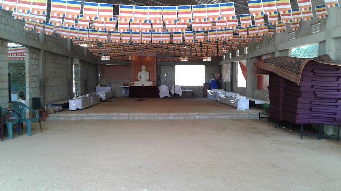
Raigam Estate Temple
Raigam Estate Upper Division Road Sri Lanka
contacts phone
:
+94
Latitude:
6.7714469
, Longitude:
80.1603162
read more
nearest Place of worship
935 m
Sri Wijaya Bodhiraja Temple
Meepe - Ingiriya Road
Place of worship
read more
1.428 km
Sri Bodhirukkharamaya Viharaya
Kalutara
Place of worship
read more
1.651 km
Kekuladola Temple
6°46'49.1"N 80°08'53.9"E, Galle Road, Colombo
Place of worship
read more
2.057 km
Sudampaya Dharmayathanaya, Bodhirajagama, Ingiriya
Ingiriya
Place of worship
read more
2.995 km
Kurana Temple
Kalutara
Place of worship
read more
3.007 km
Dahamkanda Arannaya Hadapangoda
6.798210420062897, 80, 16425300889584
Place of worship
read more
3.026 km
Dahamkanda arannaya
Place of worship
read more
3.551 km
Ingiriya Bo-Tree
Ratnapura - Horana - Panadura Highway, Ingiriya
Place of worship
read more
3.568 km
Susantha Alvis Kapu Mahaththayage Dewale
Maputugala
Place of worship
read more
3.599 km
Sri Wickramasinharamaya
Maputugala
Place of worship
read more
3.628 km
buddagayawa Temple
Sri Lanka
Place of worship
read more
3.826 km
Siri Piyarathanaramaya
Giranthi Kanda, Sirimal Road, Handapangoda, Kandanapitiya Rd
Place of worship
read more
3.864 km
Bodhinagala Bo Samindu
Bodhinagala Road, Ingiriya
Place of worship
read more
4.176 km
ධර්මයයි ඔබයි ආරාමය/ Dharmayai Obai Aramaya
Keenagahawila Road, Nugedanda
Place of worship
read more
4.196 km
Dharmayai Obai Aramaya
Kalutara
Place of worship
read more
4.511 km
Sri Vijaya Sunandaramaya
Place of worship
read more
4.582 km
Isipathananramaya temple
Madakada Hermitage Rd, Wewila
Place of worship
read more
4.602 km
Sri Jinarathanaramaya - Arakawila
Colombo
Place of worship
read more
4.602 km
Sri Jinarathanaramaya - Arakawila
Kolombo
Place of worship
read more
4.638 km
Sri Anandarama Maha Viharaya
Keenagahawila
Place of worship
read more
4.8 km
සඳගිරි සාම විහාරය සහ දහම්සඳ දහම් පාසල
Yatawatura, Pelpitigoda, Rathmalgoda Road, Malagala
Place of worship
read more
5.377 km
Sri Sangikaramaya
Poruwadanda-Handapangoda Road, Poruwadanda
Place of worship
read more
5.664 km
Nambapana Temple
Kalutara
Place of worship
read more
5.776 km
Mahingala Sri Sangikaramaya
Menerigama Road
Place of worship
read more
6.268 km
Sri Thilakarama Buddhist Temple
Poruwadanda
Place of worship
read more
📑
all categories
Accounting
Administrative area level 1
Administrative area level 2
Airport
Amusement park
Aquarium
Art gallery
Atm
Bakery
Bank
Bar
Beauty salon
Bicycle store
Book store
Bowling alley
Bus station
Cafe
Campground
Car dealer
Car rental
Car repair
Car wash
Casino
Cemetery
Church
City hall
Clothing store
Colloquial area
Convenience store
Country
Courthouse
Dentist
Department store
Doctor
Electrician
Electronics store
Embassy
Finance
Fire station
Florist
Food
Funeral home
Furniture store
Gas station
General contractor
Grocery or supermarket
Gym
Hair care
Hardware store
Health
Hindu Temple
Home goods store
Hospital
Insurance agency
Intersection
Jewelry store
Laundry
Lawyer
Library
Light rail station
Liquor store
Local government office
Locality
Locksmith
Lodging
Meal delivery
Meal takeaway
Mosque
Movie rental
Movie theater
Moving company
Museum
Natural feature
Neighborhood
Night club
Painter
Park
Parking
Pet store
Pharmacy
Physiotherapist
Place of worship
Plumber
Point of interest
Police
Political
Post office
Premise
Real estate agency
Restaurant
Roofing contractor
Route
Rv park, camping
School
Shoe store
Shopping mall
Spa
Stadium
Storage
Store
Subpremise
Supermarket
Synagogue
Taxi stand
Train station
Transit station
Travel agency
University
Veterinary care
Zoo
administrative area level 3
sublocality level 1
sublocality level 2
↑