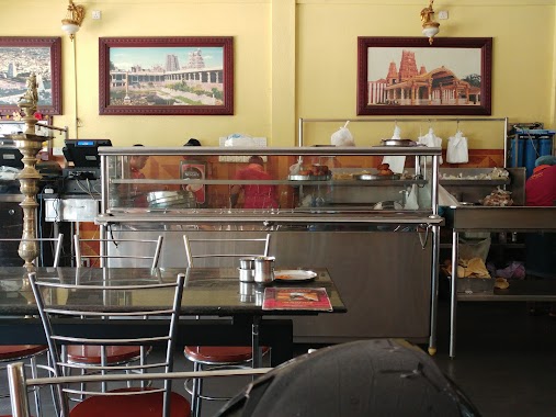
Restaurant nearby Soon Fat
Sri Lanka
Restaurant nearby Soon Fat
Soon Fat
Nallur-Oddumadam Road, Jaffna, Jaffna, LK Sri Lanka
contacts phone
:
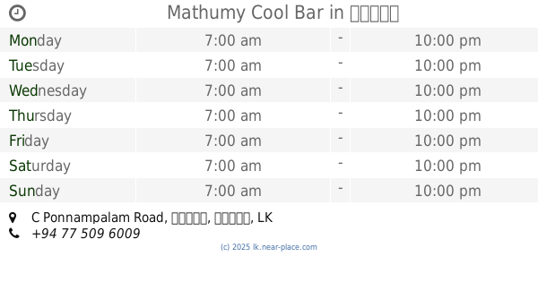
+94
Latitude:
9.6759091
, Longitude:
80.0218175
larger map & directions
read more
nearest Restaurant
236 m
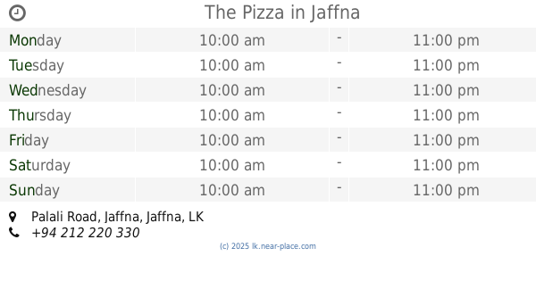
The Pizza
229, Palali Road, Jaffna
Restaurant
read more
613 m
Suvaiyutu Vegetarian Hotel
Jaffna
Restaurant
read more
672 m
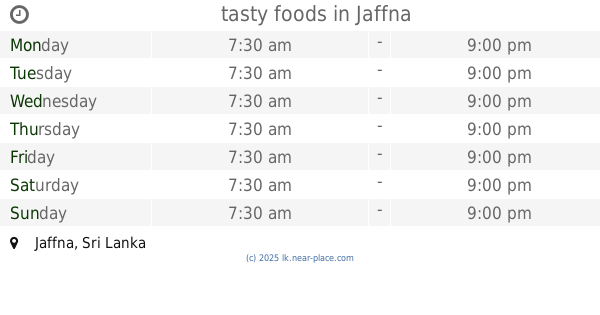
tasty foods
Jaffna
Restaurant
read more
696 m
Luxsmy veg hotel
Jaffna
Restaurant
read more
765 m
Mangos Indian Veg
359/3, Temple Road, Jaffna
Restaurant
read more
776 m
Yarl Rest
Palali Road, Jaffna
Restaurant
read more
776 m
Shakthi Hotel
Jaffna
Restaurant
read more
802 m
Royal Cream House
Kovil Road, Jaffna
Restaurant
read more
813 m
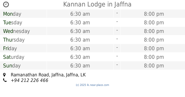
Kannan Lodge
Ramanathan Road, Jaffna
Restaurant
read more
857 m
Nathan Cafe நாதன் கபே
Kovil Road, Jaffna
Restaurant
read more
861 m
Nallur Bhavan Vegetarian Restaurant
250 Kovil Road, Jaffna
Restaurant
read more
861 m
Brighten Restaurant
Jaffna
Restaurant
read more
885 m
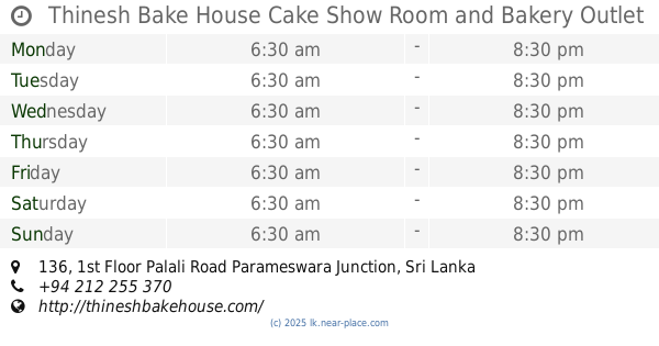
Thinesh Bake House Cake Show Room and Bakery Outlet
136, 1st Floor Palali Road Parameswara Junction
Restaurant
read more
893 m
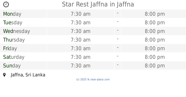
Star Rest Jaffna
Jaffna
Restaurant
read more
948 m
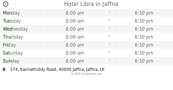
Hotel Libra
174 Kannathiddy Road, Jaffna
Restaurant
read more
1000 m
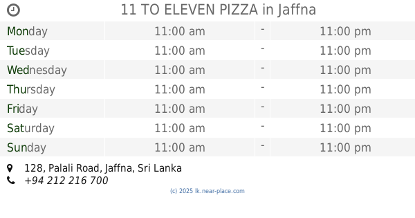
11 TO ELEVEN PIZZA
128, Palali Road, Jaffna
Restaurant
read more
1.002 km
Cosy Hotel & Restaurant
266/1 Stanly Road, Jaffna
Restaurant
read more
1.007 km
Amul Non Vegetarian Restaurant
266/1 Stanly Road, Jaffna
Restaurant
read more
1.01 km
Cosy Restaurant
266/1 Stanly Road, Jaffna
Restaurant
read more
1.011 km
அக்ஷதை
Stanly Road, Jaffna
Restaurant
read more
1.012 km
Nila Exclusive Veg. Treat
Stanly Road, Jaffna
Restaurant
read more
1.014 km
Akshathai
60, Stanly Road, Jaffna
Restaurant
read more
1.02 km
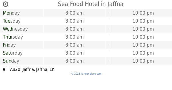
Sea Food Hotel
AB20, Jaffna
Restaurant
read more
1.036 km
Aache Hot Foot & Resaurant
Jaffna
Restaurant
read more
1.088 km
Mathumy Cool Bar
133, C Ponnampalam Road, யாழ்ப்பாணம்
Restaurant
read more
📑
all categories
Accounting
Administrative area level 1
Administrative area level 2
Airport
Amusement park
Aquarium
Art gallery
Atm
Bakery
Bank
Bar
Beauty salon
Bicycle store
Book store
Bowling alley
Bus station
Cafe
Campground
Car dealer
Car rental
Car repair
Car wash
Casino
Cemetery
Church
City hall
Clothing store
Colloquial area
Convenience store
Country
Courthouse
Dentist
Department store
Doctor
Electrician
Electronics store
Embassy
Finance
Fire station
Florist
Food
Funeral home
Furniture store
Gas station
General contractor
Grocery or supermarket
Gym
Hair care
Hardware store
Health
Hindu Temple
Home goods store
Hospital
Insurance agency
Intersection
Jewelry store
Laundry
Lawyer
Library
Light rail station
Liquor store
Local government office
Locality
Locksmith
Lodging
Meal delivery
Meal takeaway
Mosque
Movie rental
Movie theater
Moving company
Museum
Natural feature
Neighborhood
Night club
Painter
Park
Parking
Pet store
Pharmacy
Physiotherapist
Place of worship
Plumber
Point of interest
Police
Political
Post office
Premise
Real estate agency
Restaurant
Roofing contractor
Route
Rv park, camping
School
Shoe store
Shopping mall
Spa
Stadium
Storage
Store
Subpremise
Supermarket
Synagogue
Taxi stand
Train station
Transit station
Travel agency
University
Veterinary care
Zoo
administrative area level 3
sublocality level 1
sublocality level 2
↑